| |
Woods Canyon Loop - Coconino
National Forest
| Summary: |
A technical
loop hike with 3 rappels (maybe more), down
climbing and lots of rock hopping over basalt
boulders through a nice and remote canyon. To
complete this hike you will need: 1x200' rope
(or a 100' rope and 100' pull cord),
harness, descender, webbing, helmet, carabiners and a gps unit. A wet suit
would be required in cooler, wetter weather.
Download a map of this route
here (429k). |
| Directions: |
From Phoenix,
take I-17 north to Exit 315 for Rocky Park Road.
Turn left at the end of the off ramp and drive
under the highway. Turn right onto Forest Road
#80 (unpaved, rocky and bumpy) which follows
I-17 north for a ways before bending left
(west). You can drive 1.7 miles and park next to
the old coral, or continue on a short distance.
The author parked at UTM:
12 S 0441986mE, 3857525mN |
| Road Conditions: |
High Clearance Vehicle |
| Navigation: |
Difficult |
| Length: |
~8.5 miles,
but don't let the distance fool you, this is a
long hike |
| Date Hiked: |
August
2003 |
| Weather Conditions: |
Hot and humid |
|
Required Skills: |


 |
| Hike Description: |
Before
starting this hike mark the location of your
vehicle on your gps unit so you can find it
again at the end of the day. Done? Then begin
walking cross country southwest
towards the head of the canyon
that will allow entry into Woods. Set your gps
to locate UTM:
12S 0439414mE, 3854930mN
It's easy walking through open forests and
meadows as you head cross country. Soon you'll
cross a shallow drainage, then another slightly
deeper one. About 15 minutes after climbing out
of the second drainage you'll reach some old
barbed wire fence lines and Con Tank. Continue
cross country, following your gps until you
reach the top of the unnamed canyon shown on the
map above. Enter the drainage at a shallow point
and begin working your way down stream. The
upper portion of this canyon is very brushy and
you'll be climbing over large basalt boulders
(something you'll become all too familiar with
before the end of this hike). As you descend,
you'll reach 4 or 5 drop offs of 10 to 40 feet.
All of these can be down climbed without too
much trouble, however, some may wish to rig a
rope for use as a hand line or rappel.
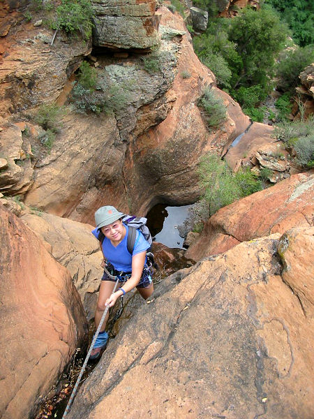
Eventually, you will reach the red Supai
Sandstone layer and 3 rappels in quick
succession. The first is 80' from a sling around
a pinch point on canyon left, the second is 80'
from two climbing nuts on canyon right (note:
rodents have begun to chew the rope on these
anchors & they may soon need to be replaced or
backed up), the third rap requires 100' of rope
and uses a tree located in the middle of the
canyon 30' back from the edge as the anchor
(this last one is undercut and has a somewhat
awkward start). Once down, retrieve your rope,
remove your harness and continue down canyon
another 10-15 minutes to the confluence with
Woods Canyon (it took the group of 5 the author
was with 4 hours to reach this point).
Turn right and begin rock hopping your way up
the dry canyon across the smooth, grey, basalt
boulder that line the channel in Woods. Be aware
that many of the rocks are not very stable and
can roll when you step on them, making a fall a
possibility. Other than a few pretty Arizona
Sycamores, this lower section is otherwise
uninteresting. After about an hour and a half of
walking, look to an alcove in the Supai on the
left to spot a decent ruin located 40' above the
canyon floor. There is no easy way up to the
ruin, which is just as well since I'm sure this
helps protect it from vandalism. Just above the
ruins, the Supai Sandstone appears underfoot and
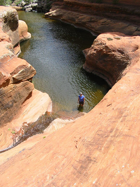
you will pass by a series of scenic pools. All
the pools can be bypassed by walking around on
one side or the other, unfortunately it is
sometimes difficult to know which side to
choose. You have a 50/50 chance, if your
progress ends in a cliff, you chose the wrong
side (just back up and try again, if you get it
wrong the second time seek medical attention).
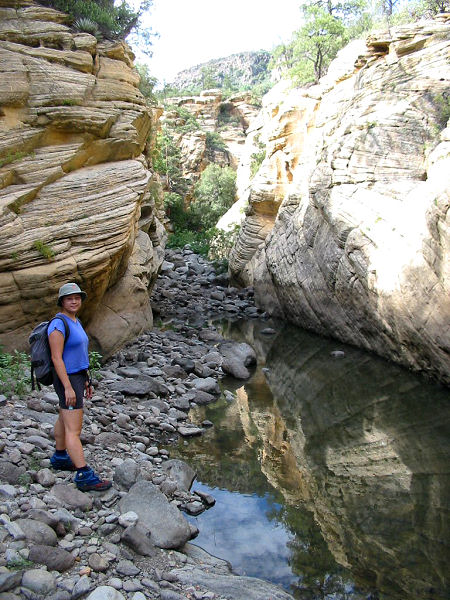
Above the Supai, the canyon enters the Coconino
Sandstone. This layer forms some moderately
narrow sections including a few filled with
water that you will be forced to wade and one
long section that is a mandatory swim (the water
in this pool is reportedly cold most times of
the year, but was actually quite refreshing when
I was here in August). More boulder hopping and
the canyon will become shallower as you enter
the upper basalt layer. There is a nice water
fall in this section that is easily climbed,
followed by a couple shallow pools that can be
avoided or crossed with a short wade. When you
reach a very large pool, there will be a
tributary canyon which enters from the right.
Turn right and follow this drainage up until it
becomes brushy. Climb out of the drainage on the
left back up to the top of the mesa. Set your
gps to find your vehicle which you had marked
earlier and continue the remaining 0.8 miles
back to your car. |
| Rating (1-5 stars): |

This is a nice hike, with good scenery in a
remote wilderness setting. The boulder hopping
is a bit relentless, but that's the price of
admission. The author and his wife completed
this hike with 3 other people in 10 hours. |
| Maps: |
Coconino National Forest Map |
| Photos: |
Click picture for larger view, click your browser's 'Back' button to return to this page. |
 |
 |
 |
|
Rappel #1 |
Rappel #2 |
Cooling off in a Supai
Sandstone pool. |
 |
 |
 |
Typical view in
the Coconino. |
Near the end
of the
one long swim. |
Boulder hopping. |
|
|
