| |
Whitetail Tank Canyon -
Coconino National Forest
| Summary: |
A technical canyon with a
challenging climb on the exit. This exit route
should only be attempted by hikers with
excellent climbing skills that are comfortable
with significant exposure. To complete this
canyon you will need
2x100' ropes (or
a 100' rope and 100' pull cord), harness w/
descending gear, webbing, and helmet. |
| Directions: |
From Prescott
drive north on Highway 89 past Chino Valley.
Between mileposts 346-347, turn east (right) at the sign for 71 which is
initially paved, but soon becomes dirt (ok for
passenger cars). Follow 71 for 10 miles until
you reach an intersection at a paved road. Turn
left (north) on this road which is listed as 173
on the map, but is signed as 73. Just after mile
marker 176 turn right (east) on Forest Road (FR)
354 at the sign for the Overland Trailhead (well
graded dirt). After driving 7.2 miles FR 354
branches right and FR 105 continues straight.
Stay straight on FR 105 driving past right
branching roads for FR 125 and FR 127.
From FR 127 continue 4.3 miles on FR 105 then
turn right onto a faint dirt road marked FR 995
(GPS Point - UTM: 12S 405870mE, 3880655mN, WGS84
Datum). Drive 0.3 miles until the road ends at a
fire ring and fence line (GPS Point - UTM: 12S
406071mE, 3880434mN, WGS84 Datum). |
| Road Conditions: |
High Clearance Vehicle |
| Navigation: |
Moderate |
| Length: |
~13 miles |
| Date Hiked: |
February
2006 |
| Weather Conditions: |
Partly cloudy and cool |
|
Required Skills: |


 |
| Hike Description: |
From the parking area, hop
the barbed wire fence and walk southeast a short
distance until you reach the drainage of
Whitetail Tank Canyon. Walk down this wide and
shallow drainage for about 30 minutes to the
head of the canyon, which begins in dramatic
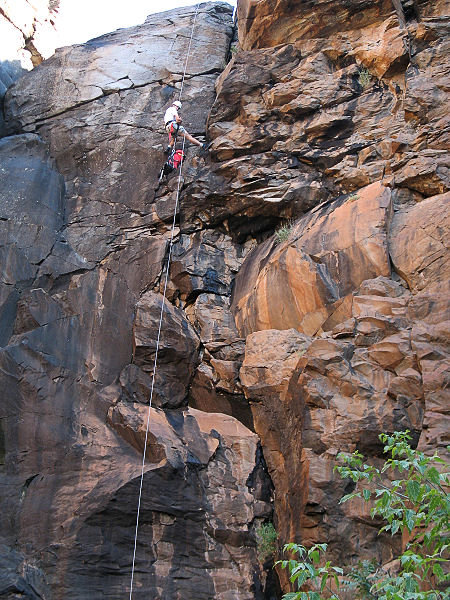
fashion with a sheer basalt cliff band. There is
a prominent tree at the head of the drop on the
right that can be used as an anchor. If you
extend the anchor ~25 feet to the edge of the
drop, the rappel is about 90 feet to the canyon
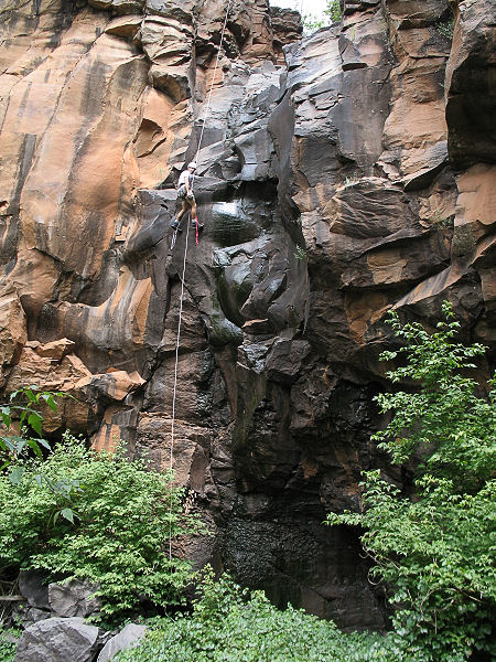
floor. A short distance down canyon is rappel
#2, a 60 footer using a tree on the right on a
ledge just above the drop. Once down, you can
remove your harness and begin rock hopping down
canyon (keep an eye open for poison ivy).
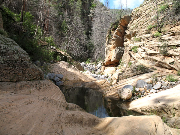
Eventually the canyon cuts through the basalt
and into the Coconino Sandstone. Unfortunately,
though there are encouraging signs, the canyon
never really slots up. Eventually you will reach
the junction with Lee Canyon. Turn right and begin hiking up this
canyon. More rock hopping (what else
is new) and you'll eventually reach a spot
marked by several cairns in the center of the
canyon. I believe this possibly marks an exit
trail used by hunters (on your left facing up
canyon). I went up this path a short distance,
but it was so faint, I decided to try my luck
with the canyon instead. A short distance above
these cairns you'll pass through a moderately
nice section of canyon. Then, as you progress
upwards, the boulders in the canyon bottom
become larger, and you'll be forced to do quite
a bit of climbing and scrambling. Finally as you
reach the upper basalt layer that marks the head
of the canyon, your progress will be blocked by
a 45 foot shear cliff with a dripping spring.
There may be better ways out of the canyon at
this point, but the author decided to climb the
cliff band on canyon left (left side when facing
down canyon) at a crack about 100 feet back from
the headwall. The exit I chose consisted of
climbing 25 feet straight up along a crack to a
shelf, moving left along the shelf to another
crack, then climbing another 15 feet straight up
to a tree. There were good hand and foot holds
all along the route, but be aware that a fall
could be fatal. Once on top, you can either head
north to pick up FR 105 (which you can follow
east to FR 995 and your car), or take your
chances heading cross country to the northeast
directly to your vehicle. |
| Rating (1-5 stars): |
 
The author and a friend completed this hike
by fixing ropes and exploring down to the
confluence with Lee Canyon and back at a fast
pace in 5.5 hours. The author hiked the exit
route up Lee Canyon on an earlier trip when
exploring Tule Tank
Wash. |
| Maps: |
Click
here (410k),
or Coconino National Forest Map |
| Books: |
None |
| Photos: |
Click picture for larger view, click your browser's 'Back' button to return to this page. |
 |
 |
| Rappel
#1. |
Rappel
#2. |
 |
|
Sandstone pseudo
narrows. |
|
|

