| |
Blue River - Apache /
Sitgreaves National Forest
| Summary: |
A pleasant hike/backpack up the Blue and Little
Blue Rivers to a hot spring and some narrows.
Beware of flash floods and strong currents after
heavy rain. Deer flies are present in late
spring and early summer. |
| Directions: |
Drive
on Highway 191 about 30 miles north of the small
town of Clifton. Between mileposts 188-189 turn
right (east) onto Forest Road (FR) #475 (also
called Juan Miller Road) towards the Blue River.
After 2 miles you'll pass the Juan Miller
Campground. Stay right where the road forks at
the 6.7 mile point, remaining on the main road.
Upper Trailhead (rough road): At
the 121 mile point on FR #475, turn left at the
sign for XXX Ranch onto FR #475C. Follow this
rough road for 3 miles to the ranch and
trailhead.
Lower Trailhead (somewhat
less rough road): Continue on FR #475 to the
13.6 mile point to where the road crosses the
Blue River. Park here. Note - this will add
about 3 miles (each way) to your hike. |
| Road Conditions: |
High
Clearance Vehicle |
| Navigation: |
Moderate -
you can't get lost in the stream, but you'll
need to keep an eye out for the correct side
drainages |
| Length: |
~15 miles |
| Date Hiked: |
May 2008 |
| Weather Conditions: |
Nice |
|
Required Skills: |


 |
| Hike Description: |
From wherever you parked (Trailhead 1 or 2)
simply begin hiking the Blue River on one side
or the other. Don't bother trying to keep your
feet dry, you'll be crossing the stream many
times before the hike is over. Benches on either
side of the river are usually rather rocky, with
occasional stretches of gravel or sand. There is
little brush though, which makes for pleasant
hiking. If you started at the lower trailhead,
after 3 miles you'll reach the XXX Ranch
(also known as the Fritz Ranch)
and gravesite of its owner Fred J. Fritz who
died in 1916. Continuing up the Blue, the canyon
becomes very wide. After hiking 4.2 miles past
the ranch, the river forks with the Blue River
continuing straight, and the Little Blue Creek
coming in from the right. There is a pleasant,
little campsite on a grassy bench where the two
forks meet. Turn right (east) and begin hiking
up the Little Blue Creek. After 2.3 miles, Hannah
Springs Creek enters from the right (east). Here
we'll take a detour up Hannah Springs Creek,
which usually requires a deep wade or two
(prepare accordingly) to Hannah Hot Spring. The
spring lies about 0.5 miles up the drainage and
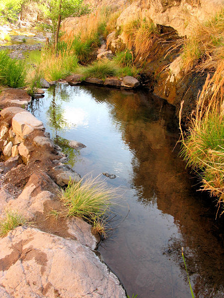
features very hot water and a man-made catch
basin that forms a small pool. While the spring
is interesting, adventurous hikers may wish to
continue their explorations up the creek to some
very nice narrows, pools, obstacles and climbs.
It'll take some effort, but it's possible to go
all the way through the narrows to where the
canyon widens again. When ready, return to the
Little Blue and continue your northerly
progress. Just past the Hannah spring drainage,
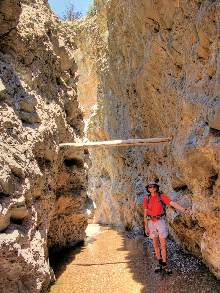
you'll pass through the Little Blue Box - a
pleasant, if short, stretch of conglomerate
narrows. Another 2.4 miles above Hannah, the
drainage splits with the Little Blue Creek
heading right and a stream formed by Dutch Blue
and Ash Creeks heading straight. I hiked up the
Little Blue for a mile from this point but,
while pleasant, didn't find anything terribly
exciting. Heading up the other drainage, the
creek splits with Ash Creek heading right and
Dutch Blue Creek going straight. A short
distance up the latter, you will find
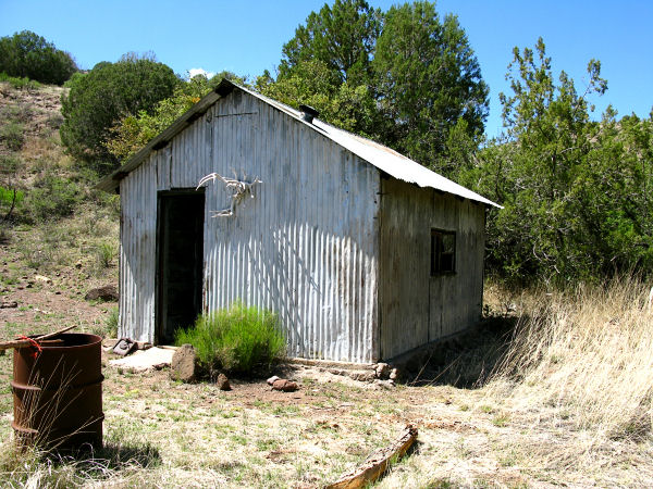
White Rocks Cabin up on the bench
on the left (west). The cabin is made of
corrugated metal and has an old stove and
register inside. Continuing up Dutch Blue Creek
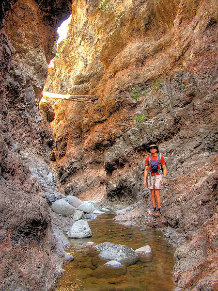
you will enter a very nice stretch of
conglomerate narrows through which the stream
twists and turns. After some hiking you'll
arrive at a 10' waterfall with a deep pool at
the bottom. Those with good climbing skills can
bypass the pool with some exposure by climbing
up and around on the right (facing up canyon).
Above the falls the narrows continue a short
distance before the canyon begins to widen once
again at about the 1 mile point beyond the Ash
Creek junction. This is as far as I went. You
can either return the way you came or continue
to explore this interesting area. |
| Rating (1-5 stars): |
   
The author and his wife hiked from the lower
trailhead up to the Blue River / Little Blue
Creek confluence where we made camp. I then day
hiked up the Little Blue completing the hike
described above. The next day we broke camp and
hiked out. Apart from the hike itself, a
highlight of the trip was spotting a sizeable
mountain lion on the drive in (the first we'd
seen in the wild in our 11 years of Arizona
residence. |
| Maps: |
Click here for a map of the hike:
Map 1,
Map 2 |
|
Books: |
Arizona Trails: 100 Hikes
in Canyon and Sierra - David Mazel |
| Photos: |
Click picture for larger view, click your browser's 'Back' button to return to this page. |
 |
 |
 |
|
Typical view in the Blue River. |
Little Blue Box. |
Hannah Hot Spring. |
 |
 |
 |
|
White Rocks Cabin. |
The narrows of Dutch Blue Creek. |
|
|

