| |
Quartz Peak - Sierra Estrella Wilderness
| Summary: |
A short, steep hike to
the summit ridge of the Sierra Estrella Mountains at Quartz Peak. |
| Directions: |
The Sierra Estrellas are
run in a NW - SE direction and lie just south of west Phoenix on the border of the Gila
River Indian Reservation. To get to the Quartz Peak Trailhead drive west out of
Phoenix on I-10 to the Pebble Creek Parkway/Estrella Parkway exit (#126). Take the
Estrella Parkway south 8.3 miles to the intersection with Elliot Road. Turn right on
Elliot and drive 2.6 miles to the left branching Rainbow Valley Road. Turn left and
follow Rainbow Valley Road 9.3 miles to the signed junction with the dirt Riggs Road
(about 1/2 mile past the Cotton Citrus Feed store). Leave the pavement and turn left
(east) onto Riggs. There will be signs posted on Riggs that the bridge is out, and
sure enough there is a blockade across the road at a wooden bridge over a deep drainage
ditch. If you take a left at the blockade and follow the drainage ditch about a
quarter mile you can cross the ditch and come back on the other side, coming out just past
the blockade. Continue on Riggs 4 miles to a 4-way junction with an unsigned road
(listed as Buzzard Rd on the BLM map). Continue straight at this junction (still on
Riggs) following the phone lines on your right. After an additional 5.3 miles (along
the way passing Rainbow Rancho - which has some airplanes, hangers, and a mortar launcher
in the front yard, complete with a not terribly friendly greeting) you will arrive at a 'T'
junction with a road running parallel to some large high tension lines. Follow the
small trail sign and turn right. Drive 1.9 miles further to a left branching road
with another 'trail' sign and arrow. Turn left onto this road and drive 1.9 miles to
the trailhead which has a restroom and small parking area (looking very out of place here
in the apparent middle of nowhere). |
| Road
Conditions: |
The BLM recommends a
4-wheel drive however I believe most High Clearance Vehicles would have no trouble in dry
weather. |
| Navigation: |
Easy |
| Length: |
6 miles - round trip |
| Date
Hiked: |
January, 1999 |
| Weather
Conditions: |
Warm, temperatures
reached 80 degrees. This is a winter hike only. |
|
Required Skills: |
None |
| Hike
Description: |
From the trailhead,
follow a level, well worn, jeep track (now closed to motor vehicles) for 1/4 mile. The trail turns left with large
cairns marking the way and begins to climb steeply up to the ridge you will be following
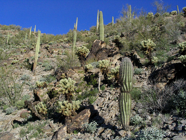
the remaining way to the summit. Vegetation consists of typical lower Sonoran plant
species, mainly: teddy bear cholla, palo verde, creosote bush, buckhorn cholla, saguaro and
brittlebush. Once on the ridge the trail continues steeply uphill, rising 2500 ft in
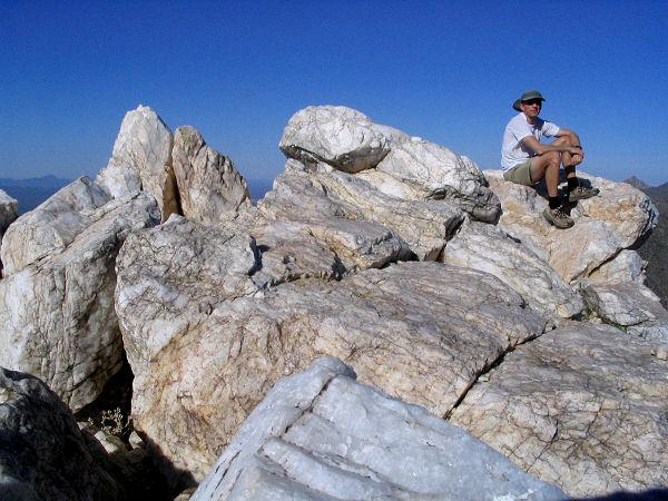
3 miles. About 1/4 mile from the summit (the large white outcropping of quartz you
will see above you) the trail fades and you must rock hop the remaining distance to the
peak. Once at the top you can either climb straight up the quartz blocks or edge to
the right where the route is a little less of a climb. Return the way you came. |
| Rating
(1-5 stars): |
  
Sort of a nice 1/2 day hike for the winter months and one that you are
unlikely to find many people. The summit consists (not surprisingly given it's name)
of some interesting blocks of white quartz mixed with mica. The author hiked
to the summit of Quartz Peak, had a brief lunch, then returned to his car in just over 3
hours. At a later date I returned to hike to the peak then attempt to travel
south along the summit to Montezuma Peak. The terrain proved to be very
rugged and risky and the trip was aborted. |
| Maps: |
The BLM has a simple map
on their web site here.
Otherwise they recommend -
USGS:Montezuma Peak, Ariz, Mobile 7.5, NE Ariz 7.5 |
| Photos: |
Click picture for larger
view, click your browser's 'Back' button to return to this page. |
 |
 |
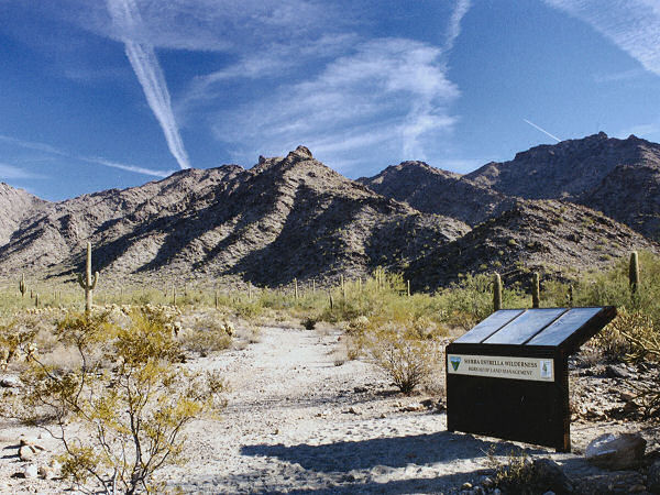
| Quartz Peak Trailhead. |
View on the ascent. |
 |
 |
| Approaching the peak. |
Quartz blocks on the summit. |
|
|

