| |
Montezuma Peak - Sierra Estrella Wilderness
| Summary: |
A rugged off trail hike to the top of
Montezuma Peak, which at 4337 feet is the second highest point in the Estrella Mountain range
(an unnamed peak to the northwest tops out at 4512 ft). This hike
is best suited to experienced hikers familiar with off trail hiking and
climbing over rough and unstable terrain. There are likely many routes one
could take to the summit, my feeling is that none are particularly user
friendly. A map of the route described may be found
here. |
| Directions: |
The Sierra Estrellas run in a NW - SE direction and lie just south of west Phoenix on the border of the Gila
River Indian Reservation. To get to the Quartz Peak Trailhead drive west out of
Phoenix on I-10 to the Pebble Creek Parkway/Estrella Parkway exit (#126). Take the
Estrella Parkway south 8.3 miles to the intersection with Elliot Road. Turn right on
Elliot and drive 2.6 miles to the left branching Rainbow Valley Road. Turn left and
follow Rainbow Valley Road 9.3 miles to the signed junction with the dirt Riggs Road
(about 1/2 mile past the Cotton Citrus Feed store). Leave the pavement and turn left
(east) onto Riggs. There will be signs posted on Riggs that the bridge is out, and
sure enough there is a blockade across the road at a wooden bridge over a deep drainage
ditch. If you take a left at the blockade and follow the drainage ditch about a
quarter mile you can cross the ditch and come back on the other side, coming out just past
the blockade. Continue on Riggs 4 miles to a 4-way junction with an unsigned road
(listed as Buzzard Rd on the BLM map). Continue straight at this
junction (still on Riggs) following the phone lines on your right.
After an additional 5.3 miles (along the way passing Rainbow Rancho - which
has some airplanes, hangers, and a mortar launcher in the front yard,
complete with a not terribly friendly greeting) you will arrive at a 'T'
junction with a road running parallel to some large high tension lines.
Follow the small trail sign and turn right. Drive 1.9 miles further to
a left branching road with another 'trail' sign and arrow (this left turn
leads to the Quartz Peak Trailhead). Continue straight for another 1.2 miles
and turn left. Follow this somewhat rougher dirt road 2.4 miles and turn
left again. Follow an even rougher and rockier road about a mile and park. |
| Road
Conditions: |
High Clearance Vehicle |
| Navigation: |
Moderate |
| Length: |
~4 miles - round trip |
| Date
Hiked: |
March, 2005 |
| Weather
Conditions: |
Partly sunny and nice |
|
Required Skills: |

 |
| Hike
Description: |
From the car park
hike north through the desert along the base of the Estrella range a short
distance towards two parallel ridge lines. Looking up the ridges you will
see that they join about 3/4 of the distance to the top at which point the
single ridge heads the remaining distance to the summit of the mountain, at
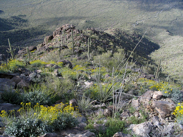
a point just north of Montezuma Peak. I opted to walk up the southernmost of
these two ridgelines, which was rugged and required the use of hands in
several places. You'll have to dodge chollas and deal with loose and
unstable rocks as you make your way up the steep slope. After the two
ridgelines join you'll come to several spots where you'll want to bypass
large rock outcrops on one side of the ridge or the other. Some additional
hiking and scrambling will bring you to the summit ridge where the walking
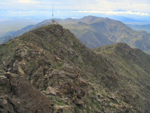
becomes easier. Turn south (right) at this point and hike along the mountain
to the first of two small antennas (which no longer appear to be
operational). Passing the antenna, the path becomes rough once more as you
drop down a short distance to shallow saddle, then begin climbing the final
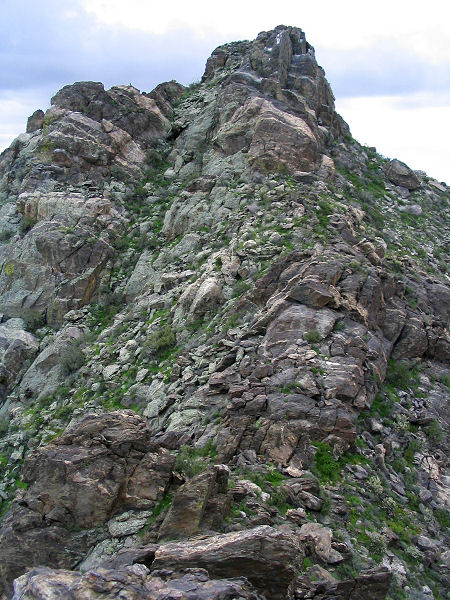
pitch of the peak itself. The easiest route to the summit is to continue
directly up the ridgeline until you reach a point where you can work your
way left into a shallow cleft on the east side of the peak. The cleft will
allow you to make your way up to the official summit of Montezuma Peak
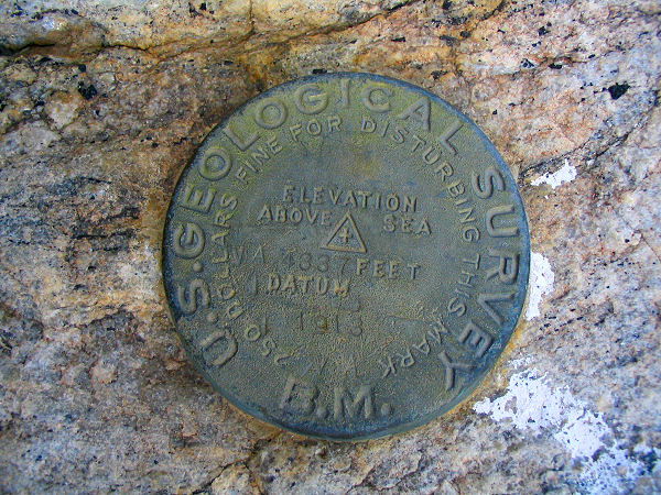
(identified by a USGS marker which lists the elevation at 4337 feet), and
great views in all directions. To get back down you could retrace your
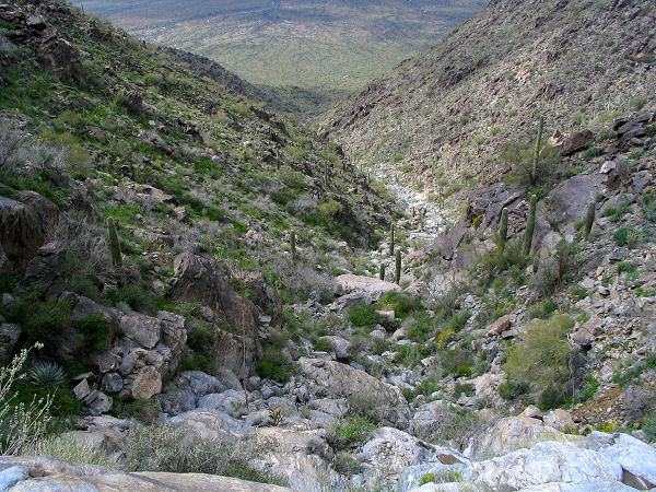
steps, or, opt for the steep wash which leads down to the west from the
saddle you passed earlier between the antenna and the peak. The wash is
basically a steep hillside at first and is covered with loose rocks that
demand your full attention. Further down, water has scoured out the canyon
to bare rock, making travel and footing less precarious. The gully
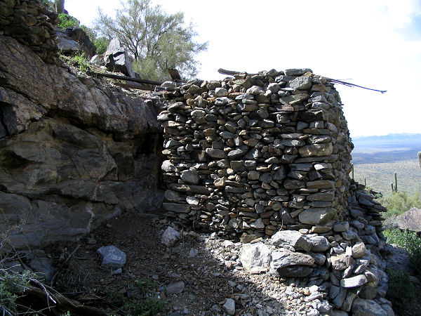
eventually becomes less steep, eventually passing the rock walls of an old
Indian ruin located on the left side of the wash. Continue down the drainage
until leaving the foothills of the mountain, at which point you'll want to
head out of the drainage on the left (south) and route find back to the
rough road and your car. |
| Rating
(1-5 stars): |
 
The author completed this hike solo at a moderate pace in 5 hours, with
extra time spent route finding and getting turned around at the end looking
for my car. |
| Maps: |
Click here for a map of
the route I hiked. |
| Photos: |
Click picture for larger
view, click your browser's 'Back' button to return to this page. |
 |
 |
| Ridgeline used for the ascent. |
Montezuma Peak from the
1'st antenna. |
 |
 |
| Montezuma Peak USGS marker. |
View south to the 2'nd antenna. |
 |
 |
| Wash used for the descent. |
Ruins in the wash. |
|
|

