| |
Nankoweap Trail - Grand Canyon National Park
| Summary: |
According to Hiking the Grand Canyon, by John
Annerino, the Nankoweap Trail was constructed by John Wesley Powell & others
in 1882 so that a geologist on the trip could study the rock layers (other
fun Nankoweap facts can also be found in this publication).
At any rate, the Nankoweap Trail is a north rim backpacking route to the
river in the Marble Canyon area of the Grand Canyon. The hike offers great
views and a chance to visit Anasazi storage graneries in a remote wilderness
setting. Unless you are planning an aggressive hike out from the creek, it's
probably a good idea to cache water at either the Tilted Mesa or Marion
Point campsites described below. Be aware that the trail is narrow in places and contains some
exposure that will be made more difficult if the trail is wet or icy. Also
be aware that this trail lies directly in the flight path of the air tour
companies - the whine of aircraft is present almost constantly during day
light hours. |
| Directions: |
You can start this hike from either the Buffalo Ranch
Road or Saddle Mountain Trailhead. The Buffalo Ranch Road Trailhead lies at
a lower elevation, which offers several advantages: the approach road is
more reliable during winter weather, and though you will be faced with a
good climb to reach the official start of the Nankoweap Trail, it will be
all down hill at the end of the hike when you are most tired. The author
started this hike at Buffalo Ranch Road.
Buffalo Ranch Road Trailhead: Drive on Highway 89A to between mile
posts 559 & 560 to the sign for the well graded, dirt House Rock Buffalo
Ranch Road (FR #8910, note: this road was formerly labeled FR #445 & the
directions you receive from the Park Service with your permit persist with
this naming convention). Head south on #8910 and drive for about 28 miles
until you reach the sign for Saddle Mountain Trail (located on the right).
Saddle Mountain Trailhead: Take Highway 67 south from Jacob Lake to
FR #22, turn left (east) and continue to FR #610. Follow #610 to its end &
the trailhead (these directions are from the Park Service - don't blame me
for their accuracy). |
| Road
Conditions: |
Passenger Car (if roads are dry) |
| Navigation: |
Easy |
| Length: |
29 miles round trip |
| Date
Hiked: |
November, 2002 |
| Weather
Conditions: |
Cool & sunny with cold nights |
|
Required Skills: |


 |
| Hike
Description: |
From the Saddle Mountain Trailhead, simply begin your
descent on Trail #57. It's three miles to the official start of the
Nankoweap Trail.
From Buffalo Ranch Road Trailhead, begin your hike behind the Saddle
Mountain Trail sign. Follow the old road as it ascends moderately through a
juniper forest. You'll have views to the east in this section of Marble
Canyon, Eminence Break & the Shinumo Alter. Soon you will reach a sign for
Saddle Mountain Trail #31, #57 to Marble Canyon and Mankoweap (with a
capital 'M', I guess that's close enough for government work). Just past the
sign the path descends into a shallow ravine where Trail #31 branches left
up the other side. Our path continues on #57, which heads right, directly up
the dry ravine (this may not seem intuitive, since the trail appears to head
directly away from Marble Canyon - you are on the right path though). As you
continue up canyon, the trail becomes steeper and steeper until you
eventually top out at a saddle and a signed junction and the Grand Canyon NP
boundary. Trail #57 continues right to head up to FR #610, the Nankoweap
Trail begins on your left (3.5 miles). A short stroll on the Nankoweap will
bring you to the edge of the Canyon. From here, the path descends a short
distance through the Supai formation, then begins winding its way east just
below the Esplanade Sandstone. It's brushy at first, but this eventually
clears. There is no way to get lost in this section since you'll have a
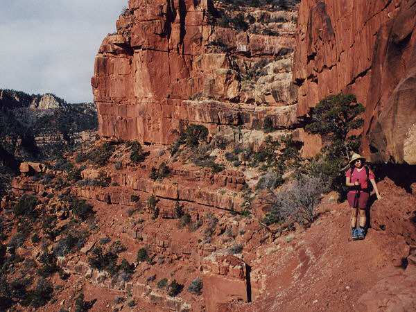
cliff on your left and a drop off on your right. The trail is narrow in a
few sections, and at one point in particular (on the way to Marion Point)
the trail becomes about 6" wide for a short stretch. There are good hand
holds & the trail was dry when the author was here, so I did not find this
section troublesome. If you have a fear of heights or if the path is wet or
icy (or you are wearing high heels or roller skates) this section may prove
difficult. Soon after this section, you will round Marion Point, a large
promontory that separates two upper Nankoweap tributaries. You can see a
very nice campsite located 20' off the trail on the point (5.5 miles). The
path then winds its way north into a side canyon before continuing east and
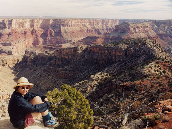
descending to Tilted Mesa (just before reaching the mesa, there are several
more good possibilities for campsites - 8.5 miles). The trail bends right
and begins dropping steeply off the mesa through the red wall. There is one
climb down at the beginning of this descent near a tree where you may wish to
pass packs. The red wall descent is long, steep and gravel covered. Take
care (baby steps are a good idea to avoid building up a lot of momentum)
through this section. The gravel will slip and slide under your feet, making
a fall a real possibility. The trail contours along the side of Tilted Mesa,
eventually reaching a series of rounded hills that aid your descent to the
creek bed. When you finally reach the canyon floor, the path levels out,
though it becomes a bit faint in sections as it travels through the black
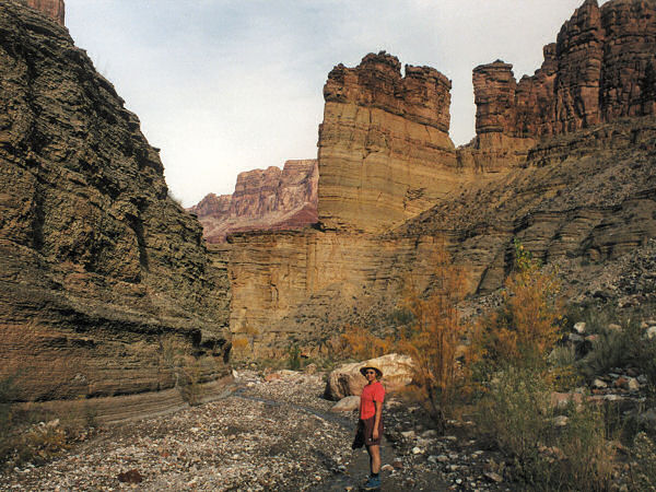
bush then descends into the drainage of Nankoweap Creek. The creek bed
itself is not particularly pretty, but there is flowing water in the stream
bed and several good campsites under the cottonwood trees (11.5 miles).
There is no formal trail between here and the river, but you can't get lost.
Simply head down stream, there are sections of use trail along one side of
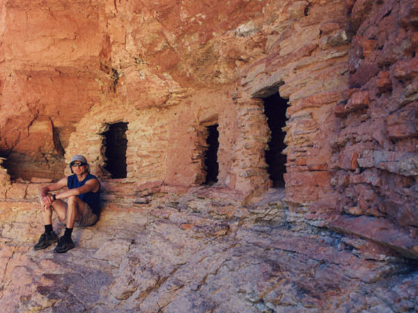
the creek or the other. As you enter the wide mouth of the Nankoweap delta,
look for some prominent trails on the right side of the canyon (14.5 miles). These trails
(made mostly by river rafters) lead down to river side campsites and up to
the often visited graneries (the beach at the mouth of the creek appeared to
be very rocky, better camp sites are likely to be found on the beaches down
river). To visit the graneries, simply stay to the right at any trail
junctions. It's a steep climb, but the ruins and the views are worth it.
When ready, return the way you came (29 miles). |
| Rating
(1-5 stars): |
   
The author and his wife completed this hike as a 2 ½ day backpacking trip
from the Buffalo Ranch Road Trailhead. The first day we hiked 6 ½ hours to
camp at Nankoweap Creek (caching a gallon of water at Tilted Mesa for the
following day). The next day we hiked down stream to the river and graneries
(4 hours round trip), then picked up our packs and hiked back up to the camp
at Marion Point (5 hours). The next day we hiked the remaining distance to our car
at Buffalo Ranch Road (3 hours). |
| Maps: |
Trails Illustrated -
Grand Canyon National Park |
| Books: |
Hiking the Grand Canyon - John Annerino
Canyon
Hiking Guide to the Colorado Plateau -
Michael Kelsey |
| Photos: |
Click picture for larger
view, click your browser's 'Back' button to return to this page. |
 |
 |
The most narrow section on
the Nankoweap Trail. |
The Little Nankoweap drainage
and Tilted Mesa. |
 |
 |
| Still descending. |
Nankoweap Creek. |
 |
|
| Anasazi graneries. |
|
|
|

