| |
Sevenmile Draw - Marble Canyon
| Summary: |
A short technical canyon in the Marble Canyon area. The
hike can be completed as a down and back trip or as a loop hike. To complete
this canyon you'll need 120' rope, harness, descender and webbing, plus
ascending gear if you're not doing the loop hike. |
| Directions: |
From Flagstaff drive north on Highway 89.
Turn left on Highway 89A, drive over the Navajo Bridge, past Lee's Ferry to
between mile markers 539 & 540. Park at a big pull off on the north side of
the road.
GPS:
441324mE, 4074153mN |
| Road
Conditions: |
Passenger Car |
| Navigation: |
Moderate |
| Length: |
3-6 hours |
| Date
Hiked: |
March, 2003 |
| Weather
Conditions: |
Sunny and nice |
|
Required Skills: |


 |
| Hike
Description: |
From the parking area on Highway 89A,
walk across the road and into the shallow drainage of Sevenmile Draw (you'll
have to duck under or climb over a barbed wire fence to do so). Head down
canyon and the drainage gradually becomes deeper. A 15 minute walk will
bring you to the confluence with the west fork of the canyon where
you'll hit a two stage pour off. The first drop off can be down climbed by
traversing right into the west arm of the drainage then descending a series
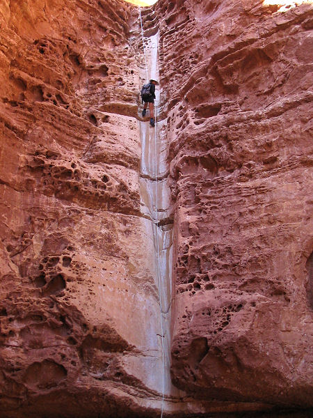
of ledges. The second drop is 85 ft and must be rappelled. Note: evidently
during some times of the year there is a muddy puddle at the bottom of this
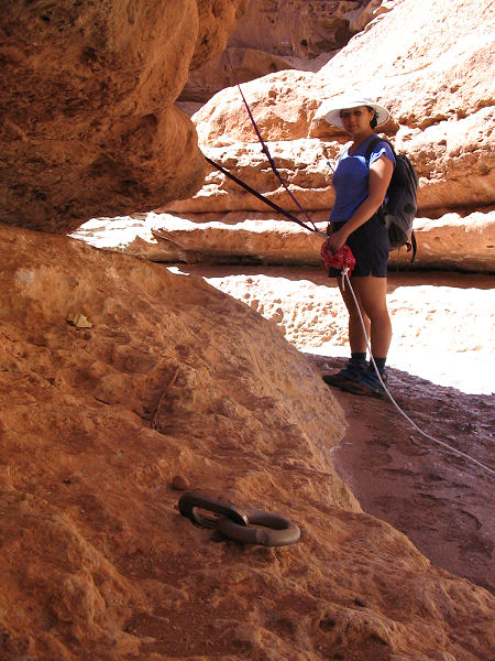
rappel, though when I was here the bottom was dry. There is a nice
natural anchor on canyon right at the top of the drop that you can sling a
piece of webbing around. Or you could use the bolts that have unnecessarily
(and unfortunately) been hammered in on both canyon right and left. After
rapping the water scoured chute, you can either pull your rope (if doing the
loop hike) or leave it fixed (if you're returning the same way). Below the
rappel you'll have to down climb through a short boulder field, then it's an
easy stroll to the river, which is mellow and quiet in this portion of
Marble Canyon. Either
return the way you came, or you can make a loop by using a small un-named
drainage about 0.75 miles down stream. To complete the loop, follow the
boulder strewn slope down river, keeping an eye on the Coconino
cliff on your right. About 0.4 mile down stream the cliff has collapsed into
a large pile of rubble (GPS 442566mE, 4072510mN).
Climb up the rubble slope to the top of the Coconino cliff band and pick your way
down river along this upper band. There is a faint use trail along this
section. Be careful of your footing, the slope consists of loose talus
in sections and travels somewhat close to the cliff edge. After a bit of
traversing, you'll reach an obvious drainage that ends in a pour off at the
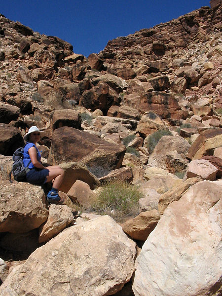
Coconino. Climb down into this drainage, then turn right and follow the steep, rubble
filled slope up and out of Marble Canyon. Follow the drainage until it
becomes shallow, then head cross country back to Highway 89A and your
vehicle. |
| Rating
(1-5 stars): |
 
The author and his wife completed the loop hike described above in 5
hours, leaving the rope fixed and returning for it after the hike. If I did
the hike again, I'd do it as a down and back hike since the traverse and
exit route for the loop hike is not much fun. |
| Maps: |
Click here for map of this
hike (428kb). |
| Books: |
None |
| Photos: |
Click picture for larger
view, click your browser's 'Back' button to return to this page. |
 |
 |
|
Bolt with
perfectly good
natural anchor 10' away. |
The 85' rappel. |
|
 |
 |
 |
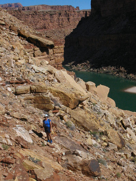
Traversing atop the
Coconino. |
View at the exit drainage. |
The climb out. |
|
|
