| Home | Warning | Gear | Books | Photography | Hikes | Links | Flora & Fauna | Etiquette | About Me | What's New |


Shinumo Wash (Twenty-Nine Mile Canyon) - Navajo Nation / Grand Canyon National Park

Summary: A hike to the Colorado River with great views of Vasey's Paradise, and Redwall Cavern. This hike requires permits from the Navajo Parks and Recreation Department and the National Park Service (if camping in the canyon).
http://www.navajonationparks.org/
http://www.nps.gov/grca/index.htm
Directions: From Flagstaff, drive north on Highway 89. Look for a sign on the right side of the road for Cedar Ridge, then turn left (west) a short distance after passing mile marker 505 onto Navajo Road 6110. Zero your odometer and follow this well graded dirt road 6.8 miles to a fork. Stay right and remain on the main track (ignoring many minor roads that branch off on one side or the other) to the 16.8 mile point. Turn left onto a less traveled and rougher road. At the 19.3 mile point turn right, then left at the 19.7 mile point. Half a mile later (20.3 miles) turn into a small pull out on the right and park. The gps point for the car park is: UTM 427591mE, 4039654mN
Road Conditions: High Clearance Vehicle
Navigation: Easy
Length: ~15 miles
Date Hiked: May 2008
Weather Conditions: Sunny and pleasant
Required Skills:
Hike Description:

From the car park head west down the slope to pick up a prominent cairned trail. The route you are to follow was constructed by the Bureau of Reclamation in the 1950’s to get horses and equipment down to the site of a proposed dam, which was to be located near Redwall Cavern.
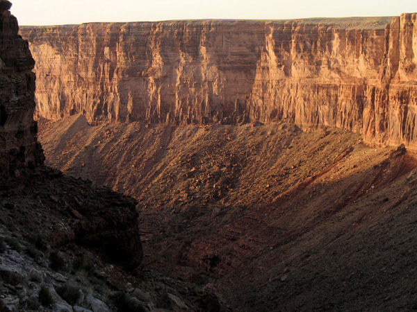
The path leads down into the drainage of Shinumo Wash only to leave the wash on the left a short distance later to bypass a large pour-off. The route then zig-zags steeply down through the Kaibab and Coconino formations. Once through the Coconino, the path traverses the steep slope in a northerly direction before dropping steeply down a series of tight switchbacks to the top of the Supai at the bottom of the wash.
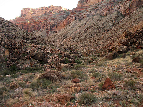
Turn left and rock hop down the wash. A short distance down canyon, look for a cairned path that begins on stream left. This good trail will allow you to bypass the majority of the rocky bed of the wash, saving time and effort. The trail crosses the wash several time as it descends the length of Shinumo. Look carefully for cairns on the opposite bank where it crosses.
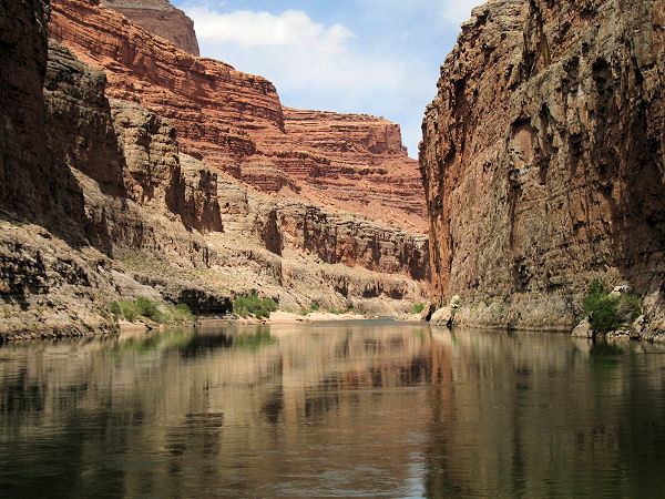
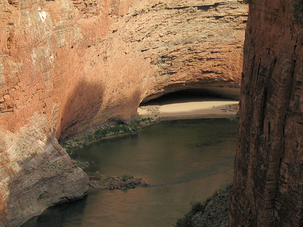
Eventually the path crosses Shinumo Wash at the head of some Redwall Narrows. It then climbs up the other side and begins winding its way downriver on the top of the Redwall. After about 1.5 miles the trail branches above Fence Fault. Right will take you down to the small beach at the mouth of Fence Fault. If you continue straight the path continues to wind along the Redwall for another 3 miles or so with views to the west of South Canyon, Stantons Cave, and Vaseys Paradise and to the south of Redwall Cavern. When ready return the way you came.

Rating (1-5 stars):
The author hiked down to Fence Fault beach and dropped gear. Then, with a water bottle and camera, hiked out to the Redwall Cavern overlook and back. After spending the night I hiked out the next day.
Maps: Trails Illustrated - Grand Canyon National Park
Books:  Canyon Hiking Guide to the Colorado Plateau - Michael Kelsey
Photos: Click picture for larger view, click your browser's 'Back' button to return to this page.
View from the rim. Typical view in Shinumo Wash.
View upriver from Fence Fault. Vaseys Paradise.
Redwall Cavern. Lost goat.