| |
Deer Creek - Grand Canyon National Park
| Summary: |
A cool hike to a good spring (which flows
year round), narrows and
water fall. The route described starts at Indian Hollow Campground. This
hike can also be completed from Monument Point via the Bill Hall Trail
which shortens the hike by 2.5 miles each way. |
| Directions: |
From
Flagstaff drive north on Highway 89. Turn left on Highway 89A and
drive to Jacob Lake. Head south on Highway 67 for a couple hundred
feet then turn right on Forest Road (FR) #461. Drive 5.4 miles to the
intersection with FR #462 and turn right. Drive 3.2 miles to the
intersection with FR #22 and turn left. Continue on FR #22 for 11.7 miles
then turn on FR #425. Follow this road 8.4 miles and turn right on FR #232
which you follow about 6 miles to the Indian Hollow Campground and Trailhead. |
| Road
Conditions: |
Passenger Car - well graded dirt
roads |
| Navigation: |
Moderate - some faint sections of trail
between Indian Hollow Campground and the Bill Hall Trail and at the
beginning of the Deer Creek Trail |
| Length: |
12 miles each way |
| Date
Hiked: |
November, 2001 |
| Weather
Conditions: |
Nice - though cool |
|
Required Skills: |

 |
| Hike
Description: |
From Indian Hollow Campground walk
past the large trailhead sign and take a quick walk through the woods to
the edge of the Canyon. The narrow Thunder River Trail drops a short
distance then heads west along a ridge a ways to a point where break down
at a bend in the canyon wall allows you to make your descent through the Coconino
Sandstone. The trail switchbacks its way steeply down to the
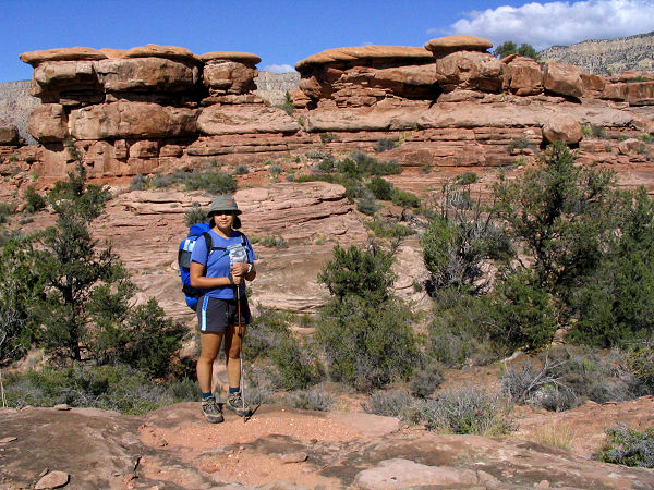
Esplanade and a sign post for trail #23. The path bends left (east) at
this point and travels back under the point from which you started. The
trail heads east for the next several miles around several large drainages
of Deer Creek. The walk along the Esplanade contains a few minor ups and
downs, but for the most part the path is quite level and easy. There are a
few faint sections of trail through this section, though nothing terribly
difficult - keep an eye out for cairns as you proceed. Five miles after
starting your hike you will pass the unsigned junction with the left
branching Bill Hall Trail (5 miles). The Park Service has made it a habit
not to name landmarks for its employees, but for some reason made an
exception for Mr. Hall who was killed in the line of duty as a seasonal
park ranger on the north rim. Continue straight ahead on the Thunder River Trail
which is more distinct at this point as it continues east over easy
terrain before dropping steeply off the Esplanade through the Supai and
Redwall Limestone formations into area on the Tonto Plateau called
Surprise Valley. Just as you reach Surprise Valley, you will come to an
unsigned junction with the right branching Deer Creek Trail (9.5 miles).
Going left will take you to Thunder Spring and Tapeats Creek, however, we will head right
onto the Deer Creek Trail. The path travels up and down a few low hills,
passing a left branching spur trail which is used by hikers traveling from
Tapeats to Deer Creek (or vice versa), before reaching a side drainage of Deer Creek. The trail travels
moderately down this side drainage on one side or the other of the stream
bed until you reach a point near a drop off and Deer Spring. At this point
the trail heads right across a rocky slope, then begins descending steeply
towards Deer Creek Canyon which you will see laid out below you. Continue
down the steep rocky slope, with views of Deer Spring along the way, to the valley floor. The trail crosses the
stream and heads left, down canyon. You will pass a short side trail and sign
for a composting toilet, then hit a nice campsite by the stream just above
the Deer Creek narrows. Drop your packs here (12 miles). The best part of
the canyon lies down stream, so continue down to the mouth of the narrows.
Deer Creek cuts an excellent stretch of deep twisty narrows before
dropping into the Colorado. The trail passes on a ledge on the right, above the narrows,
but you get some decent views down into them. It is possible to down
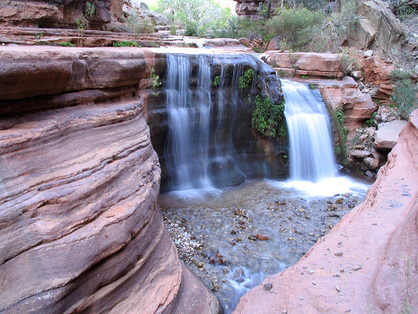
climb into the narrows on the left side of the stream just past a 12 ft
water fall. It would be very cool to explore this canyon, but warm weather
would be needed since wading and swimming are required. The trail
continues to the mouth of the canyon with a view down to the river. It
then bends right then curves left to the beach below. Head east a short
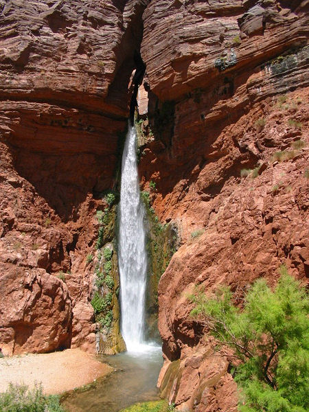
distance to an alcove for a great view of Deer Creek falls as it plunges
~75 feet to a pool below. Return to camp when ready & spend the night.
Retrace your steps to Indian Hollow with an early start the next
day.
|
| Rating
(1-5 stars): |
   
The author and his wife camped at Indian Hollow then hiked down to
Deer Creek in 6 hours. We dropped our packs then explored Deer Creek
narrows (though it was too cool to actually go wading or swimming) and falls before sunset. We hiked out the next day, retracing our
steps, in 7 hours. |
| Maps: |
Trails Illustrated -
Grand Canyon National Park |
| Books: |
Canyon
Hiking Guide to the Colorado Plateau -
Michael Kelsey |
| Photos: |
Click picture for larger
view, click your browser's 'Back' button to return to this page. |
 |
 |
 |
| The Esplanade. |
Falls at the mouth of the narrows. |
Deer Creek Falls. |
|
|

