| Summary: |
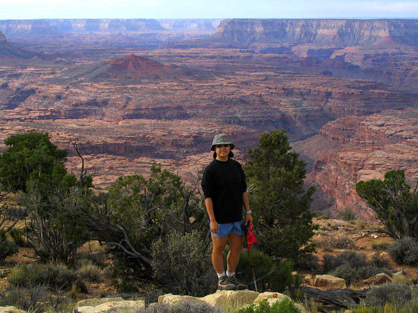
A flat hike along a peninsula of land
with good views into the Kanab Creek Wilderness 2000 feet below. |
| Directions: |
From
Flagstaff drive north on Highway 89. Turn left on Highway 89A and
drive to Jacob Lake. Head south on Highway 67 for a couple hundred
feet then turn right on Forest Road (FR) #461. Drive 5.4 miles to the
intersection with FR #462 and turn right. Drive 3.2 miles to the
intersection with FR #22 and turn left. Drive a 8.6 miles and turn right
on FR #447, drive another 3.8 miles and turn left onto FR #427. Drive 2.5
miles and turn right onto FR #227 and follow this somewhat rougher and less
traveled road 7.6 miles to the trailhead. |
| Road
Conditions: |
High Clearance Vehicle |
| Navigation: |
Easy |
| Length: |
10 miles round trip |
| Date
Hiked: |
October, 2004 |
| Weather
Conditions: |
Mostly cloudy and cool |
|
Required Skills: |
None |
| Hike
Description: |
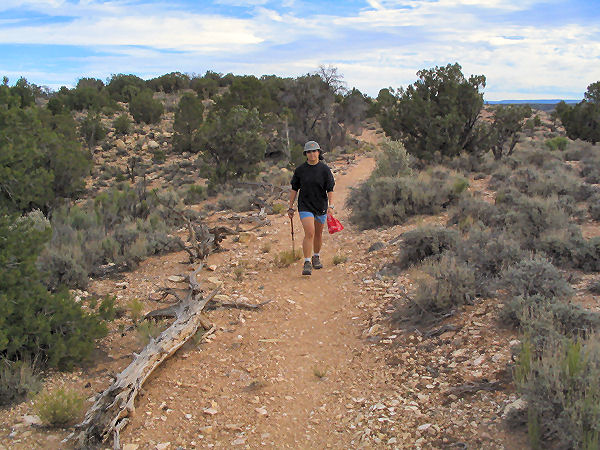
From the sign post and trailhead pick up
the path as it heads down a short hill through the pinyon and juniper
forest. The trail soon levels out and is flat and easy walking the entire
way as it heads through the scrub. Though it obviously does not see a lot of
use, the path has been well marked by the Forest Service who has lined the
path with dead logs and branches. After a bit of hiking you'll get some
views down to the left into the drainage of Sowats Canyon and when you reach
the end you'll have views of Jumpup Canyon and Kanab Creek in the distance.
When ready return the way you came. |
| Rating
(1-5 stars): |
 
The author and his wife completed this hike at a brisk pace in just under
3 hours. |
| Maps: |
Kaibab NF map available at the Kaibab Plateau Visitor
Center located in Jacob Lake. |
| Books: |
None |
| Photos: |
Click picture for larger
view, click your browser's 'Back' button to return to this page. |