| |
Sycamore Rim Trail - Kaibab National Forest
| Summary: |
A medium length hike with little
elevation change that travels through the pleasant pine forests near
Flagstaff. Along the way we'll visit a popular climbing area and sink hole. |
| Directions: |
From Flagstaff drive
west on Interstate 40 to Exit 178 for Parks Road. Head south
on Parks Rd. which turns to well graded dirt after 2.7 miles and eventually
becomes Forest Road (FR) #141. At the 9.1 mile point you'll arrive at a
4-way stop with FR 131 heading left. Stay straight at this intersection onto
FR #13 which is somewhat rougher. Follow FR #13 for 1 mile then turn left
onto FR #56. In 0.3 miles you'll reach a large parking area on the left.
Park here. |
| Road
Conditions: |
Passenger Car (as long as the roads are dry) |
| Navigation: |
Easy |
| Length: |
11 mile loop |
| Date
Hiked: |
May, 2005 |
| Weather
Conditions: |
Sunny and warm |
|
Required Skills: |
 |
| Hike
Description: |
This hike is described in a clockwise direction. From the
parking area walk past the big Forest Service sign and
pick up the path as it heads past a few shallow ponds into the forest. In a
few minutes you'll reach a sign for the Sycamore Rim Trail which points the
way to the Old Logging Site (0.5 miles) and Double Tanks (3.5 miles). A few
minutes past this point you'll reach another sign marking where the Overland
Trail crosses the path. Stay straight, and shortly you'll arrive at the
remains of a saw mill that was active in the area between 1910-1920. The
path follows along beside the right fork of upper Sycamore Canyon soon
passing Dow Spring and cabin before continuing through the forest which
features occasional views down into the canyon. After 5 miles you'll arrive
at a signed trail junction with a right branching spur trail which leads
0.25 miles right to the Sycamore Vista Trailhead. Stay straight towards
Vista Point which you'll arrive at 0.5 miles later and features a large sign
and viewpoint (what else?). The trail follows the upper left fork of the
canyon past this point eventually reaching Sycamore Falls, a popular
climbing area. From here it's possible to take a little detour to visit a
feature called the Ice Cave which is shown on the Coconino National Forest
map. The route is not marked and requires a short cross country trip to
find, but it only takes about 15 minutes (assuming you go in the right
direction). I'm not going to describe the route here, but the gps waypoint
for the feature is: UTM 12S 406892mE,
3888450mN. The Ice Cave itself is more
of a sinkhole than a cave, but true to it's name, there was ice in the
bottom on this warm May day. Ok, back at the climbing area, continue to
follow the Sycamore Rim Trail for about a mile to the junction with a left
branching trail that leads to the Pomeroy Tanks Trailhead. Stay straight and
you'll soon run into an interpretive sign for the Tanks, which are natural
reservoirs that provide a year round source of water to a variety of
wildlife. The trail drops down and crosses the Tank, then winds its way up
canyon to a junction with the Overland Trail (7.5 miles). Stay straight
(heading towards KA Hill) as the trail begins ascending gradually, crossing
a few forest roads as it does so. The path eventually begins climbing
somewhat more steeply to arrive at the top of KA Hill (9.75 miles, 7287
feet), before descending down the other side to arrive at the parking area
from which you began (11 miles). |
| Rating
(1-5 stars): |
  
The author, his wife and two friends completed this hike at a moderate pace,
including a visit to the Ice Cave in just under 7 hours. |
| Maps: |
A map of the hike can be found
here.
Note: This map was reproduced from the Forest Service sign at the trailhead. |
| Books: |
None |
| Photos: |
Click picture for larger
view, click your browser's 'Back' button to return to this page. |
 |
 |
 |
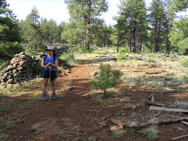
| The remains
of ye olde sawmill. |
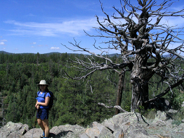
View overlooking the canyon. |
 |
 |
| Ice Cave |
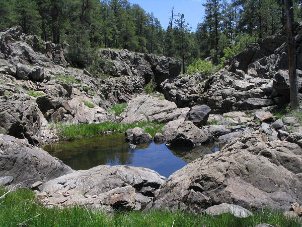
Pomeroy Tanks |
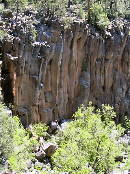
Sycamore Falls area
, note the climbers. |
|
|

