| Summary: |
A few nice hikes in a desert
setting to the top of an ancient lava flow.
|
| Directions: |
Picacho Peak is located just
west of I-10 about 60 miles south of Phoenix (40
miles north of Tuscon). From Phoenix drive south
on I-10. Take exit 219 and follow the brown
signs to the park entrance. There is an entry
fee of $6 per car load (as of this writing).
Pick up a map from the ranger when you pay. |
| Road Conditions: |
Passenger Car (paved all the
way) |
| Navigation: |
Easy |
| Length: |
Sunset Vista Trail: 6.2 miles
round trip (3.1 each way)
Hunter Trail: 2.0 miles one way (4.0 round
trip)
Calloway Trail: 0.7 miles one way (1.4 round
trip)
Nature Trail: 0.5 miles (total) |
| Date Hiked: |
April 2003 |
| Weather Conditions: |
Hot & sunny |
|
Required Skills: |
None |
| Hike Description: |
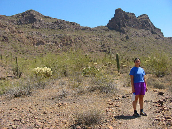
Sunset Vista Trail:
The trail begins at the Sunset Vista Trailhead
at the north end of the park. The path climbs
moderately at first as it winds its way west,
then becomes quite flat for the first 2 miles as
it heads across the bajada on the west side of
the range. As it nears the peak, it begins
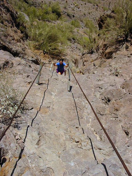
climbing steeply up a series of switchbacks,
then more steeply still as you climb a few
sections rigged with cables. At the top of the
first steep cable, you will reach the junction
with the left branching Hunter Trail. Stay right
at this junction and continue climbing. There
are several sections with cables along this
route, it might help to have gloves since some
of the cables are a bit thin & hard on the
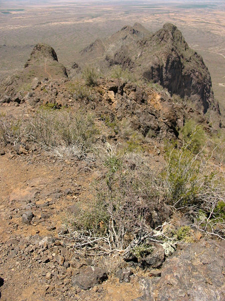
hands. Follow the trail to the summit which has
some good views in all directions. When ready
return the way you came.
Hunter Trail: This is the more popular
way to the summit. From the trail head on the
Barrett Loop, begin climbing the steep, rocky
path as it heads up the slope towards the peak
above. Eventually it climbs up to the base of a
prominent basalt cliff, then bends right and
follows the cliff face to a saddle with a few
interpretive signs. From the saddle, the trail
descends steeply west besides another escarpment
(this section is lined with cables the entire
way). At the base of the escarpment, the path
bends left and shortly joins the Sunset Vista
Trail. Stay straight at this junction and begin
the steep climb up the cables to the summit.
Calloway Trail: This is a short hike up a
moderate slope to an overlook at the base of the
peak. It only takes about half an hour to hike
from the Hunter Trail Head, but the only view is
of I-10.
Nature Trail: A short loop hike with
interpretive signs along the way. An easy and
fun stroll. You can pick up this trail from the
parking area in the Electric Campground or down
the road across from the Ranger Station. |
| Rating (1-5 stars): |
 
I've driven by the peak probably 100 times
since moving to AZ and figured I'd finally stop
in and check it out. I'm glad I did. The hikes
are nice and steep enough to feel like you've
gotten a work out. The views are good too. The
highlight of the trip was spotting 4 chuckwallas
scrambling around near the summit. |
| Maps: |
Pick one up at the Rangers Station when you pay your
entry fee. |
| Books: |
None |
| Photos: |
Click picture for larger view, click your browser's 'Back' button to return to this page. |