| |
Sawmill Canyon - San Carlos
Apache Reservation
| Summary: |
An off trail
excursion with rock hopping, wading and swimming
in a wild setting. There were two mandatory
swims when the author was here, conditions could
be very different after recent rains. The canyon
is located on the San Carlos Apache Reservation,
so you will need a recreation permit ($7/day or
$10/day family). You can find permits at the
following locations: Apache Gold Casino's
convenience store (928/475-7800, ext. 3658),
Express Stop in Globe (928/425-3911), Circle K
Store in Globe (928/425-5952), Minit Market in
Pima (928/485-3040), Pinky's Bait & Tackle in
Safford (928/428-0056), Bob Keen's Store in Fort
Thomas (928/485-2261), and Tempe Marine in Mesa
(480/782-6813). |
| Directions: |
From Phoenix, head east on highway 60 to Globe.
Turn north (left) on highway 60/77 ~20 miles to
where the highway drops down and crosses the
Salt River. Note: You might want to stop here
and assess the flow in the river. The route
described requires you to cross the river, which
might be dangerous if flows are high. Drive
approximately 3 miles past the bridge to a large
pull off on the on the south (right) side of the
road.
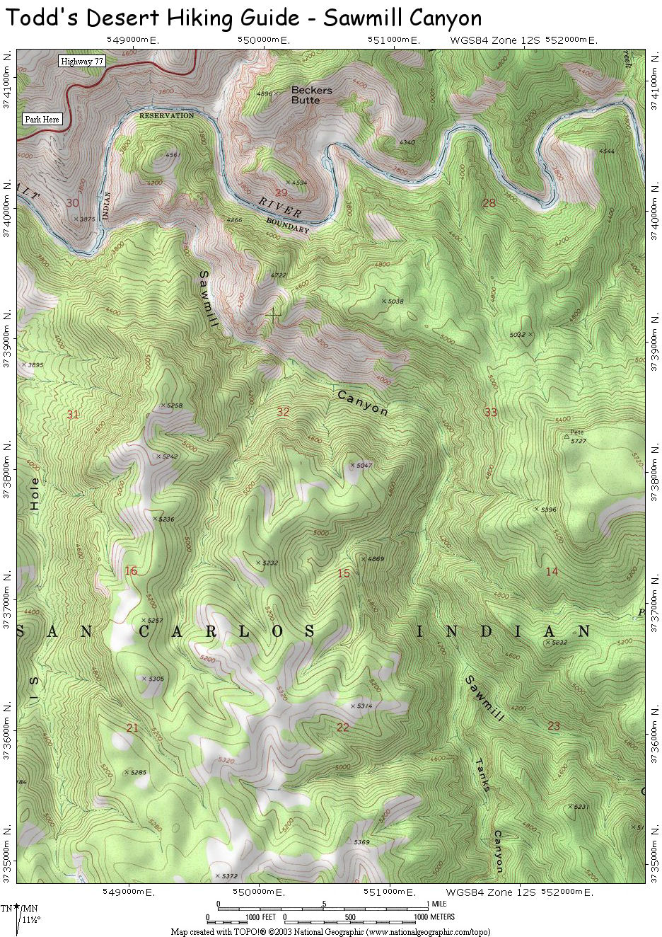
GPS: UTM 548493mE, 3740610 mN |
| Road Conditions: |
Passenger Car |
| Navigation: |
Easy |
| Length: |
You can turn
around when you want, you can see the lower and
most scenic part of the canyon in 6-8 hours. |
| Date Hiked: |
July 2005 |
| Weather Conditions: |
Sunny and hot |
|
Required Skills: |

 |
| Hike Description: |
From the pull
off, look east along the hillside below the road
and locate the prominent trail/old road that
heads down the hillside towards the Salt River.
Now that you know you're in the right place,
gather your gear and walk due south out of the
parking area on a use trail which soon bends
left to connect with the prominent path you
spotted earlier. The path is well graded and
easy to follow as it switchbacks its way down
into the Salt River Canyon. The trail ends about
100' above the river, but there is a well worn,
if somewhat steep use trail that completes the
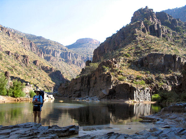
passage to the bank. If conditions permit, wade
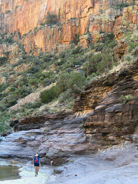
or swim across the river. Sawmill Canyon is the
prominent drainage just upstream from the path.
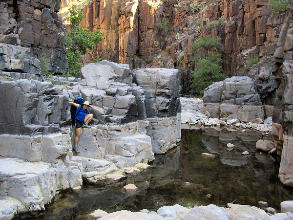
Heading up canyon you'll find the lower layers
composed of basalt. Soon you'll hit a pool and
waterfall. You can bypass the falls by climbing
around on the right. Just above is a narrows
section that can be bypassed on the left.
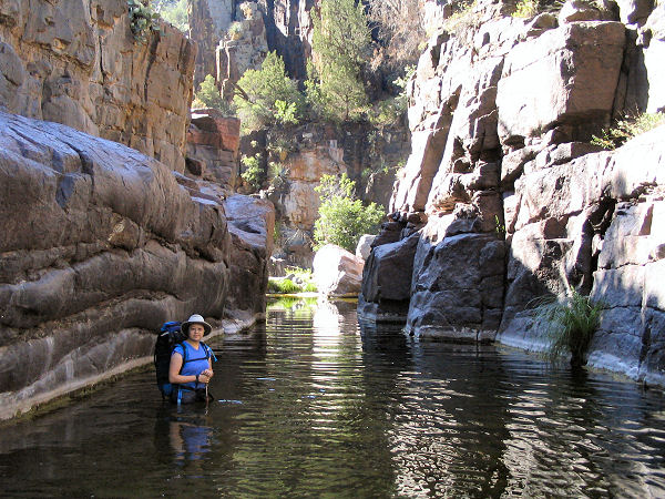
Shortly afterwards you'll reach the first swim
through a water filled hallway. It's more rock
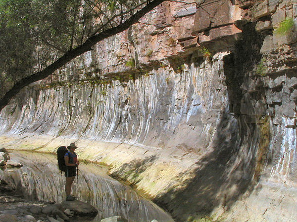
hopping and bouldering as you continue up canyon
through more nice scenery, eventually reaching
another swim through a longer hallway. About 10
minutes after this swim (about 2.5 hours from
the car) the canyon suddenly opens up, becoming
wide and uninteresting. The author continued up
canyon another 2.5 hours from this point, but
did not find anything of note. The canyon is
rather overgrown in places in this middle
section, making travel difficult. When ready
return the way you came. |
| Rating (1-5 stars): |

The author and his wife spent a long day in
Sawmill. We hiked upstream about 30 minutes past
the junction with Tank Canyon and back at an
unhurried pace in approximately 12 hours. |
| Maps: |
Click here
for a map of the area. |
| Photos: |
Click picture for larger view, click your browser's 'Back' button to return to this page. |
|
|

