| Summary: |
A river hike
through low land desert in a cow trodden
'wilderness' area near Wickenburg. |
| Directions: |
From Phoenix drive to Wickenburg, entering the
town on Highway 60. Between mileposts 111 and
110 turn right (the second right before a
McDonalds) onto El Recreo Dr. The road soon
merges with Constellation Rd (zero your odometer
here). Constellation is paved at first, but
becomes well graded dirt after 2.1 miles. Stay
on the main road throughout the drive, you'll
see considerable evidence of mining activity
along the route. At the 3 mile point, stay right
at a road sign indicating a fork, at the 8.5
mile point stay straight (towards the Williams
Ranch). The road becomes steeper and rougher
past this point. At the 13.3 mile point stay
right at a split, then soon after passing a red
sign that reads 'BLM Parking', stay right at the
next fork and drive a short distance to the
parking area with register at the end (16
miles).
Note: This parking area is on private land
(you'll see the Williams ranch on a hill a short
distance down the road). Both the book
referenced below and the BLM web site suggest
hikers ask permission to access the wilderness
from this trailhead. |
| Road Conditions: |
High Clearance
Vehicle - roads may be impassible after heavy
rains |
| Navigation: |
Easy |
| Length: |
Turn around when
you want. |
| Date Hiked: |
December 2005 |
| Weather Conditions: |
Cloudy and warm |
|
Required Skills: |
None |
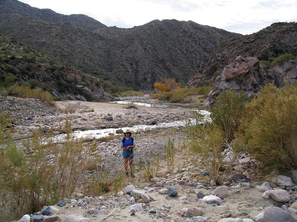
| Hike Description: |
From trail
register, continue down the dry wash past horse
pens and the ranch about a quarter of a mile to
the Hassayampa River. From here you can explore
up or down canyon. Either way you'll soon have
to cross a barbed wire fence, though it's not
clear whether the fence is there to keep the
cows in the ranch or in the wilderness (since
they are on both sides). The easiest route is
along the river or one of the many cattle trails
that line the banks. If the stream is flowing,
it's not worth the effort to keep your feet dry
since you'll be crossing it several times as you
hike. It's also possible to explore some of the
side canyons branching off from the river. The
book referenced below described Jesus Canyon
(located about 2 miles downstream of the ranch)
as 'highly scenic'. The author and his wife
hiked down the Hassayampa River to Jesus Canyon,
then walked up this drainage a ways before
returning. We did not find Jesus Canyon very
scenic. |
| Rating (1-5 stars): |
 
I suppose the allure of this hike is water in
the desert, but the degraded nature of the area
and profusion of cow pies detracted from the
'wilderness' feel. Perhaps the area is more
pristine further away from the ranch. The hike
down the river up Jesus Canyon and back was
completed in 3.5 hours. |
| Maps: |
Click here
for a map of the area. |
|
Books: |
Exploring
Arizona Wild Areas
- Scott S.
|
| Photos: |
Click picture for larger view, click your browser's 'Back' button to return to this page. |

