| |
| Summary: |
An easy hike in a
nice desert area to some narrows, a warm spring
and an old mine. The hike is located about 65
miles northeast of Wickenburg. |
| Directions: |
From
Wickenburg, leave town heading northwest on
Highway 93. Drive for about 65 miles, along the
highway, passing an interesting Joshua Tree forest
as you go.
At a little over 5 miles after passing a sign for the Burro
Creek Campground you'll drive across a large bridge
spanning Kaiser Canyon. After crossing the
bridge, and just after mile marker 135, turn right
(north) onto a dirt road which will lead down
below the bridge. Park anywhere. |
| Road Conditions: |
Passenger Car |
| Navigation: |
Easy |
| Length: |
Hike up canyon as
far as you want.
The hike down the canyon to the warm spring is
about 1.5 miles each way. |
| Date Hiked: |
January 2006 |
| Weather Conditions: |
Sunny and Nice |
|
Required Skills: |
None |
| Hike Description: |
From the parking
area, find a route under the bridge and down
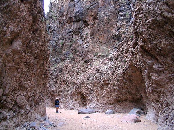
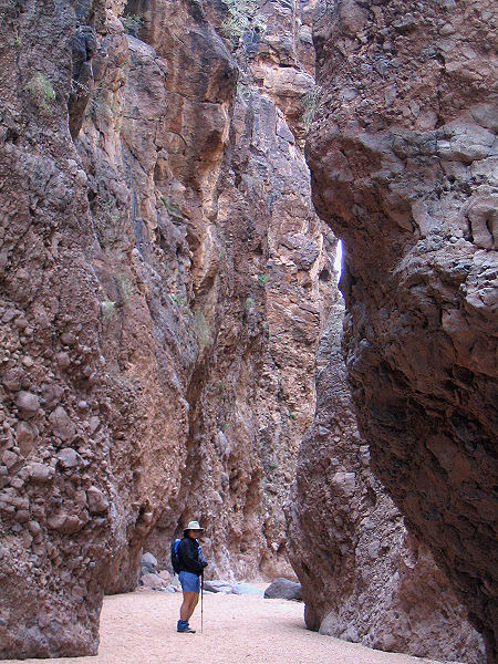
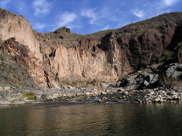
into the canyon. To visit the narrows, head
upstream to the left. The narrows are quite
scenic and consist of stunning towering walls
that rise hundreds of feet above the canyon
floor. There are a few minor climbs to get up
some drop offs, but nothing very difficult.
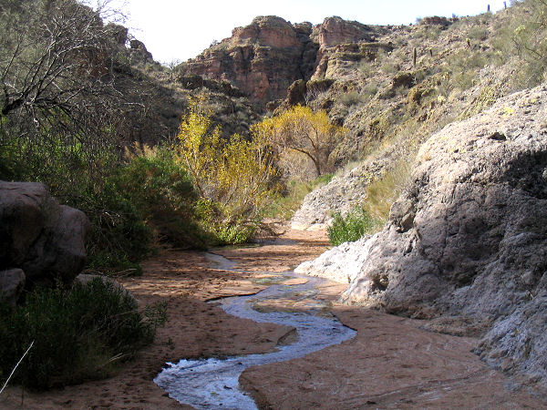
Eventually the canyon walls fade away and the
drainage becomes a wide sandy wash. Continuing
upstream for 30 minutes or so, water appears,
the canyon narrows once more and you'll enter a
scenic, if brushy, riparian area. The source of
the water is Kaiser Spring, which I had
intentions of locating, but didn't quite make it
due to the thick brush. When ready, retrace your
steps to the bridge.
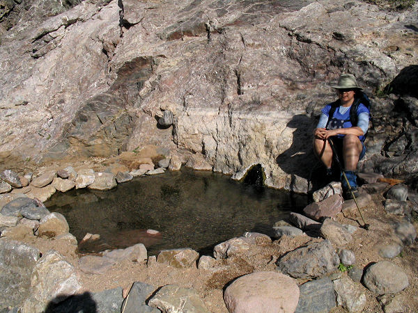
Walking down canyon, the wash is wide and flat.
Eventually an old road enters from the right.
The wash eventually becomes rockier and soon
you'll reach Warm Spring which is surrounded by
a shallow rock tub. According to a web source
(those are always accurate .... aren't they?)
the spring flows at 12 gallons per minute and
comes out of the rock at 99o F (the
pool itself is supposed to be 95o F).
Continuing down canyon, you'll soon arrive at
the confluence of Burro Creek. A short hike up
Burro Canyon is worth the effort if you have the
time. If you cross the stream and head up canyon
you can pick up an old road on the hillside
on the right. If you follow the road up hill at
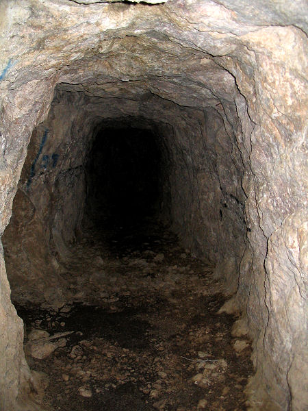
a split you will arrive at the Burro Mine (which
extends back into the hillside about 80 feet).
You can also follow the road up Burro Creek
around a corner where the creek runs through a
nice box canyon. When satisfied with your
explorations return the way you came. |
| Rating (1-5 stars): |

The author and his wife hiked up canyon to a
point near the Kelsey Spring, then hiked down to
the warm spring, Burro Creek and the mine at a
leisurely pace in 5.5 hours.. |
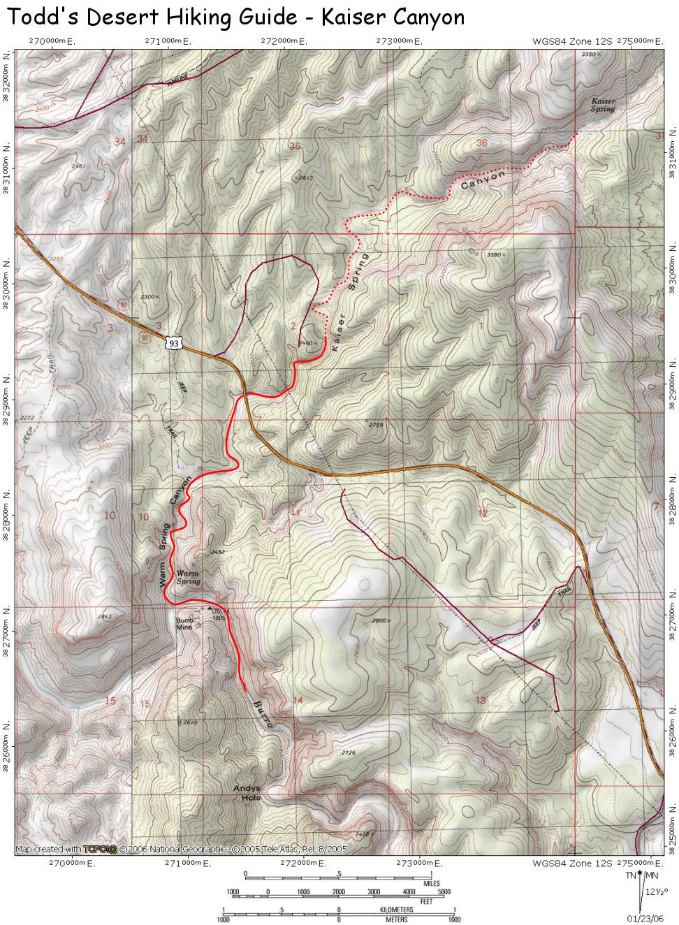
| Maps: |
Click here
for a map of the area. |
| Photos: |
Click picture for larger view, click your browser's 'Back' button to return to this page. |
|
|
