| Summary: |
A nice two
day backpacking trip to the largest natural bridge in the world (span
wise). |
| Directions: |
The
trailhead for this hike is somewhat difficult to find.
From Page drive east on Highway 98. Between mile posts 349 - 350
turn left onto the well graded, dirt, Navajo Mountain Rd. Drive 35
miles until you reach the Navojo Mountain Alliance Church on the right
hand side. At the next split turn left and drive ~8 miles until you
see the large dome shaped rock on the right hand side. Turn right on
the next dirt road past the rock. After a short distance you will
come to a well and a wooden sign with a few rules for the Navajo Mountain
area. Drive past the sign on the left hand side and follow this
rather rough road up and to the left. It will pass a large steel
water tank to the left, then climb a short stretch of slick rock before
arriving at the ruins of what used to be Rainbow Lodge. Park near
the ruins. |
| Road
Conditions: |
High
clearance vehicle |
| Navigation: |
Moderate -
the hardest part of the hike is finding the trail head. |
| Length: |
~13 miles
each way |
| Date
Hiked: |
November 2000 |
| Weather
Conditions: |
Cool with
some snow |
|
Required Skills: |


 |
| Hike
Description: |
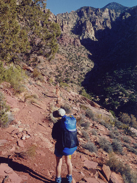
Walk up the
road a short way from the ruins and you will see two cairns marking the
beginning of the trail on the left hand side. The first part of this
trail tends to the right traveling around the base of Navajo Mountain,
winding in and out of a few canyons along the way. The first canyon
you drop into and climb out of is (aptly named) First Canyon. The
trail then winds itself in and out of the larger Horse Canyon, then a
smaller drainage. You then pass through an area consisting of some
nice sandstone rocks. After passing a large sheer sandstone wall to
the right, the trail goes through Yabut Pass then drops steeply into Cliff
Canyon. Once you reach the canyon bottom, the trail follows the
stream bed (water flowing when the author was there) on one side or the
other. After a time you will come to a major drainage entering from
the right which has a small sign reading "Red Bud Pass".
Turn right and climb up and over the fairly narrow pass. Once on the
other side head down stream once again. At one point you will come
to a fairly large drainage entering from the right with cairns continuing
down canyon and up this side drainage. The side drainage (Bridge
Canyon) is the alternate hiking route to the bridge which comes in from
the north side of Navajo Mt. Stay to the left and continue down
canyon. Just before reaching the bridge the canyon widens with a
large alcove on the right hand side. This alcove contains the
remains of a former tourist camp and a spring (from back when the only
option for viewing the bridge was over land). A short distance later
is Rainbow Bridge. There are Park Service signs at the bridge which
describes the bridge as sacred to Native Americans and to treat the area
accordingly. True to the hypocritical nature of the Park Service
there is also a huge boat dock and gazebo built to accommodate the
motorized hoard. If they felt the area to be sacred why build the
amenities? Fortunately this organization does not oversee historical
buildings or we would expect to see a parking lot in the vestibule of St.
John's Cathedral as well. Return the way you came.
|
| Rating
(1-5 stars): |

The author and his wife completed the hike to the bridge in
7 hours, camped and returned the next day in 8 hours. |
| Maps: |
Trails
Illustrated - Glen Canyon NRA, Capitol Reef NP, Rainbow Bridge NM |
| Books: |
Canyon
Hiking Guide to the Colorado Plateau -
Michael Kelsey
Canyoneering Arizona - Tyler Williams |
| Photos: |
Click picture for larger
view, click your browser's 'Back' button to return to this page. |