| |
White Canyon
| Summary: |
A bush wack type hike up a
stream through a fairly nice canyon. |
| Directions: |
The trailhead for this hike
is a little hard to find.
From Phoenix drive east on Highway 60 to the small town of Superior.
Head south out of town on State Route 177 for 9.7 miles until you come to the unpaved
Battle Axe Road on the right. Once on Battle Axe Rd. you will want to stay
right at each major branch of the road. The road heads down hill, then
bends right, traveling across sandy alluvial deposits, then eventually
becoming a small stream. Throughout this portion of the drive you will be
clearly heading in the direction of the looming form of Battle Axe Butte.
Once in front of the Butte the road bends right, crosses a small stream,
then heads up and over a rocky, rutted hill. On the other side of the hill
take the small right branching road. You can either park a short ways in
under the mesquite trees, or drive over the berm and park. The trail head
and register reside at the end of this road. |
| Road
Conditions: |
High
clearance vehicle |
| Navigation: |
Easy |
| Length: |
Maybe 4 miles? |
| Date
Hiked: |
January 2001 |
| Weather
Conditions: |
Nice |
|
Required Skills: |
 |
| Hike
Description: |
From the trail register
simply begin walking up stream. At first there is a pretty good use trail
(mainly on stream left), then it's up to you to bush wack and rock hop
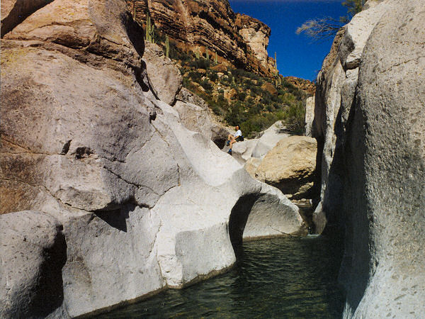
your way through the willows, cat's claw, oak and cholla. After about 45
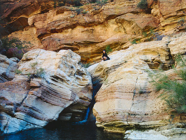
minutes you will reach a short stretch of narrows in the white rock and 15
minutes later a nice waterfall (pictured in the January 2001 issue of
Arizona Highways magazine). Not long after you pass the waterfall, the
canyon begins to narrow and (unfortunately) instead of creating a faster
moving stream that would tend to wash away vegetative accumulation, the
walls simply cram the plant growth into a tighter space. The going becomes
extremely slow (especially if you are trying to keep your feet dry as the
author was) as you duck under tree limbs and push your way through the
dense undergrowth, while the sights remain about the same. Perhaps on a
warm day with sandals it might be worth pushing your way up canyon to
see what is there, but I kind of doubt it. The author turned around &
made his way back.
|
| Rating
(1-5 stars): |
 
This canyon was a rather big disappointment. It has been profiled in the
January 2001 edition of Arizona Highways, plus there are several other write
ups on the web. Both sources made this canyon sound quite exciting and
narrow. While there are some nice spots on this hike and a couple good photo ops, the bush wacking and limited
opportunity for extended hiking make for a less than impressive trip. The author and his wife hiked upstream about 1 3/4 hours until the
going became too tedious then returned for a total trip time of 3 1/4
hours. |
| Maps: |
??? - Sorry, I didn't use a
map for this one. |
| Photos: |
Click picture for larger
view, click your browser's 'Back' button to return to this page. |
 |
 |
The
photogenic falls
in White Canyon. |
A shallow
slot through the white
rock that gives the canyon it's name. |
|
|

