| |
Seven Falls, Santa Catalina
Mountains
| Summary: |
A moderate climb to a nice series of waterfalls. This
hike is probably best done in spring after recent rains. |
| Directions: |
From I-10 take the Ina (pronounced eye-na)
Road exit #248 near Tucson. Turn east onto Ina Road and follow it as it
becomes Skyline Drive and then Sunrise Drive. After 14.5 miles, when you
reach the end of Sunrise Drive and a stop sign, turn left. The Sabino Canyon
Visitors Center and parking lot are immediately on your right. There is a $5
per car entry fee ($20 for an annual pass). |
| Road Conditions: |
Passenger Car |
| Navigation: |
Easy |
| Length: |
8.5 miles |
| Date Hiked: |
April, 2005 |
| Weather Conditions: |
Sunny & windy |
|
Required Skills: |
None |
| Hike Description: |
From the large parking lot, pick up the trail to Bear
Canyon (Trail #29) which starts behind the bathrooms. The path is wide and
flat as it heads east through the creosote flats of the bajada. Soon you'll
reach a road, turn right and walk down the road a short distance to where a
path parallels it on the right (you can walk on the road or the trail, but
the trail is a little nicer). The path crosses 2 washes and 0.7 miles after
starting, crosses the road once again to reach a junction with the left
branching Phoneline Trail #27, stay right on the Bear Canyon Trail. The path
passes through typical desert vegetation consisting of: mesquite, creosote
bush, palo verde, saguaro, prickly pear, cholla, and ocotillo. At the 1.2
mile point you'll reach a sign for Bear Canyon Rd. which is 0.5 miles to the
right and Bear Canyon, which is 0.3 miles to the left, turn left and left
again 0.1 miles later at a sign for Seven Falls. At the 1.5 mile point (1.7
miles according to the map below) you'll reach the end of Bear Canyon Rd.
and a sign pointing up canyon for the East Fork and Sycamore Reservoir
Trails which are 6.5 miles away (6.8 miles on the map). Continue up the
trail which winds it's way up Bear Canyon at a very mild grade on one side
of the stream (flowing when the author was here) or the other. The trail
eventually crosses over to the right (facing up canyon) and climbs a
distance above the streambed at a comfortable grade until you reach an
obvious left branching spur trail and sign for Bear Canyon Trail (pointing
straight). Turn left onto this spur trail, which descends to the stream bed
and crosses it to the Seven Falls (4.25 miles). You can reach the second
fall by climbing up the canyon on the left (watch your footing, the rocks
are polished and smooth) and if you're feeling adventurous (and you're a
good climber), do a somewhat more difficult climb up on the right to reach
the second (and best) falls. When ready return the way you came (8.5 miles). |
| Rating (1-5 stars): |
   
The author and his wife completed the hike to the falls in about 1.5 hours
as part of a longer loop hike using Bear Canyon and the Phoneline trail. |
| Maps: |
Santa Catalina Mountains - Rainbow
Expeditions Inc., available in the Sabino Canyon Visitor Center ($6).
Recommended! |
| Books: |
None used |
| Photos: |
Click picture for larger
view, click your browser's 'Back' button to return to this page. |
 |
 |
 |
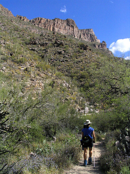
| Heading up Bear Canyon. |
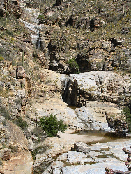
Seven Falls. |
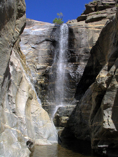
Fall #2. |
|
|

