| |
Cochise Trail #279, Dragoon
Mountains - Coronado National Forest
| Summary: |
A hike to a tall, trickling waterfall that involves an
elevation loss, and gain, of 2,700 feet. |
| Directions: |
From Tucson drive east on I-10 to Highway
80. Head south on 80 to just past milepost 315 and turn left (east) onto
Middle March Road. Drive 10 miles on this well graded dirt road to a cattle
guard and sign for the Coronado National Forest. Turn left just past the
cattle guard, following the sign for the West
Stronghold (this is also Forest Road #687). This road is somewhat rougher
(but still decent) and heads due north, paralleling the western front of the
Dragoon Mountains.
To go to the Council Rocks, follow FR #687 for ~7 miles and turn right onto
FR #687K. Follow this rough road 0.2 miles to the end.
To get to the West Stronghold, follow FR #687 for 7.2 miles to a ranch. At
this point the road bends to the east and becomes rougher (high clearance
needed). Follow the road another 2.8 to where it ends at the trailhead.
|
| Road Conditions: |
High Clearance Vehicle |
| Navigation: |
Easy |
| Length: |
~10 miles |
| Date Hiked: |
October 2006 |
| Weather Conditions: |
Sunny & warm, followed by clouds, rain and hail |
|
Required Skills: |
 |
| Hike Description: |
Cochise Trail:
From the trailhead, walk across the dry creek bed to a sign for the Cochise
Trail #279 which gives the mileage for the Cochise Stronghold Campground as
5 miles. After passing through a stile the trail begins climbing at a
moderate grade beside a prominent drainage which will be on your left. There
are nice views of rugged rock formations as you ascend along the well
maintained gravel path. After a mile or so, the trail negotiates a few
switchbacks before topping out at a pass at the 1.75 mile point (according
to a mileage sign, anyway). The path begins descending at a more gentle
grade on the other side of the pass. There are rock formations on this
eastern flank of the Dragoons, but they are not as plentiful as those to the
west. The trail descends for 3 miles to an intersection with a 0.4 mile
nature loop, which features a few signs identifying plants found in the
area. Follow the nature trail in either direction to the Cochise Stronghold
Campground (5 miles), which sees a lot of visitation due to the fact that
the road is paved on this side of the mountain. When ready, return the way
you came (10 miles).
Council Rocks:
From parking area at the end of FR #687K walk through a gate and follow a
use trail to the right up into the rocks. After 10 minutes of walking the
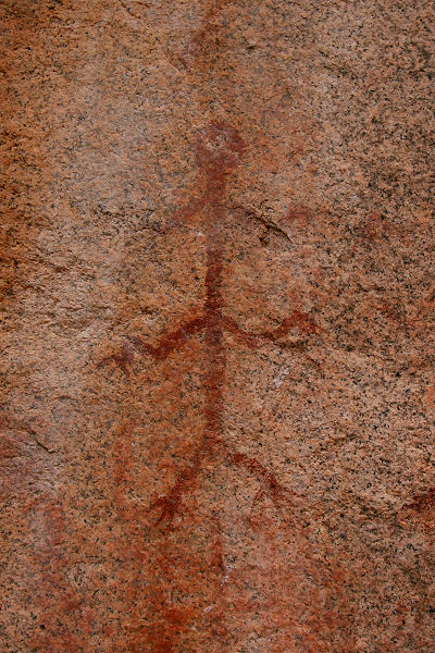
path will lead to the Council Rocks and an interpretive sign. There are a
few faded pictographs in a small amphitheater formed by some large boulders. |
| Rating (1-5 stars): |
 
The author and his wife completed the hike in 5.5 hours at an unhurried pace. |
| Maps: |
Coronado National Forest - Douglas
Ranger Districts |
| Books: |
None used |
| Photos: |
Click picture for larger
view, click your browser's 'Back' button to return to this page. |
 |
 |
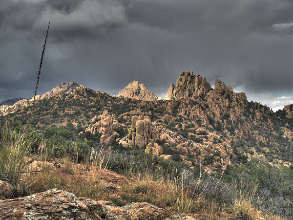
Gathering storm clouds
over the Dragoons |
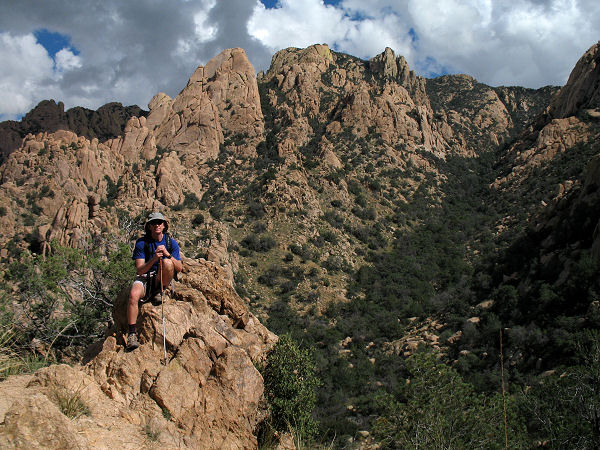
Typical view ascending
the Cochise Trail. |
 |
 |
| Another view along the trail. |
Pictograph at the Council
Rocks. |
|
|
