| |
Romero Canyon Loop, Santa Catalina
Mountains
| Summary: |
A long steep and
sometimes remote loop hike around the western section of Pusch Ridge in the Santa Catalina
Mountains. |
| Directions: |
From Phoenix drive south
on I-10 to Tucson. Take the exit for Ina Rd. Drive east until you reach North
Oracle Rd (U.S. 89). Turn north (left) on North Oracle and drive approximately 6
miles to the Catalina State Park entrance on your right. There is a $5/carload
charge to enter the park. Follow the Park road to the trailhead parking lot at the
end. |
| Road
Conditions: |
Passenger Car - paved all
the way |
| Navigation: |
Difficult - about 5 miles
of faint path |
| Length: |
22 miles, 5800' elevation
gain |
| Date
Hiked: |
February, 2000 |
| Weather
Conditions: |
Daytime highs in the
upper 70's made it warm in the sun and nice in the shade |
|
Required Skills: |

 |
| Hike
Description: |
From the parking lot walk
east across the road to the trailhead (0 miles, 2720 ft) and begin walking on this wide
sandy track towards Romero Canyon (signs point the way). This first part of the hike
lies within Catalina State Park, the Park allows dogs on it's trails as evidenced by the
poop you will be dodging. After 0.6 miles you will reach a signed junction with the
Canyon Loop, continue east on the Romero Canyon Trail. You then begin climbing
moderately through an area covered with saguaro, paloverde, fish hook barrel cactus,
staghorn cholla and ocotillo. The trail climbs through a rocky, pretty area to a
ridge, then drops a short distance to Romero Creek (2.8 miles, 3600 ft) which had a small
amount of not too clean looking water when the author performed this hike. The trail
crosses the stream (look for cairns) and begins ascending once more. There are a
couple stream crossings that are a little confusing in this area, keep your eyes peeled
for cairns. As you continue to ascend the sunny slope sotol, manzanita, hopbush and
silver leaf oak become more prevalent. Eventually the canyon becomes mostly forested
with pinyon pine and alligator juniper entering the mix and the trail begins a steep climb
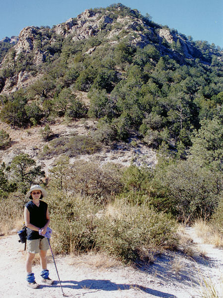
up to Romero Pass (7.2 miles, 5320 ft) with views back down canyon and south up at the
Cathedral Rocks. Walking to the left a short distance brings you to a signed
junction with the West Fork of Sabino Canyon Trail which continues east, and the Mt Lemmon
Trail which heads to the northeast (left). Continue the relentless ascent on the Mt
Lemmon Trail. When you finally reach the top of this climb there will be a large
rock outcrop just off the trail to the left which provides excellent views down into the
canyon from which you have come and makes a nice lunch spot. The trail then drops a
short distance to a signed junction with the right branching Wilderness of Rocks Trail
(9.1 miles, 7260 ft). Stay to the left and continue on the Mt Lemmon Trail. From this point you begin a moderate ascent, winding through some nice rock formations,
then climbing more steeply entering a burned area and finally to a signed junction (11.5
miles, 8560 ft) at the highest point in this hike. Turn left onto the Samaniego/Sutherland trail and follow this rocky path down through more burned area. After 0.8 miles (12.3 miles, 8000 ft) the Sutherland Trail branches off to the
left. Turn left onto this faint path. The next 4.3 miles follow a rather faint
trail which is quite overgrown in places. Make sure you have enough daylight to make
it through this section, since the path will be hard enough to follow in full day light
let alone after dark. For the first part of the trail you can follow the brown signs with red labels
indicating underground power lines. Where the lines come above ground follow the
wires to the last pole on the ridge before the lines drop off the ridge to the right. Look for cairns on the left hand side at this point and continue on the faint trail
that roughly follows the line of the ridge. There are clues along the way which tell
you that you are on the right track. At some points there is a faint to good trail,
at others there may be cairns or a few pieces of flagging tape tied to tree branches. After a long steep decent in which the trail gradually becomes more distinct, the
trail crosses a grassy dry stream bed before meeting up with a rocky jeep road (17.1
miles, 4640 ft). Follow the rocky road as it parallels some power lines (actually
the same ones you followed earlier at the top of the ridge) for 2.3 miles to a tall pole
on the left hand side with arrows pointing the way back to the park entrance (19.4 miles,
3440 ft). The trail becomes flat and smooth at this point (a welcome relief for your
tired feet and legs) and winds through the brush as it parallels the Pusch front range
which you can see off to the left. After 1.8 miles (21.2 miles, 2800 ft) you will
reach a signed junction. Stay right following the arrow pointing to the trailhead
and the completion of your journey which you will reach after 0.8 miles (22 miles, 2720
ft). |
| Rating
(1-5 stars): |
  
This hike is for the strong, fast, experienced and psychotic. Good
trail following skills are required and an early start. The reward is that you are
unlikely to see any other humans for the majority of the trek. The author and his
wife completed this hike in just under 12 hours, spending the last hour hiking by
headlamp. |
| Maps: |
Santa Catalina Mountains
- Rainbow Expeditions Inc. |
| Books: |
Portions of this hike are
covered in: 'Arizona Trails - 100 Hikes in Canyon and Sierra' by David Mazel |
| Photos: |
Click picture for larger
view, click your browser's 'Back' button to return to this page. |
 |
 |
| Romero
Pass |
Sunset
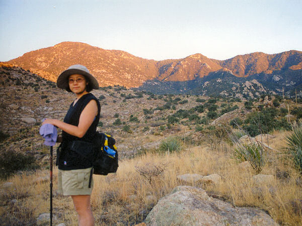
with 4 miles left to go. |
|
|

