| |
Tanque Verde Ridge, Rincon Mt. District - Saguaro National Park
| Summary: |
A steady climb to a nice peak with 360 views. Here's how the Park Service interpretive sign describes this route: "The Tanque Verde Ridge Trail is narrow rocky and steep with spectacular views of the Tonto Basin. The trail travels through a wide variety of plant and animal habitats. As the trail gains in elevation the plant communities gradually change from desert scrub and desert grassland to oak-pine woodland. Large mammals include: cougar, coyote, javelina, mule deer and black bear." |
| Directions: |
From Phoenix drive south on I-10 to Tucson. You want to get on the Old Spanish Trail in eastern Tucson. There are many ways to get there, the author took exit 259 and went east on 22nd Street (sort of a slow drive with all the traffic lights, so there may be a better route). Head east towards the mountains, eventually you'll reach the intersection with Old Spanish Trail and a sign reading Saguaro National Park 4 miles, Colossal Cave 15 miles. Turn right and follow Old Spanish Trail 4 miles to the Park entrance on the left. After paying the $6 per carload entrance fee (valid for a week), follow the loop road around to the right following the signs for the picnic areas. Along the way you'll pass the Cactus Forest Picnic Area then Freeman Homestead Trailhead before arriving at the Tanque Verde Trailhead and parking area on the right. The trailhead is on the immediate right as you enter the picnic area (complete with picnic tables and restroom). |
| Road Conditions: |
Passenger Car - paved all
the way |
| Navigation: |
Easy - good trail with sign posts at all trail intersections |
| Length: |
18 miles to Tanque Verde Peak and back, 13.8 miles to Juniper Basin Camp & back |
| Date Hiked: |
March, 2002 |
| Weather Conditions: |
Beautiful & sunny, cooler at the summit |
|
Required Skills: |
 |
| Hike Description: |
From the trailhead sign begin walking on the Tanque Verde Ridge Trail (0 miles, 3100 feet). A metal sign at the trail beginning lists Juniper Basin 6.9 miles, Tanque Verde Peak 9 miles. The trail is flat a first as it winds it's way through the desert scrub consisting of: prickly pear, jojoba, palo verde, mesquite, saguaro, cholla and ocotillo. After about 5 minutes you'll reach a trail register with sign in sheet. The path then bends left and begins climbing moderately towards the ridge line. The trail itself consists of firm sand or rocks throughout the hike, which provides excellent footing. At the ridge the trail bends left and continues it's moderate (if relentless) ascent. As you gain elevation you'll have good views to the left of Tucson and the brown cloud that hovers above, then later to the right into the Tonto Basin. Slowly you'll notice that saguaros and cholla begin to disappear and are replaced by sotol, sugar sumac, shindaggers and bear grass. A little higher, junipers, oaks and grasses become more prevalent and there are a few breaks in the climbing as the trail dips down into a few shallow drainages as it ascends. The trail continues through the grasses in an area where most of the trees appear to have been blackened by an old forest fire. The path is a little indistinct in places where the grasses are thick, but cairns mark the way at any confusing spots (the author had no trouble staying on the trail). The path bends right, drops into the shallow valley of Box Canyon and continues climbing. A short distance later you will reach Juniper Basin Campground (6.9 miles, 6000 feet). There is a sign pointing towards the campsites & toilet. Campsite #1 has a metal bear box that should be used if camping. The author was not able find any water available at the camp, so make sure you bring plenty if you are planning on an overnight stay. If you only want to do a 13.8 mile hike, this makes a good turn around point, we however, will follow the other small metal sign to the left for Tanque Verke Peak 2.1 miles, Cowhead Saddle 4.6 miles. The path winds its way through a more shady and forested area with many aligator juniper trees. There are small orange metal markers nailed to trees to presumably mark the path, however, the trail is so distinct these markers are unneccessary. In a few spots as you ascend the trail crosses areas of solid rock, look for cairns to mark the way. Closer to the summit you'll begin have good views to the right of Mica Mountain and Rincon Peak and not too long afterwards you reach a signed junction: Cowhead Saddle is 2.5 miles to the left and Tanque Verde 100 yrds straight. Continue straight to the summit. There is a trail register at the base of some large rocks. An easy scramble to the top of the rocks provides excellent 360 views and flat spots for catching your breath (9.0 miles, 7040 feet). Temperatures at the summit are much cooler than the desert below, which will either be refreshing or down right cold depending on the time of year of your hike. When ready, return the way you came. |
| Rating (1-5 stars): |

There is a bit of uphill walking involved in this hike which some may find relentless (though I found the grade to be mostly moderate, if long). The upper parts of the ridge line are very scenic and the change in life zones with the gain in elevation is interesting as well. The author completed this hike solo at a rather quick pace in 6 ½ hours. |
| Maps: |
You'll can get a free Park Service map at the entrance fee station |
| Books: |
'Arizona Trails - 100 Hikes in Canyon and Sierra' by David Mazel |
| Photos: |
Click picture for larger
view, click your browser's 'Back' button to return to this page. |
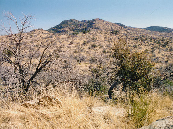 |
Typical view
on the way
to the peak. |
|
|
