| |
Rincon Peak, Rincon Mt. District - Saguaro National Park
| Summary: |
A steep climb on a non-crowded trail to a nice peak with 360 views. |
| Directions: |
From Phoenix drive south on I-10 past Tucson. Take exit 297 for Mescal and turn left at the end of the exit ramp. Follow this road north. After 2.8 miles the road becomes well graded dirt eventually enters private ranch land. After driving 15.5 miles from I-10 you'll reach a large brown sign: Miller Creek Trail is left, Turkey Creek Trail is right. Turn left and drive a short distance to the Miller Creek Trailhead. |
| Road Conditions: |
High Clearance Vehicle is probably best, although a Passenger Car can make it if you take it slow |
| Navigation: |
Easy - good trail with sign posts at all trail intersections |
| Length: |
16.2 miles |
| Date Hiked: |
March, 2002 |
| Weather Conditions: |
Nice & sunny, very cold at the summit |
|
Required Skills: |
 |
| Hike Description: |
The trail begins just to the left of the Arizona Trail sign (0 miles, 4200 feet). After passing through a fence you'll come to a sign for the Miller Creek Trail: Saguaro National Park 1.5 miles, Rincon Peak Trail 4.4 miles, Happy Valley Saddle Camp 4.9 miles, Rincon Peak 8.1 miles. The trail is level at first as it winds its way beside Miller Creek through a shaded oak and manzanita forest towards the base of the mountain. The many cow pies in the area are an indication that you are still outside the park boundary. After walking about 30 minutes you'll come to another fence and just on the other side a sign, indicating that you are now in Saguaro National Park, and a register (1.5 miles, 4200 feet). The path then begins climbing moderately to steeply up the sunny boulder strewn foothills of the mountain. After an hour or so of climbing the trail rounds a corner to the left & drops down a short distance into a shady, forested wash. The path bends left and heads up the wash a distance before climbing out on the left to eventually top out at a saddle. The trail then descends a short distance to a signed junction: Rincon Peak & Happy Valley 0.5 miles (straight), Deer Head Spring Trail 4.4 miles (right). Stay straight (this trail is called the Heartbreak Ridge Trail, though the sign does not identify it as such) towards Rincon Peak, which you can see looming over the trees ahead (4.4 miles, 6200 feet). The next half mile is pleasant, easy walking through a pine/juniper forest until you reach another signed junction: Rincon Peak 3.2 miles (left), Rincon Creek Trailhead 7.7 miles (straight). Happy Valley Camp may be found a short distance down the trail towards the Rincon Creek Trailhead (permit required for overnight use). We, however, will turn left towards Rincon Peak (4.9 miles, 6080 ft). The path soon begins climbing again (moderately at first) through a forest of oak, alligator juniper, ponderosa pine, manzanita & yucca. The climb becomes steeper as you begin to glimpse the rocky peak once again across a rugged valley. The trail continues towards the peak, levels out somewhat as it crosses a slick rock drainage, then shortly afterwards climbs more steeply through a pine forest of Douglas Fir. At the base of the peak you'll reach a sign that says "Foot trail only, no stock", you are close to your destination, but the hardest part of the hike is still ahead of you. Just past the sign the trail begins an extremely steep series of switchbacks that only seem to become steeper the closer to the peak you get. At a steady pace this section of trail only lasts about a half hour or so, but it's a grueling 30 minutes. You'll know you are close when the trees begin to thin and large rocks appear. Shortly thereafter you'll reach a trail register, then it's a short scramble (follow the cairns) to the summit (8.1 miles, 8482 feet). At the top you'll be greeted with great 360 degree views, a cool (or cold) breeze, a very large rock cairn and yet another register in a green ammo can (upon which some genius has written a few of their profound thoughts) bolted to the base of the rock pile. Take in the view, have a snack & when ready return the way you came staying right at all signed junctions. |
| Rating (1-5 stars): |
 
The author has completed this hike on two occasions. On the latest trip the author and his wife completed this hike at a moderately quick pace in 7 hours. |
| Maps: |
National Geographic Trails Illustrated -
Saguaro National Park |
| Books: |
'Arizona Trails - 100 Hikes in Canyon and Sierra' by David Mazel |
| Photos: |
Click picture for larger
view, click your browser's 'Back' button to return to this page. |
 |
 |
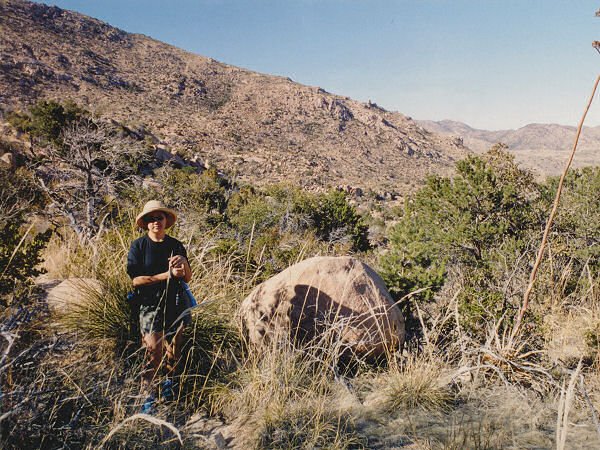
| The rocky
slope of Rincon Peak. |
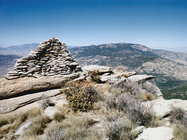
Rincon summit
& cairn. |
|
|
