| |
Sheep Bridge Loop - Tonto National Forest
| Summary: |
A long loop hike from Sheep Bridge using the Willow Spring Trail and Dutchman Grave Trail. Some good scenary and much wildlife - the author saw thousands of birds in the grass lands as well as mule deer and two herds of javalinas.
Note: This hike was completed prior to
the Willow fire which burned through the Mazatzal Wilderness in
June and July of 2004. Actual trail conditions
may differ from those described below. |
| Directions: |
Be aware that his trailhead involves a long drive on bumpy dirt roads. From Phoenix, drive north on I-17 to exit #223 and head east on the Carefree Highway. Drive all the way to the end at a 'T' intersection and turn left on Tom Darlington Dr. and follow it a few miles until it ends at Cave Creek Rd. where you'll turn right. You'll pass a small airport on the left and further down the road, Desert Mountain (also on the left). Where the road splits, you'll see a sign for Bartlett Lake & Rangers Station to the right; you'll want to stay left (this is Forest Road 24, zero your trip odometer here to follow along with my directions). Shortly afterwards you'll pass a sign for Seven Springs, Sears Kay Ruin, Camp Creek, Residential Area. After 2 miles you'll enter the Tonto National Forest. At the 4.5 mile point the pavement ends in a well graded dirt road. Continue winding along the road, at the 12 mile point you'll hit a short stretch of pavement as you enter the Seven Springs Recreation area and Cave Creek Campground (this is a fee area if you plan on a stop over, though I don't believe you have to pay if you're just driving through). The road is more narrow and rough when it turns back to dirt on the other side of Seven Springs, but still passable by passenger car. At the thirty mile point, you'll reach a junction with FR 269 (also called Tangle Creek Rd.). Bloody Basin I-17 is 27 miles to the left, Verde River 12 miles to the right; we'll go right. This road is quite rough and rocky, you'll need at least a high clearance vehicle to make it through. You'll go up and over a rocky hill and eventually begin dropping down to the river and bridge, which you'll reach at the 42 mile point. Park next to the bridge. Note this is also a popular destination for fisherman and rednecks (I'm using the bullet holes in all the signs and a few saguaro as evidence). |
| Road
Conditions: |
High Clearance Vehicle |
| Navigation: |
Easy - someone found a lot of time to build cairns on this route |
| Length: |
18-20 miles: there is some conflicting information regarding the length of the Willow Spring Trail. The sign at the start of the hike indicates that it is 8 miles to the junction with the Mazatzal Divide trail. The sign at the junction says 10 miles back the way you came to the Sheep Bridge. David Mazel's book lists the distance as 9.8 miles. I'm not sure who's correct. |
| Date
Hiked: |
April, 2002 |
| Weather
Conditions: |
Cloudy with rain, sleet, and occasionally sun and steamy heat |
|
Required Skills: |
 |
| Hike
Description: |
Begin this hike be walking across the Sheep Bridge (0 miles, 2100 ft). This part of the Verde River has been historically used by sheep herders to seasonally move their flocks between the high country and desert. The suspension bridge you're crossing was constructed in 1989 to replace the old bridge (built in 1943, remnants of which are visible nearby) which fell into disrepair. About 5 minutes from the trailhead the path drops down to a drainage (Horse Creek), turn left and cross the wash (ignore the use trail that continues straight beside the creek) and a short distance after climbing the other side you'll come to a signed junction. The Willow Spring Trail continues straight (8 miles to the Mazatzal Divide Trail), to the left is the Verde River Trail #11 and Dutchman Grave Trail #22. This is the where the loop begins. The author hiked it counter clockwise and will describe it accordingly. Continue straight on the Willow Spring Trail which is extremely flat and wide as it heads east through an area dominated by creosote bush, palo verde, prickly pear, saguaro, jojoba, brittle bush, buckhorn cholla and mesquite. The path is easy to follow and (as with the rest of this hike) cairns have been placed at moderate intervals, some of them quite large. After about 40 minutes, you'll pass a Mazatzal Wildernes boundary sign (2.2 miles, 2430 ft). Another 40 minutes later, you'll pass a gate. The path then begins a gradual ascent into the foothills and the scenary improves. After a somewhat steeper climb, the trail levels out once again as you wind your way through some rounded foothills. The trail begins climbing moderately again and occasionally you'll get a glimpse down to the right into the prominent drainage of Horse Creek. Another hour of walking will bring you to a saddle with a junction and sign for Willow Spring Basin (7.2 miles, 3860 ft). If you head down the path to the right, you can walk 3/4 miles to Willow Spring (which supposedly flows year round). We, however, will head to the left and begin climbing moderately, then more steeply, up towards the ridge line above. As you climb you'll have great views of the Verde River and valley you passed through earlier as well as down to the right, into the drainage of Horse Creek. The path climbs a series of steep switchbacks, eventually topping out at a saddle (8.8 miles, 5020 ft), then begins dropping gradually down the other side beside a wash which will be off to the right. Shortly after reaching the floor you'll reach a signed junction: Mountain Spring Trail 1/4 mile straight, Sheep Bridge 10 miles back, and to the right the Deadman Trail #25, Davenport Wash Trail 6 miles, and Club Cabin 7 miles. Continue straight towards Mountain Spring (which supposedly has year round water) and in 5 minutes you'll reach another signed junction. Stay left following the sign for Dutchman Grave Trail #22, Red Hills Trail #262 (10 miles, 4840 ft). This next section you'll be hiking through a grassy hillside with beargrass, juniper, ponderosa pine and yucca. The trail heads north and west & as you hike you may feel like you are heading more to the north than you should (I felt that way), but that's the way the path is designed. The trail is fairly level as it winds it's way towards a prominent red hill located across from Sycamore Creek. The path bends left and begins descending moderately then more steeply as it switchbacks down then crosses the creek. Shortly thereafter, you begin climbing out on the right. The trail climbs to a ridge, then begins a few short descents and climbs before beginning a steady drop to the north west through grassy fields below a large ridge on the right. Not much to say about this section. Continue your rocky descent until you see a big patch of cottonwoods in a basin below you. The path heads directly towards the cottonwood grove, passing through a fence and wooden gate just before reaching them. The trail winds through the shady grove and through another gate before you cross a dry wash then climb a low ridge to a signed junction. The Dutchman Grave Trail #22 and Sheep Bridge (5 miles) continues straight, the Red Hills Trail #262 & Fuller Seep (12 miles) heads right. Continue straight on the Dutchman Grave Trail (15 miles, 2900 ft). The path drops down and passes through another shady glen of cottonwoods (there are a number of use trails under the trees, stay on the paths to the right). Back in the sun, you'll drop down, cross a dry, rocky wash (keep an eye out for the big cairns) then perform an annoying climb (coming this late in the hike) up to ridge then steeply down the rutted trail on the other side with views to the right of the cottonwood lined Sycamore Creek. Once down, there are a few more small hills to negotiate before reaching a gate, then 10 minutes later a Mazatzal Wilderness Boundary sign. The path is once again nice and flat as you travel southwest along an area labeled HK Mesa on the map. As the author was hiking through this area, he was suddenly surrounded by the low grunts of a herd of a dozen javalinas (unfortunately they were too quick to get any photos). The path heads towards a low dome shaped hill, passes it to the left then begins descending towards the bridge and river which you will see below you. After dropping down a short distance you'll reach a signed junction with the Verde River Trail #11 (Red Creek 8 miles) which heads right, Sheep Bridge 1/2 mile straight; continue straight. The path drops down and crosses Sycamore Creek (flowing when the author was here), then hops over to the Horse Creek drainage (which has a huge log jam at it's confluence with the Verde). You'll reach the signed junction you passed earlier in the day. Turn right and follow the sign back over the bridge to your car (20 miles). |
| Rating
(1-5 stars): |
 
The author completed this hike solo at a quick pace in 7.5 hours. |
| Maps: |
Mazatzal Wilderness Tonto
National Forest, USFS |
| Books: |
Several sections of this hike are described in: Arizona Trails - 100 Hikes in Canyon and Sierra' by David Mazel |
| Photos: |
Click picture for larger
view, click your browser's 'Back' button to return to this page. |
 |
 |
The beginning of the wide,
flat
Willow Spring Trail. |
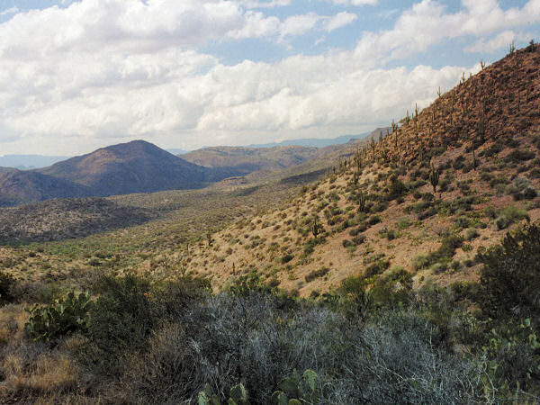
Descending the Dutchman
Grave Trail. |
|
|
