| |
Workman Creek - Sierra Ancha Wilderness,
Tonto National Forest
| Summary: |
A pleasant and wet loop hike through the upper reaches of
Workman Creek in the Sierra Anchas. Wading and swimming is required to
complete this hike. Be aware that the
rock in the canyon is very slick. |
| Directions: |
From Phoenix
drive east on Highway 60 almost to Globe. Turn
left (north) on Highway 188 (also listed as 88
on maps) and drive 14.4 miles to Highway 288.
Turn right on 288 which is paved at first and
after a short distance crosses the Salt River on
a single lane bridge. After 12.2 miles you will
come to an intersection with left branching A
Cross Road. Continue straight on Highway 288 for
another 15 miles to the sign and turn off on the
left for Reynolds Trailhead and camp. |
| Road
Conditions: |
Passenger Car |
| Navigation: |
Easy |
| Length: |
10 miles |
| Date
Hiked: |
June 2008 |
| Weather
Conditions: |
Warm and Sunny |
|
Required Skills: |


 |
| Hike
Description: |
From the trailhead parking area, walk
through the stile in the fence and begin following the wide dirt trail up
hill (the trail at this point looks as if this used to be an old road).
About 100 ft in you will come to a sign for the Hells Hole Trail (284) 6
miles, Boyer Trail (148) 2 miles. Note: Based on my walk time I do not
believe either of these mileages to be terribly accurate, I'm guessing the
Boyer Trail is 2.5 miles away & Hells Hole 5 miles. The trail tops out at a
shoulder then begins descending moderately through a ponderosa pine forest
interspersed with manzanita, alligator juniper, agave & emory oak. At Armer
Ranch the trail bends right, paralleling the drainage of Workman Creek for a
short distance before dropping down into it. Leave the trail at this point
and simply follow the creek downstream. Don't bother trying to keep you feet
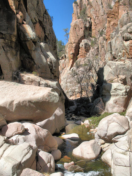
dry, you'll be walking in water much of the time. Soon the creek enters a
very nice box canyon composed of pink granite polished smooth and rounded by
the water. There are a few spots in this section where you'll have to
determine the best way around an obstacle or down a small falls. A possible
deep wade or short swim may also be required. After a bit of hiking you'll
reach a junction with Reynolds Creek which enters from the right. This
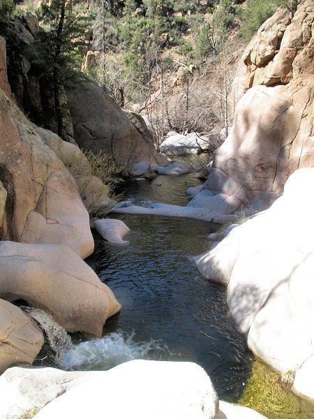
drainage is wider than Workman and not as interesting. Continue downstream
through a very pleasant canyon climbing, wading, rock hopping and swimming
where necessary. After several hours of hiking the canyon will begin to get
more brushy. When this occurs, keep your eyes open for the lower end of the
Hells Hole Trail and camp sites which will be on the left hand side of the
creek. Pick up this distinct path as it begins climbing steeply up and out
of the canyon on the south side of Workman Creek. The trail ascends through
oak chaparral, manzanita and pine to eventually top out on a flat juniper
dotted mesa. Walk across the mesa and continue straight, passing the
junction with the right branching Boyer Trail. The path then descends into
upper Workman Creek where you left the trail earlier in the day. Retrace
your footsteps the remainder of the way to Reynolds Camp and your vehicle.
|
| Rating
(1-5 stars): |

The author and two friends completed this hike in 5.5 hours. Not knowing
what to expect we brought rope and technical gear. We didn't need it, but
the hike was quite nice all the same. |
|
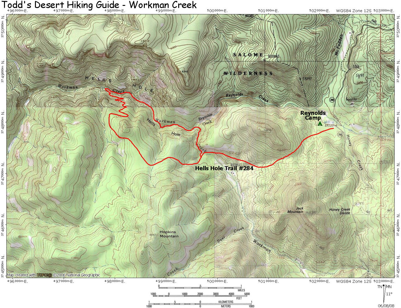
Map: |
Click
here for a map of
the hike. |
| Photos: |
Click picture for larger
view, click your browser's 'Back' button to return to this page. |
 |
 |
|
Typical views in Workman Creek. |
|
|
