| |
Devils Chasm - Sierra Ancha Wilderness, Tonto National Forest
| Summary: |
Devils Chasm is located in
the Cherry Creek area of the Sierra Ancha
Wilderness. The hike involves a steep climb up a
remote canyon to well preserved (and well known)
Salado Indian ruins. Normally I would not
publicize the location of Indian ruins, but this
hike has been published elsewhere and are
frequently visited (in fact the author ran into
another group of 8 as he was coming down the
canyon, and this was on a non-holiday weekday).
Not to sound like a broken record but, ruins are
fragile and irreplaceable, please leave the area
as you found it. |
|
| Directions: |
From Phoenix
drive east on Highway 60 almost to Globe. Turn
left (north) on Highway 188 (also listed as 88
on maps) and drive 14.4 miles to Highway 288.
Turn right on 288 which soon crosses the Salt
River on a single lane bridge. After 6.7 miles,
turn right onto the well graded, dirt Cherry
Creek Road (which is also Forest Road 203).
After 8.8 miles at the sign for Coon Creek FR
#203 bends right and crosses the creek (straight
will take you onto private ranch property). At
the 13.3 mile point you reach a sign for the
left branching Bull Canyon Road (FR #203A), stay
straight on FR #203. After passing the Ellison
Ranch, the road becomes considerably rougher and
rockier and soon you'll reach a Forest Service
sign which reads:
| "Sierra Ancha Cliff Dwellings:
Prehistoric cliff dwellings are located in
several of the rugged canyons within and near
the Sierra Ancha Wilderness. They were built
between 1280 and 1350 AD by indians known
presently as the 'Salado'. Why they chose to
utilize this challenging environmental
zone is not yet fully understood. Cliff
dwellings are fragile and irreplaceable.
Please do not climb on the walls, or roofs
or cause any other form of injury or
disturbance. Violators are subject to
arrest, fines and or imprisonment."
|
| At the 22
mile point on the Cherry Creek Road park on the
left at a small pull out under some oak trees
(the gps coordinates are UTM 512959mE,
3742604mN). |
|
|
| Road Conditions: |
High
Clearance Vehicle |
|
| Navigation: |
Moderate |
|
| Length: |
~4 hours |
|
| Date Hiked: |
November 2003 |
|
| Weather Conditions: |
Cool and overcast |
|
|
Required Skills: |
 |
| Hike Description: |
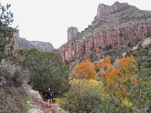
From the car park, follow the
wide path as it begins climbing up into the
canyon. The trail soon narrows as it winds its
way on the left side of the Devils Chasm
drainage (flowing when the author was here). As
you continue up canyon the path becomes somewhat
more faint and braided (stay on the most
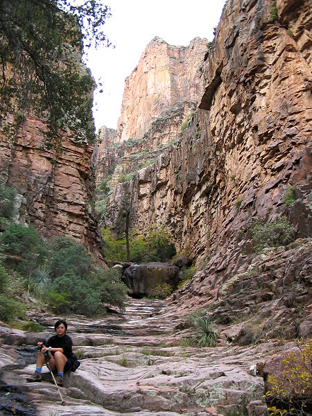
prominent route). About and hour into the hike,
the path will enter a pretty section at a
slickrock bowl. Just above this point a large
choke stone blocks your path. You can get around
this obstacle by climbing up on the right side
(not very difficult, but be careful since the
rock is smooth). Above are a few more small
climbs, but they are not hard. As you continue
up canyon, look for paths on one side of the
drainage or the other which will enable you to
bypass several obstacles in the stream bed
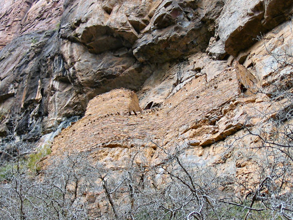
itself. Higher in the drainage, look for a
prominent trail that climbs out of the stream
bed on the right hand side (facing up canyon).
The eroded path climbs straight up the steep
dirt hillside which does not have much in the
way of good foot holds. As you climb you will
catch site of the ruins located in a shallow
alcove above you. Climb up until you are
directly beneath the structure, then work your
way left, pushing through some thick undergrowth
until you can climb a series of ledges up to the
ruins itself. The ruins are some of the better
preserved that the author has seen with several
rooms and evidence that it once had several
stories. When ready, return the way you came. |
|
| Rating (1-5 stars): |

The author and his wife completed this hike
in 3.5 hours. |
|
| Books: |
None |
|
| Maps: |
Tonto
National Forest, USFS (not a very good map) |
| Photos: |
Click picture for larger view, click your browser's 'Back' button to return to this page. |
|
 |
 |
 |
|
Climbing into the canyon. |
Slickrock bowl. |
Salado ruins. |
 |
 |
 |
| One of rooms. |
The south wall. |
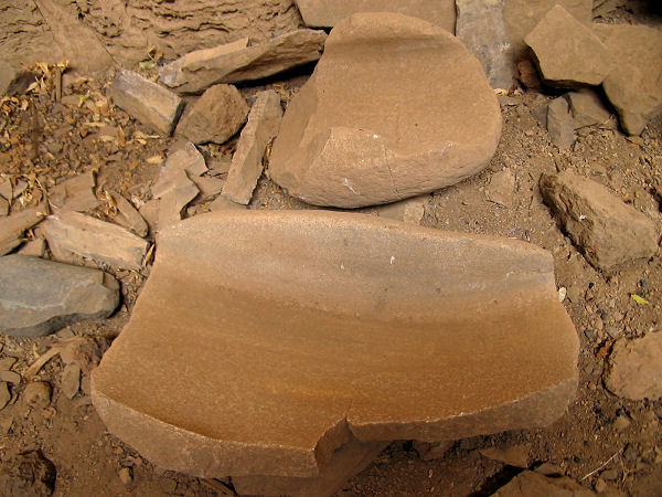
Broken matate. |
|
|
