| |
Parker Creek Trail - Sierra Ancha Wilderness, Tonto National Forest
| Summary: |
A nice, if somewhat steep
(2000 ft elevation gain), out and back hike
through the forest on a well maintained trail
(thanks BSA Troop 954 - Mesa, AZ!) in the Sierra
Ancha Wilderness. The last mile of this 4 mile
path is through an area heavily damaged by fire
and is not terribly scenic. |
|
| Directions: |
From Phoenix
drive east on Highway 60 almost to Globe. Turn
left (north) on Highway 188 (also listed as 88
on maps) and drive 14.4 miles to Highway 288.
Turn right on 288 which is paved at first and
after a short distance crosses the Salt River on
a single lane bridge. After 12.2 miles you will
come to an intersection with left branching A
Cross Road. Continue straight on Highway 288 for
approximately 7 more miles just past the DOT
road maintenance yard to a brown Forest Service
Sign which points to the right for trail #160.
Turn right for the trailhead and parking area. |
|
| Road Conditions: |
Passenger Car |
|
| Navigation: |
Easy |
|
| Length: |
8 miles |
|
| Date Hiked: |
May
2004 |
|
| Weather Conditions: |
Warm
and sunny |
|
|
Required Skills: |
None |
| Hike Description: |
From the parking area (0
miles, 5000 feet) walk to the trail sign for
Parker Creek Trail #160 & signs for Coon Creek
Trail #254 & Rim Trail #139, 3 miles, Workman
Creek Road #487, 4 miles. There is also a
warning sign indicating that the 10,000 acre
Coon Creek fire has created severe flash flood
conditions & that hikers should also beware of
falling trees and branches. Begin walking on the
well maintained trail as it begins climbing
through scrub oak forest towards the south fork
of Parker Creek. The path enters a shaded oak
forest as it reaches the drainage (watch for
poison ivy) and continues climbing, soon passing
a gauge station. As you continue to climb,
you'll enter a pine woodland as the path
completes several wide switchbacks which brings
it well up onto the hillside above the creek.
Still more climbing and the pine trees give way
to scrub and not long afterwards the trail
reaches the top of the hill at a small memorial
for an elderly man who disappeared hiking in the
area in 2002. The path soon begins descending
along the side of a hill marked as Carr Peak on
the map through a burned area towards the
prominent drainage of Coon Creek. After rounding
the drainage, the path begins climbing again and
soon splits at an unmarked junction. Straight
ahead is the continuation of the Parker
Creek Trail which you have been following, while
right is the Rim Trail. Crews obviously haven't
had a chance to maintain the Rim Trail since the
fire, and you'll find that the path soon
degrades into piles of fallen logs. So we'll
stay straight at the junction continuing along
the Parker Creek Trail which continues climbing
through a heavily burned area, eventually
topping out at Workman Creek Road which is also
FR 487 (4 miles, 7000 feet). This isn't much of
a destination, but so it goes, return the way
you came (8 miles). |
|
| Rating (1-5 stars): |
  
The author completed this hike at a fast
pace in 3.5 hours, carrying out two 8 pound
dumbbells someone had abandoned along the trail
(ugh!). Grasshoppers lined the trail,
particularly in the fire damaged sections,
flying up in a cloud with every step.
Unfortunately they do not appear to have the
ability to change directions very readily after
they launch up from the ground, resulting in
grasshoppers occasionally hitting and bouncing
off of my torso, arms, head and face. |
|
| Books: |
None |
|
| Maps: |
Tonto
National Forest, USFS (not a very good map) |
| Photos: |
Click picture for larger view, click your browser's 'Back' button to return to this page. |
|
 |
 |
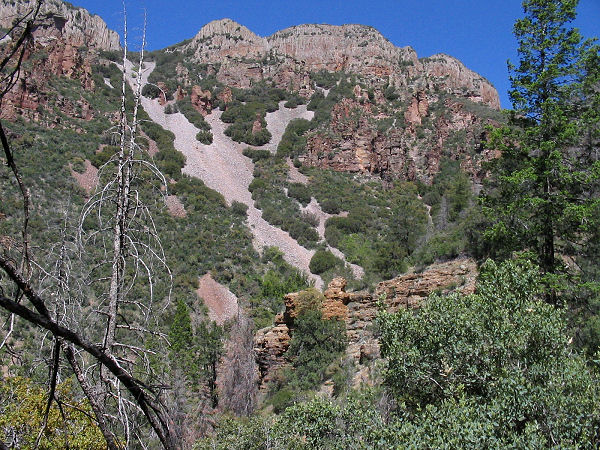
View from the trail along
Parker Creek. |
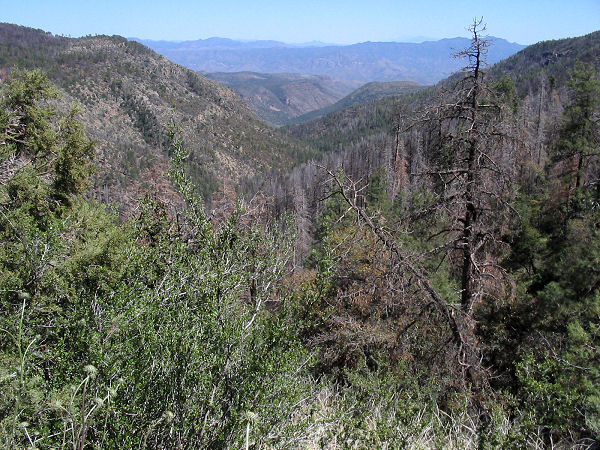
The heavily fire damaged
Coon Creek drainage. |
|
|

