| |
Tortilla Trailhead Loop - Tonto National Forest
| Summary: |
A long day hike or multi-day
backpacking trip from the Tortilla Trailhead
using the Hoolie Bacon, Red Tanks, Coffee Flat
and JF Trails. |
| Directions: |
From Phoenix
take US 60 east. Exit at Apache Junction (Idaho
Road, Highway 88) and drive northeast (left) on
State Highway 88. Follow 88 to the end of the
pavement (about 25 miles) then a few miles
further until you reach the signed parking area
for Tortilla Trailhead on the right hand
side. Follow the rough dirt road (FR 213), which
has some rather aggressive stone steps at the
beginning, three additional miles to the
cul-de-sac at the end. |
| Road Conditions: |
4-Wheel Drive |
| Navigation: |
Moderate |
| Length: |
22 miles |
| Date Hiked: |
March
2003 |
| Weather Conditions: |
Cool & mostly
overcast with brief hail in the morning |
|
Required Skills: |

 |
| Hike Description: |
From the
cul-de-sac, the
JF Trail begins just past the fence line and
signs indicating the area is 'closed to motor
vehicles' (0 miles). The JF Trail begins as an
old rocky road as it climbs moderately through
the desert grassland, soon passing a
Superstition Wilderness boundary sign. After 0.8
miles you will reach a signed junction with the
Hoolie Bacon Trail (which heads right), the JF
Trail continues left (0.8 miles). Turn right
onto the Hoolie Bacon Trail. The path winds its
way through a few low hills, then descends to
travel beside a wash, crossing it a few times.
After the third crossing you'll come to a camp
site, stay to the right (looking for cairns) as
you exit the camp. The trail bends left, away
from the stream bed, and begins climbing
moderately, then more steeply up into the hills.
It eventually tops out at a saddle, then
descends down the other side. At the base of the
hill, you'll pass the mouth of Trap Canyon
(which will be on the right), then you'll cross
a few washes and climb up and over a low hill.
The canyon you see below you on the right is
Upper La Barge Box and as you approach it,
you'll reach the signed junction with the Red
Tanks Trail which goes left and right (5.1
miles). Stay left on the Red Tanks Trail as it
bends right traveling over a flat area until you
reach a stream bed. When you hit the stream,
it's a little confusing; turn left and rock hop
upstream a short ways then look for the trail on
the left side. When you're on the trail once
again you will parallel the stream bed a short
ways, cross it, then climb over a low hill down
to another wash. The trail follows this wash up
to where it boxes out, then climbs up the right
side to a saddle. There is a similar canyon just
on the other side of the saddle. The trail now
travels down this wash (a few sections are a
little overgrown, but otherwise the trail is in
good shape). At the bottom of this canyon
another drainage enters from the left, the trail
bends right and follows the combined stream (if
any is flowing) down canyon. Continue onward as
the trail parallels the stream bed of Randolph
Canyon. Towards the end of this section, the
trail becomes somewhat steeper, then drops you
down to the red sandstone canyon bottom at the
intersection of Frasier and Randolph Canyons
(9.8 miles), and a sign for the Coffee Flat
Trail, which heads left and right. Turn left
onto the Coffee Flat Trail, dodging cow pies as
you go, as you head up Frasier Canyon to the
east. The path is distinct at first, but soon
disappears entirely. When in doubt, simply walk
right up the stream bed & keep your eyes peeled
for cairns on one side of the drainage or the
other. Eventually the path exits the wash on the
left and then begins following a barbed wire
fence (which will be on your right) until you
reach a windmill and ranch house (this is the JF
Ranch - the source of the environmental
degradation that extends for miles in every
direction). Walk through a fence, then continue
down the dirt ranch road (12.7 miles). Now the
tricky part. After about 10 minutes, just before
the road bends to the right and away from the
wash you have been following, look for an
unsigned trail on the left which continues to
follow the wash. Walk along this path for a
while, and look for another wash that comes in
from the opposite bank of the stream bed and an
old toppled cairn and trail. Cross the wash to
the left (even though the trail continues
straight) and pick up the trail near the old
cairn as it climbs a low hill, then drops down a
short distance and winds its way towards a
windmill. This area has been obliterated by
cattle, so if you get lost, simply head towards
the windmill. There is a tank and metal trough
near the windmill. Look for cairns on the north
side of the tank that lead to the left (13.5
miles). Once you find them, you are now on the
JF Trail which heads north towards the crags of
La Barge Mountain. The trail is level at first,
then drops down and crosses a wash. On the other
side, the path begins the long climb up to
Tortilla Pass, which you will reach a mile and a
half later (16.0 miles). At the pass (complete
with shiny new trail signs) the Rogers Trough
Trail branches right, we, however, will stay
left on the JF Trail. The path winds through
some hills, then traverses the left slope of
Goat Canyon (with some fairly expansive views)
through an area a bit overgrown with scrub oak.
You then complete a short climb up to a ridge
before descending on the right of another wide
valley. The path then climbs out of this valley
to the right to a ridge, then begins the long
descent through the grasslands on a rocky path
between rolling hills. Eventually you will reach
the junction with the Hoolie Bacon Trail you had
passed earlier (21.2 miles). Stay right and hike
the remaining 0.8 miles back to your car (22
miles). |
| Rating (1-5 stars): |
  
The author completed this hike after several
days of heavy rain. I almost didn't make it out
to the trailhead since there was barely enough
traction to climb the wet rocks at the start of
the rough road. The hike was completed at a
fairly brisk pace in 9 hours. |
| Maps: |
Beartooth Maps - Superstition Wilderness Topographic Map |
| Photos: |
Click picture for larger view, click your browser's 'Back' button to return to this page. |
 |
 |
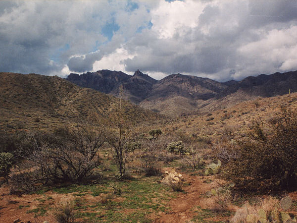
A rare stormy day
in the Superstitions. |
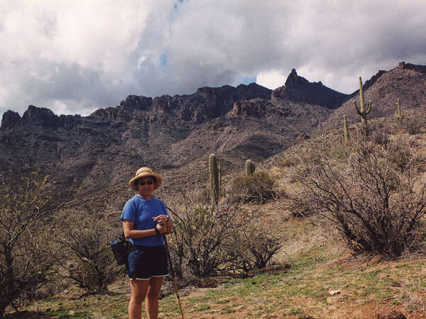
Getting ready
to climb beside
La Barge
Mountain. |
|
|

