| Summary: |
A hike up or down a rocky
canyon in the Superstition's. |
| Directions: |
From Phoenix take US 60
east. Exit at Apache Junction and drive northeast on State Highway 88. Follow
88 to the end of the pavement (about 25 miles) then a few miles further until the road
begins a steep decent into the canyon. The road crosses Fish Canyon at the bottom of
the hill then bends sharply to the left. There is a small area on the right where
you can park, or continue another 0.7 miles to the parking lot on the north side of the
road. From here you can head either up or down canyon - no trail exists. |
| Road
Conditions: |
Passenger Car - well
graded dirt roads |
| Navigation: |
Easy - follow the stream
bed |
| Length: |
Lower Fish ~10 miles
round trip, Upper Fish as far as you want to go |
| Date
Hiked: |
Lower Fish January 2000,
Upper Fish January 1999 |
| Weather
Conditions: |
Nice |
|
Required Skills: |
None |
| Hike
Description: |
Lower Fish: Head
down canyon following the stream bed. The trash will eventually fade away as you get
away from the road. After passing through a wide flat section the stream bed bends
to the left and enters a deep canyon. There is quite a bit of bush whacking required
and some scrambling over rocks. After about 4 miles you will see come power lines
and a road on the left, another mile will bring you to the Salt River and your turn around
point.
Upper Fish: The upper part of the canyon requires some boulder
climbing and rock hopping. The turn around point is arbitrary, head back when you
get tired. |
| Rating
(1-5 stars): |

This canyon probably has quite a bit of water in it during some times of the
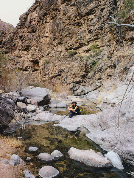
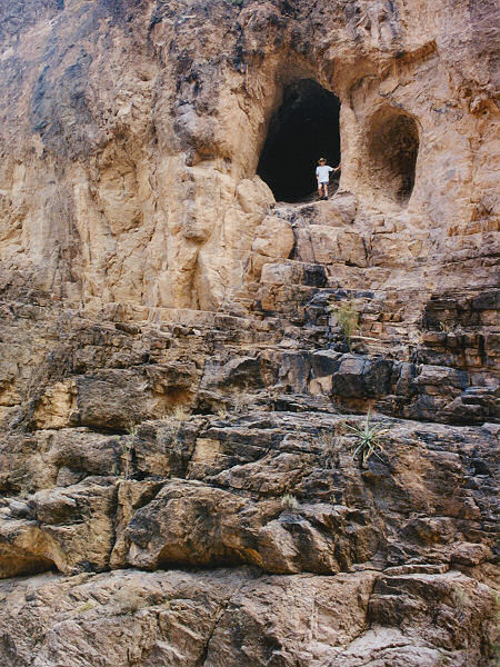
year. When the author performed these hikes the canyon was mostly dry however.
Fish is quite deep in places, but remains fairly wide throughout. The canyon
has some pretty spots as well as some shallow caves (actually more like alcoves) to
explore but overall is not tremendously exciting. The author hiked from 88 upstream
and back in about 7 1/2 hours, then at a later date hiked from 88 to the Salt River and
back in approximately 8 hours. |
| Maps: |
Beartooth Maps -
Superstition Wilderness Topographic Map |
| Books: |
'Canyoneering Arizona',
Tyler Williams |
| Photos: |
Click picture for larger
view, click your browser's 'Back' button to return to this page. |