| |
Soldiers Camp Trail, Four Peaks
Wilderness - Tonto National Forest
| Summary: |
A remote out and back hike on
a seldom used trail with good views of the Four
Peaks. My advice on this hike is to pay careful
attention to your surroundings since there is
much route finding involved. If you memorize
your route on the way in, it will make your
return trip considerably easier. |
| Directions: |
Drive east
out of Phoenix on the Bee Line Highway (Highway
87) to between mile markers 203 & 204 (just
before mile
marker 204). Turn right at the sign for Four
Peaks onto the dirt Forest Road 143 (bumpy and
rough in a few places) and drive 2 miles to a
junction with the right branching FR 401. Turn
right onto 401 and follow it 4.2 miles to
Cottonwood Camp (a cowboy camp with a few old
trashed buildings). Head east through the area
ignoring the many branching use roads and drive
across the creek. The road becomes 4-WD at this
point and soon begins climbing a series of rocky
hills. Drive 4.6 miles on this rough road (which
is still FR 401) to a small pull out on the left
marked by a brown plastic trail sign. |
| Road Conditions: |
Four Wheel Drive |
| Navigation: |
Difficult |
| Length: |
7 miles one
way, 14 miles out and back |
| Date Hiked: |
January 2005 |
| Weather Conditions: |
Sunny and nice |
|
Required Skills: |

 |
| Hike Description: |
From the Soldiers Camp
Trailhead, pick up the trail next to the brown
plastic trail sign which soon leads past a
wooden sign letting you know you are on Soldiers
Camp Trail #83. Though obviously not used very
often, the path is fairly distinct at first (and
marked by frequent cairns) as it ascends
gradually through grassy hills dotted with
prickly pear, saguaro, cholla and agaves towards
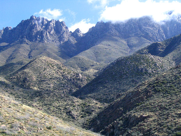
the jagged profile of the Four Peaks in the
distance. The trail then descends a short
distance into a shallow valley, crosses a wash,
then heads up the valley to eventually climb out
on the right side. Continue along the path as it
continues to ascend at a comfortable grade up
along a ridgeline eventually reaching a minor
sloping saddle where it becomes considerably
more difficult to follow. Head straight across
the saddle (resist the temptation to continue
climbing the hills to the right) and begin
descending into a minor drainage keeping your
eyes peeled for infrequent cairns. Near the
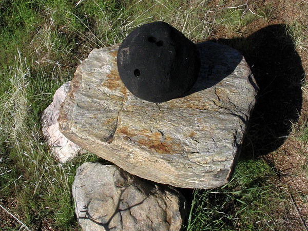
bottom of the drainage, pick up what appears to
be a very old section of road that bends right
crossing first a small drainage, then a larger
one marked by the bowling ball cairn pictured
below. On the other side of this wash you will
see cairns leading straight and to the right.
Stay straight, traveling perpendicularly to the
wash you just crossed, and begin ascending the
hill on the other side. The faint to
non-existent path bends slightly to the left and
enters a shallow 'V' shaped drainage which has
few cairns and no discernable trail. Climb up to
the top of this drainage to a saddle marked by a
large cairn. The trail continues to the north
descending gradually to the drainage of Boulder
Creek and Soldiers Camp (which is nothing more
than a grassy area beside the creek). Cross
Boulder Creek and continue straight up an arm of
the hill on the other side (again, there is no
trail, keep your eyes open for cairns) to
another minor saddle which has the remains of an
old rock wall and some great views of the Peaks.
The path levels out for a short distance as it
continues north on the left side of a wide
valley, eventually becoming steeper and steeper
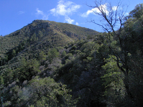
as it climbs out the head of the valley to Big
Saddle and a sign for the Four Peaks Wilderness.
Head straight across the saddle and begin
descending steeply on a somewhat more distinct
trail that leads through a forested area to soon
reach a fence line and small boxed spring. The
trail continues descending beside the fence,
eventually leveling out before coming out at the
Mud Spring Trailhead which features a small and
not very level camping area under the trees.
When ready, return the way you came.
|
| Rating (1-5 stars): |
 
The author completed this hike solo at a
moderately quick pace. It took 4 hours to hike
from the Soldiers Camp Trailhead to Mud Spring
with some time spent route finding. It took 3
hours to return since the route was familiar. |
| Maps: |
Tonto
National Forest Map or Click here:
Map 1,
Map 2 |
| Photos: |
Click picture for larger view, click your browser's 'Back' button to return to this page. |
 |
 |
|
Desert and Four Peaks. |
Bowling ball cairn. |
 |
 |
|
Four Peaks in the clouds. |
Big Saddle. |
|
|

