| |
Browns Peak/Amethyst Mine -
Four Peaks Wilderness, Tonto National Forest
| Summary: |
The Four Peaks Wilderness was
established in 1984, and contains approximately
60,740 acres with a major mountain rising up in
its center from the desert foothills. The Four
Peaks themselves are visible for many miles, and
are one of the most widely recognized landmarks
in central Arizona. Two nice hikes can be done
on, or in the shadow of, the Four Peaks using
the Lone Pine Saddle Trailhead as your starting
point. Those looking for adventure can perform a
semi-rugged 5 mile roundtrip climb to the summit
of Browns Peak (at 7,657 feet the highest and
northernmost of the Four Peaks as well as the
highest point in Maricopa County). Those more
interested in hiking than climbing, an easier
7.5 mile roundtrip stroll to the site of the
Amethyst Mine (the only active amethyst mine in
North America) along the base of the peaks is
available. |
| Directions: |
The Lone Pine
Saddle Trailhead can be accessed from either FR
143 from the west or from El Oso Road from the
east. El Oso Road is by far the nicer of the
two.
From the west: Drive east out of Phoenix on the
Bee Line Highway (Highway 87) to between mile
markers 203 & 204 (just before mile
marker 204). Turn right at the sign for Four
Peaks onto the dirt Forest Road 143 (bumpy and rough in a few places)
and follow it about 18 miles to the top of the
ridge. Turn right at the sign for Lone Pine
Saddle & follow this twisty road 1 mile to the
trailhead.
From the east: Turn west onto El Oso Road (which
lies about 8 miles south of Punkin Center on
Highway 188). Follow this well graded dirt road
11 miles to the turn off for Lone Pine Saddle.
Turn left at the sign and drive the remaining 1
mile to the trailhead.
Caution: These roads are narrow and heavily used
by jeeps, ATVs, motorbikes and other yahoos on
the weekends. Keep your speed down, since there
are many blind corners. |
| Road Conditions: |
El Oso Road - Passenger Car
FR 143 - High Clearance Vehicle |
| Navigation: |
Easy |
| Length: |
5 miles - Browns Peak
7.5 miles
- Amethyst Mine
8 miles - If you do both on the same trip |
| Date Hiked: |
March 2004 |
| Weather Conditions: |
Pleasant and sunny |
|
Required Skills: |
 - Brown Peak
None - Amethyst Mine |
| Hike Description: |
At the trailhead there is a
map which features the progress of the 1996 Lone
Pine fire (supposedly caused by an improperly
extinguished cigarette) which damaged much of
the area. Walk past the sign to the trail
junction where Browns Trail #133 leads straight,
Four Peaks Trail #130 heads left. Go straight on
the Browns Trail which begins climbing
moderately up through the oak, pine and juniper
forest. The trail soon reaches a ridge and bends
left along the top of the ridge a short ways,
then along the left side of a hill, heading
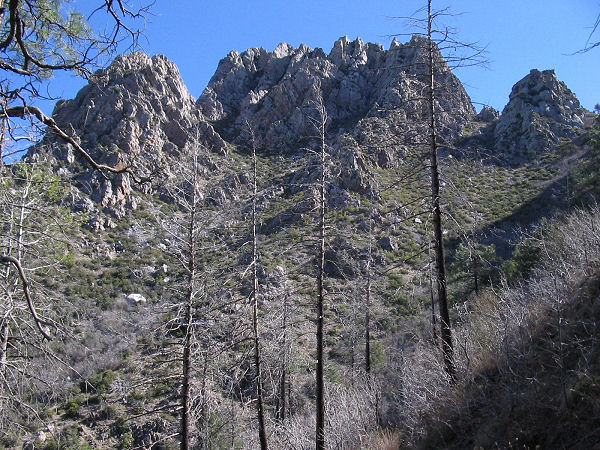
towards the peaks. As you continue to climb you
will see increased evidence of the Lone Pine
fire. Just before reaching a saddle, you will
reach a signed junction with the Amethyst Trail
#253 which enters from the left. Stay straight
(you are now on the Amethyst Trail). Climb the
remainder of the way up to the saddle, then turn
left and walk a short distance to a prominent
fire ring.
Browns Peak: To get to Browns Peak,
continue straight through the camp on a well
trodden use trail which immediately begins
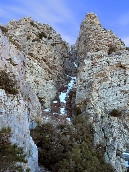
climbing up towards the prominent cleft in the
rock above you. The path climbs to the base of
the rock, skirts it a short distance to the
right, then enters the skree slope of the cleft.
Standing at the base of the cleft, you'll now
see that the route is a steep slope, rather than
a vertical climb. Climb up the loose rock
straight up the cleft. Be careful about your
foot placement, not only so that you won't fall,
but also so you don't send rocks careening down
onto other climbers below. There are a few short
climbs as you continue up the slope, all have
good hand and foot holds. Once you've reached
the top of the cleft, it's a short and easy
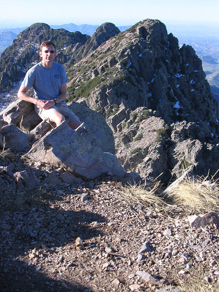
climb to the left to gain the summit and some
terrific views. There is a trail register and a
bunch of junk in a small ammo can on the peak.
When ready, return the way you came (taking it
slow for the climb back down).
Amethyst Mine: To get to the Amethyst
Mine, from the fire ring, look for a somewhat
faint trail which leads slightly down the slope
to the right (south). The Amethyst Trail
contours along the slope just below the peaks,
descending gradually as it does so. The path is
slightly overgrown, but is otherwise easy
walking, with the exception of one short, steep
downhill section as you round the third peak.
The Amethyst Mine lies on private property
beneath the 4th (and final) peak. There is a
gate, razor wire and no trespassing sign marking
the end of the trail. Return the way you came. |
| Rating (1-5 stars): |
 - Browns Peak
- Amethyst Trail
The author hiked to the
summit of Browns Peak then out to the mine and
back at a fast pace in 4.5 hours. There was a
bit of snow remaining in the cleft on the climb
to the peak, but it was soft and didn't add much
to the difficulty. |
|
Books: |
None |
| Photos: |
Click picture for larger view, click your browser's 'Back' button to return to this page. |
|
|