| |
Secret Place #1 (Karma Canyon*)
*
Alias, not found on any map.
| Summary: |
A strenuous technical canyoneering loop trip with rappelling, climbing and swimming required. Along the way you will be faced with natural anchor decisions, ~6 rappels, difficult climbs and one keeper pot hole. The reward is great scenery in a narrow, rarely visited canyon. To complete this hike you will need 200' of rope (or
a 100' rope and a 100' pull cord), harness, helmet, carabineers, ascending/descending gear, webbing, at least one other person
and possibly a wet suit. One member of the group should be a very strong climber who is comfortable with exposure. This route follows two forks in the upper part of a larger drainage. The path leads you down the deeper, more technical canyon, then you will follow the more shallow drainage back up and out again. It might be a good idea to recon the shallow drainage before attempting this loop hike. There is one rather tricky climb coming out of this drainage and you'll want to be sure there is someone in your party that is able to complete it. |
| Road
Conditions: |
4-Wheel Drive |
| Navigation: |
Difficult - you'll likely need a gps unit to find your way into the canyon and back to your car afterwards |
| Length: |
~6 miles round trip |
| Date
Hiked: |
March 2002 & July 2002 |
| Weather
Conditions: |
Cool with ice cold water (literally - ice was floating on the water) |
|
Required Skills: |


 |
| Hike
Description: |
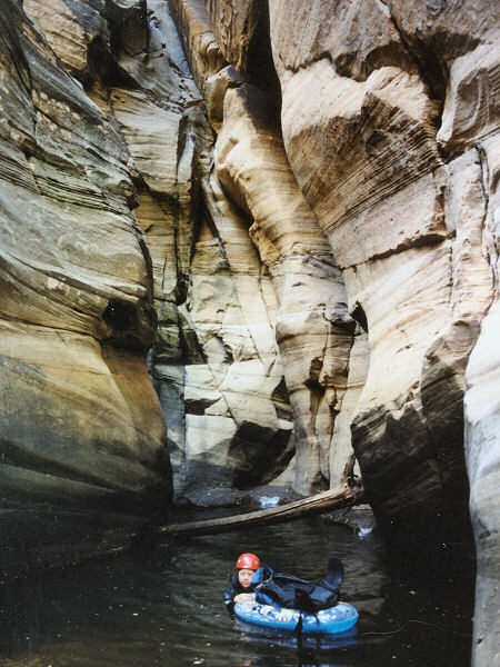
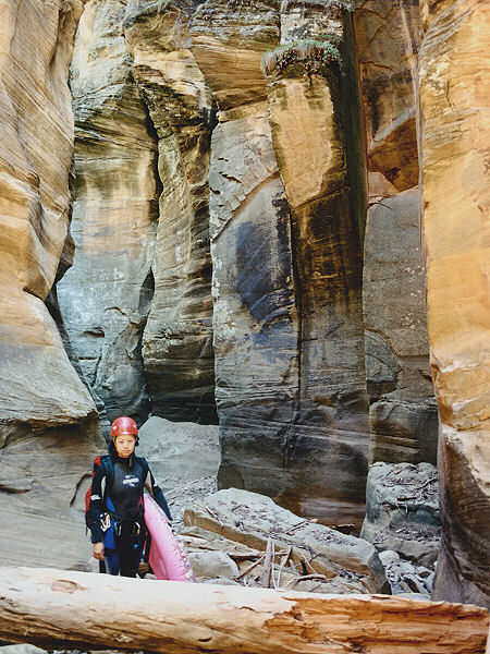
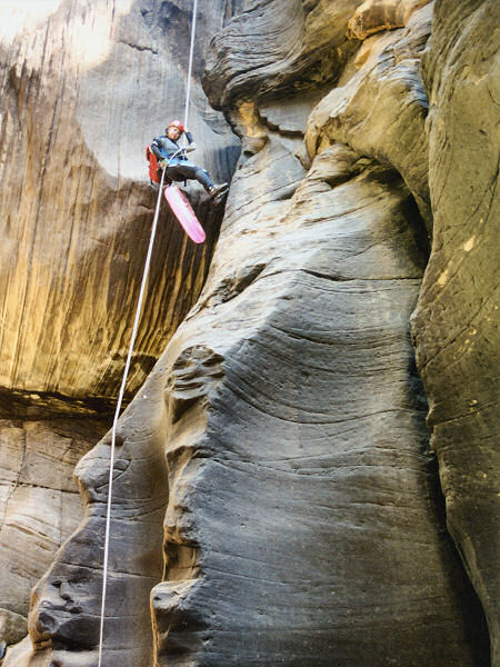
From the car park begin walking in the direction of the entry point marked on your gps (the author identified this location on a previous scouting trip in the area). You will walk down a hill and shortly reach the bottom of a shallow drainage. This is the drainage you will climb out of on the return, so it's a good idea to make a small rock cairn so you know where to exit to find your car. Continue out the other side of the wash and climb up and out to the top of the hill. Here you will be able to pick up an old farm road. Walk to the left until you reach an intersection, then turn right. Follow this road for about 1.5 miles to a point where a shallow wash crosses it. Head down the steep, rocky, brushy wash. The drainage is a little indistinct at first, but becomes more prominent as you get closer to the main canyon. You will have to do some climbing and route finding around some moderate drop offs to make it all the way down to the main canyon bottom. Once in the drainage, head down canyon. The canyon deepens quickly and you may have to splash through a few shallow pools (don't bother trying to keep your feet dry). A short distance after a swim through a small pool you will be faced with the first technical section as the canyon narrows and plummets abruptly. The first obstacle is a somewhat tricky down climb to the left or you can climb up on the right and perform a 45' rappel from some trees (with all the gear we were carrying the author and his wife opted for the rappel). Immediately after this first rappel is a choke stone and 15' drop, you can use the choke stone as your anchor point. There is a pool that you must swim at the base of the drop, however, it is possible to stand on a small ledge at the base of the rappel to unclip your descender and pull your rope prior to the swim. On the other side of the pool is another choke stone and 20' rappel. There is a large boulder in the middle of the canyon that may be used for an anchor point, then pass your rope over the choke stone. There is a large pool at the base of the rappel and another swim. Once on the other side a short stroll will bring you to a large debris pile of logs and brush. There is a 35' drop on the other side of the pile into a waist deep pool. One of the many logs in the pile may be used for your anchor point. The canyon opens up a little bit after this rappel and it's easier walking. After about 15 minutes, however, you'll come to an 80' drop off at a sheer sculpted sandstone wall. There is a boulder wedged into a crack at the top of the drop off that you can thread your webbing through for an anchor. Most of this rappel is free hanging. After this long drop is another pool, followed by a 15' down climb (the author body belayed his wife down this obstacle, then down climbed it himself). Shortly afterwards you'll come to a down climb into a pool with a steeply sloped ledge on the right.
The best route is to climb around on the ledge. If you decide to enter the pool, send your best climber first (but don't let them take the rope). Climbing out of the pool on the other side presents some difficulty so you'll want one person with rope available in case a rescue is required.
Just beyond this pool, you will be faced with a 25' drop. Good climbers should be able to get down
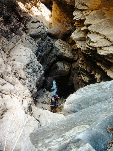
without much trouble, but some might find it easier to just rig off a small tree on the left and rappel down. Continuing down canyon there are a number of drop offs, down climbs and pools, the author and his wife passed packs over the harder climbs, but none required the use of rope. Eventually the canyon becomes noticeable wider and you'll come to the confluence with the side drainage you passed earlier (no more swimming is required, so this is a good spot to take off your wet suit). The main canyon continues onward, however, it does not appear to be particularly interesting. It took the author and his wife 6.5 hours to reach this point. Turn up canyon and begin climbing up the other fork. As you rock hop your way up canyon there are a number of climbs required. Some are moderately challenging and may require rope, but only two are of real note. The first is a sheer 60' wall. You can not climb this obstacle, but you can by pass it by climbing a steep, slippery scree slope on the right, then bush wacking your way down into the main drainage above the fall. Just after this wall is another sheer, leaf covered wall. There is no way around this one however and it must be climbed. Most of the climb is not terribly difficult with the exception of one tricky move to get around a large boulder. Unfortunately this move is near the top where your exposure is the greatest. My suggestion is to give your strongest climber one end of a rope, while the others feed it out to ensure it doesn't snag. Once up the dry fall, the climber can secure the rope to a large tree on canyon left for the rest of the party to climb using ascenders or prussiks. Above this fall is more climbing and rock hopping, but nothing difficult. The canyon eventually becomes quite shallow (stay to the right at any junctions) and you'll reach the cairn you created earlier that day. Kick over the rocks to hide the fact that you were here, then climb up and out of the drainage using your gps unit to find your way back to your car. |
| Rating
(1-5 stars): |
   
The author scouted out this trip in January, but ice and lack of a wet suit prevented him from making much progress down the main technical route. He then went down the exit route to the confluence and climbed out without rope to ensure he could do it. The author returned with his wife at a later date armed for bear. Not knowing what to expect we wore 6mm wet suits and carried 400' of rope. The wet suits, though constrictive, were definitely needed to survive the icy swims (in mid summer perhaps a shorty wet suit might suffice?). We completed the loop in 9 hours.
The author returned again in July and completed the hike with a much lighter
pack and no wet suit in 6 1/2 hours. |
| Photos: |
Click picture for larger
view, click your browser's 'Back' button to return to this page. |
 |
 |
One of many
short
swims in the narrows. |
Just before
the log
jam. |
 |
 |
| The big
rappel. |
The exit
canyon - one
person must free
climb this drop. |
|
|

