| |
Secret Place #5 (X-Pine Canyon*)
*
Alias, not found on any map.
| Summary: |
A scenic technical loop hike with 3 rappels and wading/swimming. To complete this hike you will need: 2x150'
ropes (or a 150' rope and a 150' pull cord), harness, descender, webbing, helmet, dry bag and carabineers. A wet
suit would be a good idea in all but the hottest weather. |
| Road
Conditions: |
4-Wheel Drive |
| Navigation: |
Moderate |
| Length: |
6 1/2 hours |
| Date
Hiked: |
November 2002 |
| Weather
Conditions: |
Cool |
|
Required Skills: |


 |
| Hike
Description: |
From the non-descript car park, head due
east over a low ridge then begin descending gradually, then more steeply,
into the main drainage of this tributary canyon. Once in the bottom of the
drainage, turn left and head down stream. The canyon is shallow and
uninteresting at first, with a bit of bush wacking. After about 1/2 hour
you'll reach a junction with the other fork of the canyon and the brush
diminishes. The canyon then slowly begins to deepen and you will be faced
with a few obstacles which may be down climbed with a little effort. Another
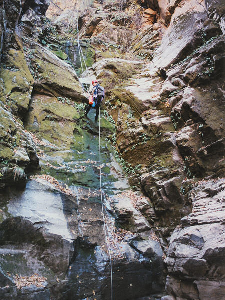
short walk will bring you to the technical section. The first drop is a
double rappel (about 30' each with a pool separating them) using the large
tree on canyon left. Immediately afterwards is a 50' rappel from the large
choke stone in the middle of the stream bed, followed by a deep wade or
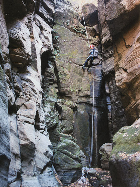
short swim. Don't remove your harness yet, instead continue down stream
through a nice section of canyon completing the few short down climbs along
the way. Just before you reach the main canyon junction you will be faced
with one more rappel (35' from a tree back from the edge on the right).
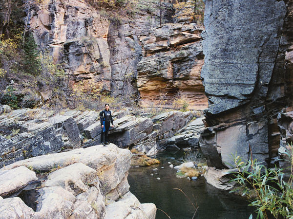
Remove your harness (but keep your wet suit on), then head left down stream.
You will be faced with several stream crossing and a few deeper pools as you
rock hop down canyon and will pass a few nice campsites along the way. After
about a mile, you'll pass under a set of power lines (keep an eye out for
this landmark), followed shortly afterwards by a long swim where the canyon
narrows. About 5 minutes after completing this swim look for a few cairns
and a use trail leading up to a bench and camp site on the left. Take off
your wet suit and walk west along the bench until you spot the somewhat
faint and steep trail that leads up and out of the canyon. At the top you'll
pick up a forest road that you can follow back to the car park where you
started. |
| Rating
(1-5 stars): |
 
A nice enough canyon, but be prepared for some cold swimming (particularly
if you hike it in November like I did). The author and his wife completed
this hike with two friends in 6 1/2 hours. |
| Photos: |
Click picture for larger
view, click your browser's 'Back' button to return to this page. |
|
|