| |
Secret Place #7 (Grotto Pool Canyon*)
*
Alias, not found on any map.
| Summary: |
A long and challenging hike, just to
get to a short, but spectacular set of narrows. AZ Highways published photos
of this canyon in its August 2001 issue, but did not provide the location.
Looked nice, so I figured I'd find it. To complete this hike, I'd suggest:
1x100' rope and 1x100' pull cord (overkill, but better to have it), harness, descender, webbing, helmet, dry bag and carabiners. A wet
suit is required in all but the hottest weather. I'd also suggest a gps,
since the navigation is sort of tricky. |
| Road
Conditions: |
Passenger Car |
| Navigation: |
Difficult |
| Length: |
12+ hours (plan on an overnight) |
| Date
Hiked: |
June 2003 |
| Weather
Conditions: |
Hot, with cool water |
|
Required Skills: |


 |
| Hike
Description: |
From the car park, begin hiking on the signed trail as it
winds it's way through the oaks, eventually passing a private ranch (with
free roaming dogs). After dropping down and crossing a wash there will be a
sign for a tank & a few cairns on the left. Follow the trail behind the sign
as it bends left and begins climbing, eventually topping out at a saddle.
It's flat walking, following a faint path for a while, until you reach the
tank, at which point the trail disappears altogether. Head cross country
using your gps & if your lucky, like I was, you'll eventually pick up the
trail again as it skirts around a prominent drainage, which will be on your
left. The route winds its way around the drainage, then bends left and
begins descending along a faint grassy path peppered with a few cairns at
infrequent intervals. When the canyon appears, there will be a side drainage
immediately on your left. Follow the edge of this side drainage & pick up
the path that leads through a break in the cliffs down into the canyon. You
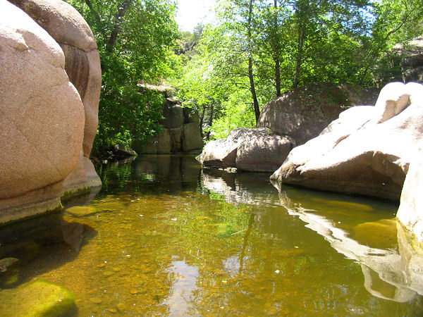
are now in a fairly nice canyon with a little stream that gurgles through
pink granite boulders (note: I suspect the stream may dry up in mid to late
summer). Once in the canyon bottom, turn left, and begin rock hopping and
bush whacking your way down stream. You'll be wading fairly frequently, so
don't bother trying to keep your feet dry. There is one short section in
this upper portion of the canyon where you'll even have to do a short swim.
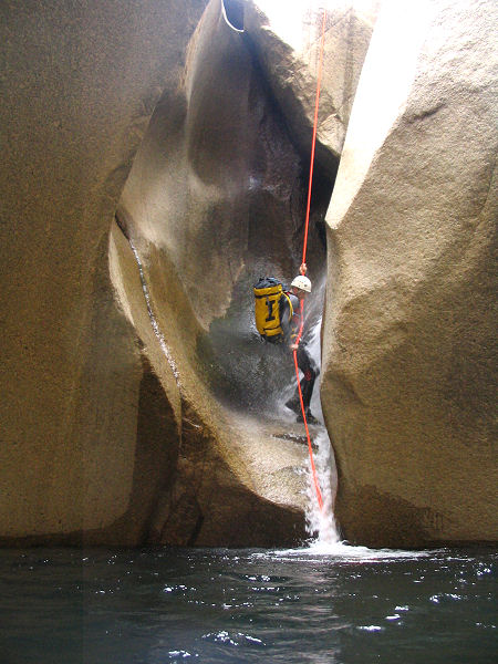
After a bit of slogging, you'll come to your first set of obstacles - two
drop offs. I rappelled the first drop, using a choke stone at the head of
the drop as an anchor (about 30' into a pool), the second drop I was able to
bypass by doing a nasty thrash through the brush on canyon left (the left
side of the canyon facing down stream). Once you're back in the stream bed,
it's more of the same: rock hop, wade, push through some brush, repeat.
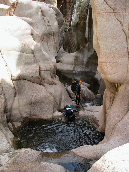
Finally, the object of your quest appears. The canyon drops into a short
stretch of nice narrows with a few pools which end in a 20' chute and 7'
drop into a deep pool. You can slide down the chute and jump into the water,
or, backtrack out of the narrows and find a bush or tree above on one side
or the other to rappel into the grotto below (this is what I did since I was
traveling solo and was a bit apprehensive about jumping, rap length was
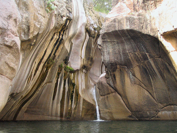
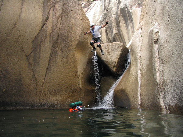
about 60'). Just below the grotto, you'll do a little scrambling over big
white granite boulders, then slide into a big pool and swim under one
particularly large rock. On the other side is your last rap, about 40 feet
from a pinch point at the top of a large boulder. There is a deep pool at
the bottom which is a bit tricky to exit since there's a large rock blocking
the way. Exit the pool, climb under the next boulder blocking your path and
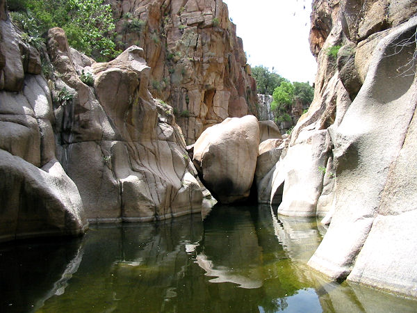
chimney 6 feet down into another pool and your last swim. There is a bit more granite
to content with, but the obstacles can be bypassed by climbing around on the
right side of the canyon. At the bottom of the granite, a prominent canyon
enters the main drainage you have been following from the left. This is your
exit canyon. Turn left & bush whack your way upstream to a point where you
can pick up a prominent trail which will take you up and out of the canyon
and back to your vehicle. |
| Rating
(1-5 stars): |
 
The author, traveling solo, hiked the route described above down through the
narrows then up the side canyon to the prominent trail in about 9.5 hours. I
was exhausted from the climbing and the heat so I set up a bivy for the
night. The next day, I hiked the trail up and out to my car in another 2.5
hours. Note: canyoning solo is NOT recommended! However, if you chose to
take the risk, be sure to let someone know where you are and when to expect
to hear from you in the event that SAR needs to be called for rescue. |
| Photos: |
Click picture for larger
view, click your browser's 'Back' button to return to this page. |
|
|