| |
Sheiks Canyon / Bullet Canyon
Loop - Cedar Mesa, Utah
| Summary: |
A pleasant
loop hike to a series of well preserved ruins,
petroglyphs and pictographs. A permit is
required to hike in the area. These are
available at self-pay kiosks located at most
major roads and trailheads. Cost is $2 per
person per day or $5 per person per week. As
always: ruins are fragile
and irreplaceable, please leave the area as you
found it. A little history of the area from one
of the trail signs:
| "The first
inhabitants of southeast Utah were the
basket maker people who lived on the mesas
and in the canyons between 200-700 AD.
While here they built pit houses, storage
cysts, small masonry dwellings and grew
crops including corn and beans. Today the
Pueblo people who live in the Rio Grande
valley in New Mexico and the Hopi mesas in
Arizona are recognized as some of the
descendents of the basket makers. Please
respect their ancestral homeland." |
|
| Directions: |
A car shuttle or 4 mile road
walk is required to complete this hike. Grand
Gulch / Cedar Mesa
is located on Highway 261 north of Mexican hat
in southern Utah. To get there drive from AZ to
Utah on Highway 163 through Monument Valley.
After passing the town of Mexican Hat, turn left
on Highway 261and drive up onto the mesa via the
Moki Dugway. Car Spot: Drive north to
between mileposts 21-22, turn left on Forest
Road #251 and drive 1 mile to the signed Bullet
Canyon Trailhead. A passenger car should have no
trouble making to this trailhead if roads are
dry.
Trailhead: From the Bullet Canyon
Trailhead, continue on FR #251 (which becomes
somewhat rougher) for 1.5 miles and turn left
onto an unsigned dirt road. High clearance
vehicles can follow this road 2.4 miles to it's
end at the trailhead for Sheiks Canyon. There is
a nice campsite under the trees at the head of
the canyon. |
| Road Conditions: |
High Clearance Vehicle, a
passenger car will get you close |
| Navigation: |
Easy |
| Length: |
13 miles |
| Date Hiked: |
November
2007 |
| Weather Conditions: |
Cool and sunny |
|
Required Skills: |
 |
| Hike Description: |
From the
Sheiks Canyon Trailhead, simply hop in the dry
wash and begin following it down canyon. After a
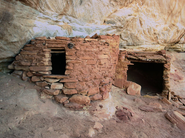
short hike you will come to the well preserved Yellow House
Ruins, which are on the right. Continue down
canyon, keeping an eye out for granaries on the
right as you go (almost all ruins in the area on
are on the south sides of the canyons where they
receive the most winter light). There
are two sets of drop offs in Sheiks Canyon. The
first can be descended largely by remaining in
the creek bed. The second is bypassed by
following a steep hiker trail which descends the
hillside on the right. Once in the bottom of the
canyon again, and just before entering Grand
Gulch, look for a prominent alcove
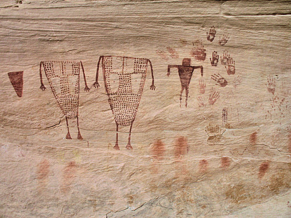
on the right which houses the Green Mask ruins
and a large number of pictographs. Shortly
afterwards you'll come to the junction with
Grand Gulch (3.5 miles) and a well established hiker trail.
Turn left and head down Grand Gulch scanning the
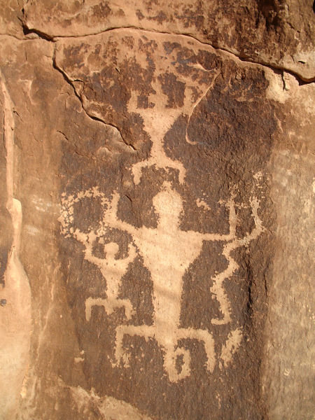
right hand wall for ruins. The most prominent is
the Wall Ruin, which has a hiker trail which
leads up to the bench where it is located. Just
beyond the Wall Ruin the prominent drainage of
Bullet Canyon enters from the left (6 miles). Turn left
and head up Bullet Canyon. There are several
sets of ruins in the canyon, all of which are
located on the left (south wall of the canyon). The most
prominent of which are the Jail Ruins and the
Perfect Kiva Ruins. The trail spends more time
in the dry wash above the Perfect Kiva Ruins.
Look for trails which climb up on the left to a
bench to avoid a number of large boulders in the
canyon bottom. Then further up canyon, you'll
climb up on the left again into a side drainage.
Skirt the dryfall at the head of this canyon and
drop
into the main drainage of Bullet Canyon once
again. As you continue up canyon, the drainage
becomes quite shallow and you may see the boxy
structure of the Rim Ruin up on the rim to
the left. About 15 minutes later, the trail
climbs up to the left to the Bullet Canyon
Trailhead (13 miles). If you've spotted a car here, your
hike is over. Otherwise you'll have to follow
the road about 4 miles back to your car at the
Sheiks Canyon Trailhead. |
| Rating (1-5 stars): |
   
The author and his wife and two friends
completed the loop, spotting a car to avoid the
road walk, at a casual pace in 8 hours. |
| Maps: |
National Geographic Trails
Illustrated Map - Grand Gulch Plateau
A map of the hike may also be found
here. |
| Books: |
Canyon
Hiking Guide to the Colorado Plateau -
Michael Kelsey |
| Photos: |
Click picture for larger view, click your browser's 'Back' button to return to this page. |
 |
 |
|
Yellow House Ruins. |
Pictographs at the Green Mask Ruins. |
 |
 |
|
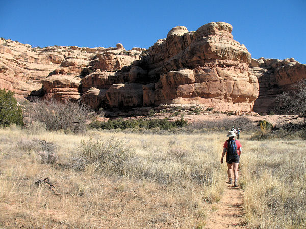
Typical view in the canyons. |
Petroglyphs at the Wall Ruins. |
 |
 |
|
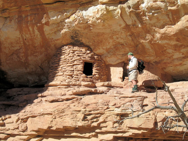
Small granary in Bullet Canyon. |
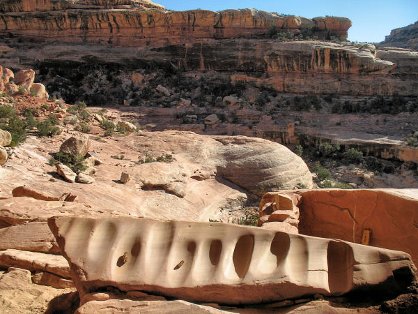
Metates at the Perfect Kiva Ruins. |
|
|

