| |
Yellow Rock, Red Top and Hidden
Cache Loop Hike - Grand Staircase Escalante
| Summary: |
An on and off
trail hike that visits some great photo
opportunities as well as a historic site with a
mysterious history.
|
| Directions: |
From Highway
89 between Page, AZ and Kanab, UT drive to
between mileposts 17-18 and turn north on the
well graded, dirt Cottonwood Road. Drive 14.4
miles to just past a cattle guard and right
branching Brigham Plains Road to a short pull
off on the left (west) which is the trailhead
for Hackberry Canyon. The gps point for
the car park is: UTM 419359mE, 4123741mN |
| Road Conditions: |
Passenger Car
(when roads are dry) |
| Navigation: |
Difficult |
| Length: |
~4-6
hours |
| Date Hiked: |
March, 2005 |
| Weather Conditions: |
Cloudy, cold and windy with
scattered rain and sleet |
|
Required Skills: |
 |
| Hike Description: |
From the
Hackberry Canyon car park. Follow the use path
west across Cottonwood Wash. You should see the
large drainage of Hackberry Canyon in front of
you. Don't head up Hackberry, instead turn left
(south) and parallel the cliff band for about
0.2 miles to the next small drainage to the
west. Walk up this drainage and look for a trail
which heads up to the right of the canyon
(facing up the drainage). The path climbs
steeply to a ridge then bends left, heading
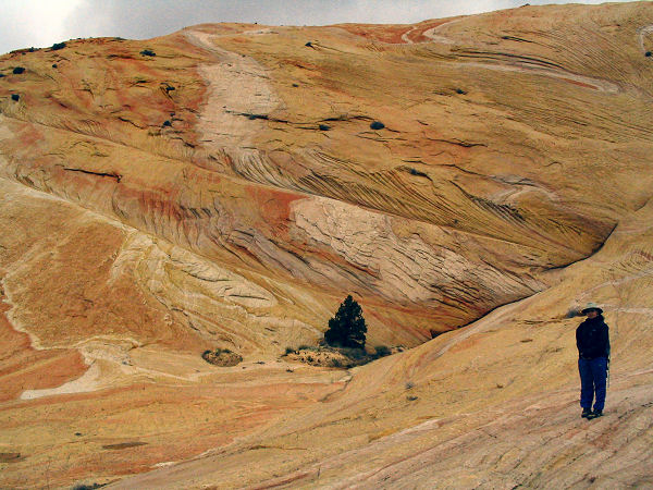
towards the massive form of Yellow Rock. The
rock features some interesting swirls of red,
tan and yellow stone, which is great for
photography (though better suited to a sunny
day, unlike when the author was here). The path
is cairned at fairly regular intervals where it
travels over slick rock. Look for it to lead
around the southern base of Yellow Rock before
bending right to traveling along a sandy track
through a juniper dotted landscape. Once on
sand, the path is fairly easy to follow and it
eventually leads to a somewhat indistinct
junction with the Box Trail which leads left
down to the Paria River and right along the rim
of Hackberry Canyon. Turn left at this point and
begin the gradual descent towards the Paria.
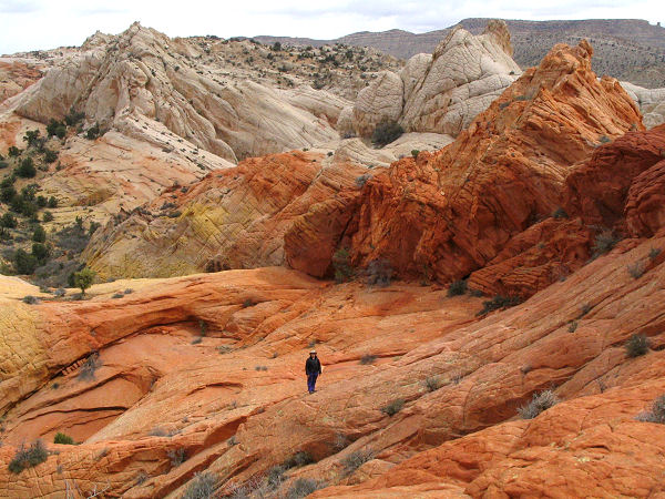
Just before dropping down into the Paria, an
interesting detour (takes about 1.5 hours) can
be made to what M. Kelsey (reference below)
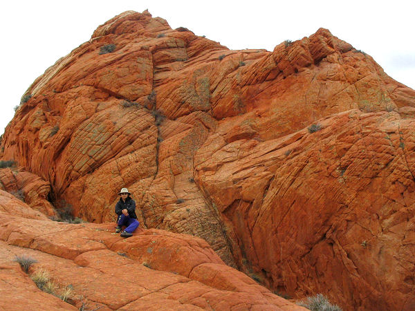
calls Red Top, a bright red outcrop of rocks
amongst the yellow sandstone. Just before
dropping down to the river, leave the path to
the left (south) and climb up to the top of a
ridge. From this vantage point look south and
spot the obvious group of bright red rocks.
Route find your way through the tangle of
drainages and rocks (staying on the slick rock
whenever possible) towards this feature. Be sure
to look back occasionally to memorize your route
for the return trip. A bit of scrambling and
hiking is required to complete the side trip.
When ready head back to the Box Trail and finish
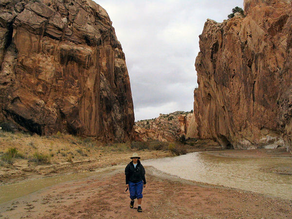
your descent into the Paria. Once at the stream,
turn left (southeast) and follow the river
through the Box of the Paria. On the other side
of the box you will see two minor drainages
entering the Paria from the left (north). The
second of these drainages has a faint trail
which leads up it along the left side of the
wash (facing up the drainage). A short, steep
detour up this path to the top of the ridge will
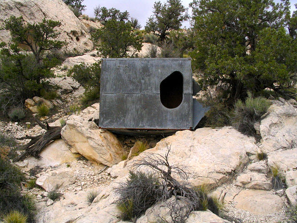
bring you to Hidden Cache - a steel box and
walled in cave. It is not known how these items
got here or their purpose, but M. Kelsey has
done a good job documenting the original
discovery in his book below (you'll have to buy
his book if you want the scoop, it wouldn't be
fair for me to recount the story since he did
all the research). Once your curiosity is
satisfied, return to the Paria and follow it the
remainder of the way to Cottonwood Road. Turn
left and follow this road 2.7 miles back to your
car. |
| Rating (1-5 stars): |
 
The author and his wife got turned around a
few times route finding this hike using the book
below. In retrospect, most of our errors were
due to user error and not taking the time to
study the map carefully. We were ultimately
successful and completed the hike described
above, exploring Yellow Rock, Red Top and the
Hidden Cache in about 5.5 hours. |
| Maps: |
Click
here for a
map. Note: The route drawn is an approximation
of the actual route hiked, use your eyes and
good sense to stay on the path and find your
way. |
| Books: |
Hiking and Exploring the Paria River -
Michael Kelsey |
| Photos: |
Click picture for larger view, click your browser's 'Back' button to return to this page. |
 |
 |
|
Yellow Rock. |
The route to Red Top. |
 |
 |
|
Red Top. |
Paria Box. |
 |
 |
|
Hidden Cache. |
Hidden Cache cave. |
|
|
