| Summary: |
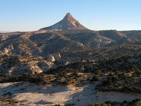
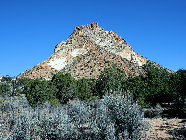
A half day hike / scramble to
the summit of Mollies Nipple. |
| Directions: |
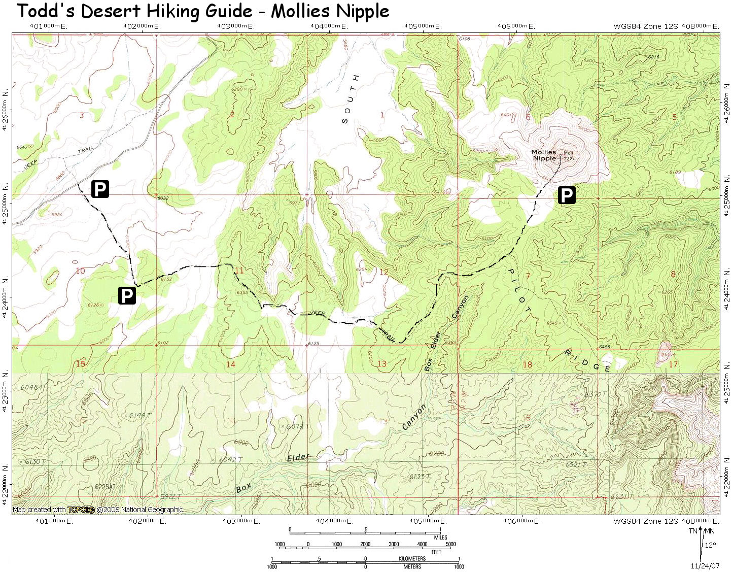
From Page, drive west on
Highway 89 to Utah milepost 37. Turn north onto
Nipple Ranch Road and drive 10.2 miles to where
the road forks. Turn right, passing through a
gate (if it's closed when you arrive, close it
behind you) and drive a mile and turn right onto
a sandy road which soon passes between two large
boulders. The distance from this point to
Mollies is about 4.5 miles. Where you park
depends on how confident you are that you won't
get stuck. Passenger cars should park here. Most high clearance vehicles should
be able to drive about 1.2 miles in to a high
point in the road. A road runs right to the base
of the peak, so you may be able to avoid a road
walk altogether. Park wherever is convenient. |
| Road Conditions: |
High Clearance Vehicle |
| Navigation: |
Easy |
| Length: |
1-9 miles, depending on where
you park |
| Date Hiked: |
November, 2007 |
| Weather Conditions: |
Cool and sunny |
|
Required Skills: |


 |
| Hike Description: |
From your car
simple walk down the sandy road as it winds
through the junipers towards the peak. At the 4
mile point the road splits. Take the obvious
left fork which heads 0.5 miles to the base of
the mountain. From there, simply scramble
straight up the south side of the mountain. Be
careful with your footing, the rock on the slope
is loose in sections. Stick to the larger rocks
which are less prone to sliding. About 3/4 of
the way up, pick out a use trail as it leads
just to the left of the highest point of the
hill to the base of the capstone that makes up
the peak. You'll have to use your hands in a few
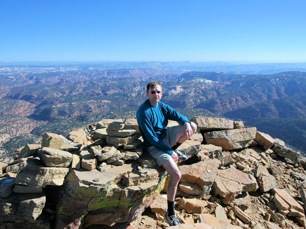
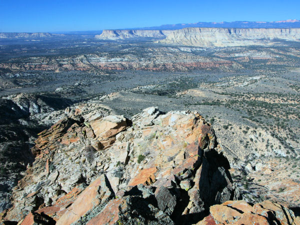
places to climb this rock to the summit, which
features spectacular 360 degree views of Kitchen
Canyon to the north, Starlight Canyon to the
east and the Pink Cliffs in the distance to the
northwest. When ready, return the way you came. |
| Rating (1-5 stars): |

The author walked the road 3.5 miles to
Mollies Nipple, completed the climb and returned
in 5 hours. |
| Maps: |
Trails
Illustrated - Canyons of the Escalante
Click here for a
map of the hike. |
| Books: |
Hiking and Exploring the
Paria River
- Michael Kelsey |
| Photos: |
Click picture for larger view, click your browser's 'Back' button to return to this page. |
