| |
Big Horn Canyon Loop - Grand
Staircase Escalante
| Summary: |
A nice canyon loop hike
through shallow narrows in a tributary of Harris
Wash. On the way out you will be faced with a
few climbing and route finding challenges. |
| Directions: |
From the
small town of Escalante, drive east on Utah
State Highway 12 towards the town of Boulder.
Between mile posts 70 and 71 turn right (just
before a sharp left turn and series of yellow
and black arrow signs) onto the unsigned Old
Sheffield Road. Drive exactly 2.8 miles to a
small, one car pull out on the right hand side.
Along the way to this parking area you will pass
a small conical butte off to your left. The car
park lies in a low point in the road near a
small, squarish butte which lies off on the right hand
side. GPS coordinates for this spot are: 12S
462662mE, 4174459mN |
| Road Conditions: |
Passenger Car |
| Navigation: |
Moderately Difficult - route
finding is required |
| Length: |
6
½ hours |
| Date Hiked: |
November,
2002 |
| Weather Conditions: |
Cold and sunny |
|
Required Skills: |
 |
| Hike Description: |
From the car
park look for the use trail that heads down into
the drainage of the east fork of Big Horn
Canyon. The trail skirts the squarish butte to
the right then drops down into the dry wash. The
wash is a mix of sand and slick rock and is wide
and uninteresting at first. After about 15
minutes you will arrive at a 60' dry fall that
is easily bypassed on the left. Forty minutes or
so after the start of your hike, you will pass a
prominent drainage which enters on the right
(this is the middle fork of Big Horn Canyon),
you will continue down the wash. A bit below the
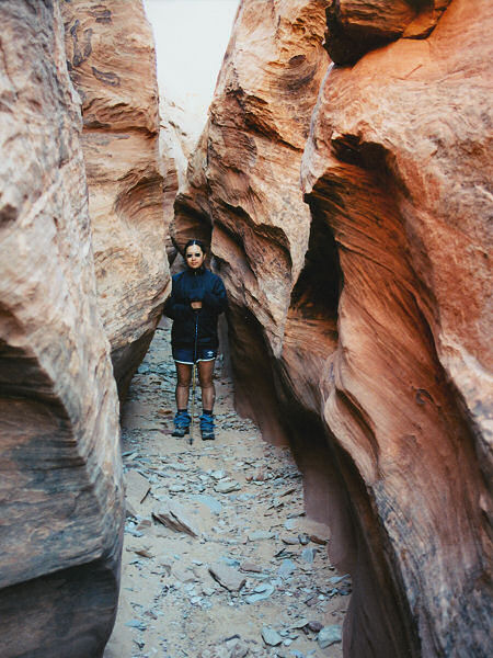
confluence, the canyon begins to slot up. The
narrows aren't terribly deep, but the swirling
colors of the sandstone make for a pretty walk.
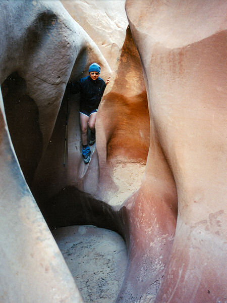
There are no real obstacles as you go. At one
point, you have to perform a short climb down
followed by a slide or jump of 3 ft, but nothing
difficult. The canyon soon widens and you will
reach another dry fall of 60' which leads into a
short set of narrows, but there is a well
established trail on the right that allows you
to bypass this drop (there is a bit of a climb
down at the end of this bypass in order to get
back into the canyon bottom). Continue down
canyon into another, much longer stretch of
narrows. You may be forced to take off your pack
and walk sideways at a few points. All too soon,
the canyon widens and you will reach the
confluence with the west fork of Big Horn. The
west fork is your exit route; however, if you
continue down canyon a short distance, you will
arrive at the confluence with the very wide
Harris Wash, where an old hanging fence crosses
the drainage. Head up the west fork of Big Horn
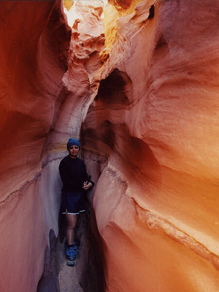
which slots up right away. The canyon quickly
becomes relatively deep, twisty and photogenic
and contains a few narrow up climbs. On the
other side of the narrows you will find yourself
stopped by a 30' circular dry fall. What now?
How about climb out of the canyon up the steep
slick rock slope on canyon left (remember canyon
left means you are facing down canyon; it helps
to have at least one fairly decent climber in
your party to ensure your escape). Once out,
climb over the low ridge to your left and back
into the drainage and continue upstream in the
now wide and sandy wash. The drainage has a few
forks through this section, stay in the main one
as you head up canyon (if you have a GPS head
towards 12S 460286mE 4171580mN). The canyon soon
slots up once again, and again you'll come to a
30' dry fall that blocks your progress. What
now? How about climbing out on canyon left
again. Climb around and drop back into the
drainage. Continuing on, there are no more
narrows, but 4 more dry falls to negotiate. The
first one can be bypassed on canyon left by
backing up 20-30'. The second dry fall is more
of a box canyon and once you realize your path
is blocked, you will likely be well past any
easy route up. Backtrack as far as needed
to route find your way to the rim, then follow
the rim to the top of the falls. The author
found a difficult route out a short ways back on
canyon left, my wife went down stream another
100 yards to find an easier route out on canyon
right. The third dry fall is only 20', and can
be climbed without much difficulty. The final
fall (are we done yet?) is only about 15', but
it consists of an overhanging shelf. The author
used a log to assist a climb directly up the
falls, my wife went around and found a sketchy
route up on canyon right. The drainage is now
just a shallow wash. Continue north for a while
then begin to route find your way to the
northeast (do your best to choose a path that
does not damage the fragile cryptobiotic soil).
It's a long dull sandy slog through this section
and if you head too far to the east (like I did)
you will run into the cliff that forms the walls
of the middle fork of Big Horn. Continue
northeast around the head of middle fork and you
will run into Old Sheffield Rd. Turn right and
follow the road back to your car. |
| Rating (1-5 stars): |
   
A fun canyon with enough pretty narrows and
climbs to make it interesting. I'd give this one
4 stars, but the cross country trek at the end
knocked it down half a star. The author and his
wife completed this hike in 5.5 hours. |
| Maps: |
Trails Illustrated - Canyons of the Escalante |
| Books: |
Canyon
Hiking Guide to the Colorado Plateau -
Michael Kelsey |
| Photos: |
Click picture for larger view, click your browser's 'Back' button to return to this page. |
 |
 |
 |
The small drop
in the
east fork. |
Typical
narrows in the
east fork. |
The nice deep
narrows
in the west fork. |
|
|

