| |
Phipps Wash - Grand Staircase
Escalante
| Summary: |
A nice and
fairly easy hike to a scenic arch and the
Escalante River. |
| Directions: |
From the
small town of Escalante, drive east on
Utah State Highway 12 towards the town of
Boulder. Drive exactly 1.1 miles past Old
Sheffield Road to a pullout between mile posts 71 & 72 and
park on the right side of the road. Note: Old
Sheffield Road lies between mile posts 70 and 71
just before a sharp left turn and series of
yellow and black arrow signs. The GPS
coordinates for this parking area are: 12S
461095mE 4178256mN
Alternatively, if you do not want to park next
to Highway 12, Rudi Lambrechtse (referenced
below) suggests parking a short ways down Old
Sheffield Road. You will have to negotiate a
steep slick rock slope though, if you choose
this second parking area. |
| Road Conditions: |
Passenger Car
- paved all the way |
| Navigation: |
Moderate |
| Length: |
11 Miles |
| Date Hiked: |
November,
2002 |
| Weather Conditions: |
Cool and sunny |
|
Required Skills: |
 |
| Hike Description: |
From the
Highway 12 car pull off, simply head east down
the shallow wash. It's a bit brushy at first,
but that soon passes and before long, you will
reach a junction with a short side canyon that
enters from the right (GPS: 12S 461687mE
4177541mN). This is the spot you would enter had
you come in from Old Sheffield Road. There is a
pour off and pool where these two drainages
meet. Head left and continue down the sandy
drainage. The drainage heads towards the east
and about 30 minutes after leaving your vehicle
you will reach a large dry fall of 80+ feet that
blocks your path. The fall is easily bypassed by
following a use trail around on canyon right.
The path leads around the slick rock then
descends to the canyon bottom once again via a
sandy hill. Just below this point you will
arrive at the junction with Phipps Wash (GPS:
12S 462721mE 4176696mN). Turn left and head down this wide and sandy wash. The canyon isn't
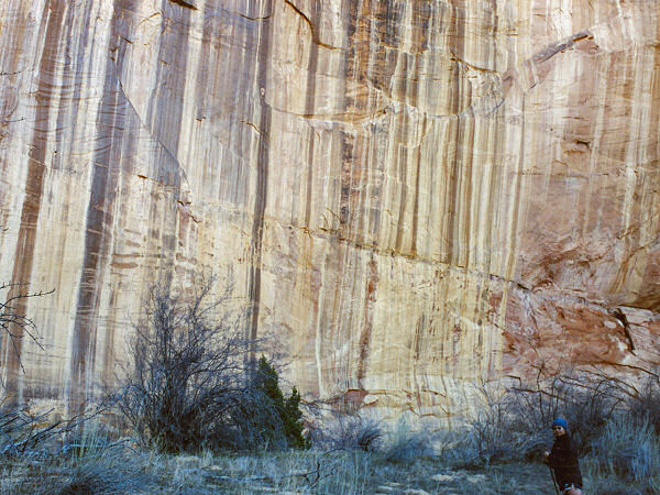
terribly interesting, but the towering, varnish
streaked canyon walls are nice. After slogging a
while, water begins to surface and vegetation
proliferates. It's a bit bush wacky at first as
you head through the willows, but soon becomes
nicer. A short walk will bring you to a large
flat camp site under a tall, overhung alcove
(GPS: 12S 463477mE 4177996mN). A bit beyond, you
will reach a side canyon that enters from the
right (GPS: 12S 462721mE 4176696mN) which
contains Phipps Arch. To visit the arch, follow the foot trail to
the side canyon and begin climbing the slick rock
slope on the downstream side of the canyon. The
path begins climbing towards the northeast, then
negotiates a few ledges to a 6' tall sandstone
pillar. Watch for cairns as the path heads north,
up a few more ledges, then northeast once again.
In the upper levels of the canyon, which contain
large pocketed sandstone domes, is the arch
(GPS: 12S 463883mE 4178860mN). When ready, head
back to Phipps and continue down canyon another
half hour to the confluence with the Escalante
River. Here Phipps, which had gone underground,
surfaces again, to enter the Escalante in a
wide, sandy delta, covered with cottonwood
tress. If you spotted a car, it's only about a
mile up the Escalante to Highway 12 (you'll get
your feet wet), otherwise, return the way you
came. |
| Rating (1-5 stars): |
  
The author and his wife completed the hike
to the arch and Escalante and back from Highway
12 in just under 6 hours. |
| Maps: |
Trails Illustrated - Canyons of the Escalante |
| Books: |
Hiking
the Escalante
- Rudi Lambrechtse |
| Photos: |
Click picture for larger view, click your browser's 'Back' button to return to this page. |
 |
 |
Varnish stained walls
in Phipps Wash. |
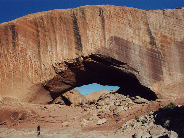
The east side of Phipps Arch. |
 |
 |
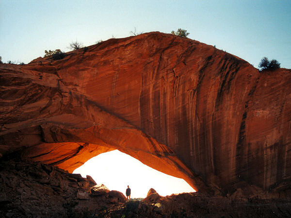
| The west side
of Phipps Arch. |
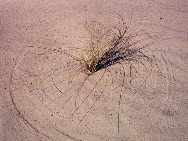
Grass & sand. |
|
|

