| |
Kodachrome Basin State Park - Utah
| Summary: |
A
surprisingly nice state park located near Cannonville
UT with plenty to do and see. Like all UT state
parks, there are fees for everything: entry fee
$5 per car load, bicycles and walk ins $3,
showers $2 per person (plus the $5 entry fee),
camping $14 per night (includes shower).
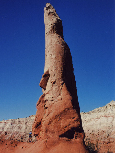
The main feature of the park are the many
sedimentary pipes (also called geysers) in the
area. The park contains 67 of these pipes which
geologists believe to have originated in one of two
ways: as injections of liquefied sand triggered
by earthquakes, or as remnants of ancient
springs. The spires were left standing after the
softer Entrada Sandstone surrounding them eroded
away. Evidence near the park suggests that Native
Americans were the first to wander through this
area. Around the year 1900, cattlemen from Cannonville and Henrieville ventured into this
basin, called it thorny pasture and used it for
winter grazing. In the summer of 1949, the
National Geographic Society sent an exploration
party to document and photograph this uncharted
area. Using Kodak's Kodachrome film to capture
the areas vivid colors, they named it Kodachrome
Flat. The story of the exploration can be found
in the September 1949 issue of National
Geographic Magazine. The area was designated as
a state park in 1962. Fearing repercussions from
the Kodak film company for using the name
Kodachrome, the name was changed to Chimney Rock
State Park, however, within a few years Kodak
gave permission to rename the park Kodachrome
Basin State Park. |
| Directions: |
This state park is located on
the north end of Cottonwood Road (which connects
Highway 89 with Highway 12) just south of Cannonville, UT. |
| Road Conditions: |
Passenger Car - paved all the
way |
| Navigation: |
Easy |
| Length: |
Several trails and lengths to
choose from |
| Date Hiked: |
November,
2002 |
| Weather Conditions: |
Nice & sunny |
|
Required Skills: |
None |
| Hike Description: |
Pick up a trail map at one of
the kiosks in the park.
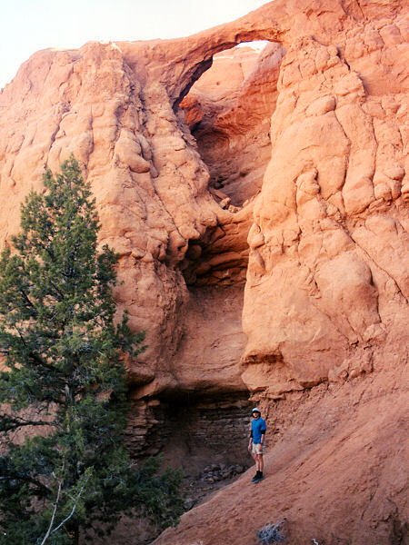
Shakespeare Arch Trail: A ½ mile self
guided hike (pick up a guide at the trailhead)
to a small natural arch. Time to complete = 10
minutes.
Sentinel Trail: A 1 mile loop trail that
starts near the Shakespeare Arch on the right.
This trail basically loops around then on top of
the rock formation in which the arch is located.
The trail doesn't quite seem finished and
becomes somewhat faint near the end (follow the
bits of pink flagging tape tied to the brush). A
sandy descent brings you back to your car. Time
to complete = 40 minutes.
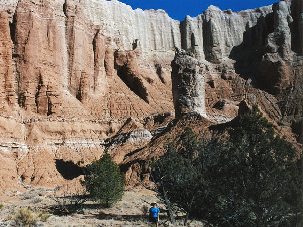
Grand Parade Trail: A level 1½ mile long
loop hike that takes you in and out of some nice
box canyons south of the Angels Palace Trail.
The box canyons are picturesque with the lower
dark red Entrada Sandstone and the white taller
Dakota Sandstone cliffs towering behind. I got a
bit confused near the end of this trail, since
there are multiple use paths branching this way
and that, you can't get lost though. Time to
complete = 45 minutes.
Panorama Trail: The length of this trail
depends on how many of the side trips you feel
like taking. Supposedly, if you take them all
you'll hike about 5 miles. The side trips
definitely take time, but they provide close up
views of some interesting geysers (sand pipes),
rock formations, hand prints, box canyons, deep,
dark, undercut alcoves and view points. Be aware
that the main section of this trail is multiple
use and sees traffic from horse drawn carriages
and bicycles. I pedantically hiked each and
every detour on this trail completing the loop
in 2 hours 45 minutes.
Nature Trail: A paved ½ mile self guided
path. Pick up a guide at the trailhead. Time to
complete = 15 minutes.
Angels Palace Trail: A 1 mile round trip
that leads up a little canyon then up on top of
the Entrada Sandstone layer. Passes by some
interesting rock formations and has some nice
views of the park. Time to complete = ½ hour.
Eagle's View Trail: A steep ½ mile round
trip with an elevation gain of 500 ft or more
with good views. |
| Rating (1-5 stars): |
  
The author and his wife hiked all the
trails in the park except the Eagle's View Trail
(we ran out of daylight), then paid the $4 for a
very welcome shower (though the water could have
been warmer). |
| Maps: |
None |
| Books: |
Hiking and Exploring the Paria River -
Michael Kelsey |
| Photos: |
Click picture for larger view, click your browser's 'Back' button to return to this page. |
 |
 |
 |
|
Chimney Rock |
Shakespeare Arch |
Ballerina Geyser |
 |
 |
|
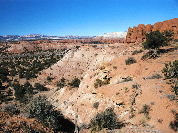
Kodachrome Basin |
Box
canyon along the
Grand Parade Trail. |
|
|

