| |
Tukuhnikivatz, Peale & Mellenthin Peaks -
Manti-La Sal National Forest
| Summary: |
A strenuous off
trail hike to the prominent peaks of Mounts Tukuhnikivatz, Peale &
Mellenthin in the La Sal Mountains, each of which features incredible 360
degree views. The route begins in Gold Basin then follows the ridgeline
between summits. It's best to avoid the peaks and ridgelines in the
afternoon during the summer thunderstorm season due to the danger of
lightening strikes. |
| Directions: |
From the town of Moab, UT head south out
of town on Highway 191 and turn left onto Airport Road at the sign for the
La Sal Mountain Loop Road. Drive 0.5 miles to the end of this road to a 'T'
junction and turn right. Follow this paved road for 12 miles, then turn
right onto Geyser Pass Road, which is also Forest Road (FR) #071, at the
sign pointing towards Gold Basin. The road becomes well graded dirt as it
winds its way up into the mountains. Drive 5.6 miles and turn right onto FR
#0421. Continue 1.6 miles to the end of this road in Gold Basin and park. |
| Road
Conditions: |
Passenger Car |
| Navigation: |
Moderate |
| Length: |
6.5 miles |
| Date
Hiked: |
July, 2007 |
| Weather
Conditions: |
Warm and sunny |
|
Required Skills: |


 |
| Hike
Description: |
From the road end in Gold Basin, pick up
a use trail that begins at the no motorized vehicle sign and follow it down
to cross a stream at the base of Tuk No. Looking up from this point you will
see a prominent treeless scree slope. This is your route to the Tuk No
ridgeline. The slope is quite steep and covered with loose rocks. Stick to
the areas where the rocks are largest and thus less prone to movement. Near
the top of the slope, bend left to attain the ridgeline, which can be
followed directly up to the summit of Tuk No. From this point, simply follow
the obvious ridgeline to gain the 12,482 foot summit of Mount Tukuhnikivatz.
From this vantage point you will be able to scout the route ahead for the
remainder of the hike. Your route simply follows the ridgeline between peaks
with a few detours thrown in to gain the summits of Mounts Peale and
Mellenthin. When ready, descend Tukuhnikivatz to the east to a saddle below
the unnamed peak marked 12,145 on the map. In order to gain the the top of
this peak you must climb around or through several jagged cliffs that lie
directly in line with the ridge. The scree along this section is
particularly loose and the route steep. It's best to stay close to the
jagged rocks since they provide some modicum of stability to the slope. I
found this section to be the most difficult portion of the hike. Once on top
of this summit, you can either continue north along the ridgeline, or
perform a detour southeast to the summit of Mount Peale, which, at 12,721
feet, is the highest point in the range. The route to Mount Peale is
distinct and relatively easy, providing a high return for the effort
required to see it. When ready, continue your progress from the 12,145 foot
peak along the ridgeline to the north heading over two minor summits (the
second of these, marked 12,271 on the map is the steepest). From the top of
the second summit you can use the prominent ridgeline leading east to begin
your descent to Gold Basin, or continue north along the main ridge to the
summit of Mount Mellenthin. There is a fairly distinct
route all the way to the summit of the latter. After climbing Mellenthin,
return to the base of the 12,271 foot
peak and follow a fairly distinct track partially back up this hill. Veer
right on a series of use trails to gain the ridgeline, which descends to the
east back down towards Gold Basin. After descending the ridge past a weather
station, leave the ridge to the left (southwest) and pick your way down the
steep slope into the forest below to eventually return to Gold Basin and
your vehicle. |
| Rating
(1-5 stars): |
    
The author completed the loop hike described
above at a fast pace, pushing hard the entire way to beat the afternoon
thunderstorms, in 8 hours. |
| Maps: |
Latitude 40° Maps - Moab East Utah Trails Recreation Topo
Map
Click here for a map of
the hike. |
|
Books: |
Utah Mountaineering Guide 3rd Edition
- Michael Kelsey |
| Photos: |
Click picture for larger
view, click your browser's 'Back' button to return to this page. |
 |
 |
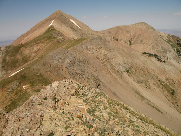
Ridgeline
between Tuk No and
Tukuhnikivatz. |
View from
Tukuhnikivatz of the
ridge towards Mt. Peale. |
 |
 |
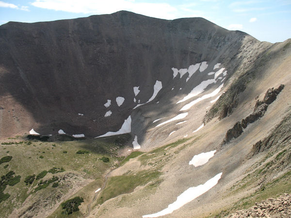
Looking back towards
Tukuhnikivatz
after climbing the . |
View from Peale of the
ridgeline
to Mellenthin. |
 |
 |
Looking back towards Peale en
route
to Mellenthin. |
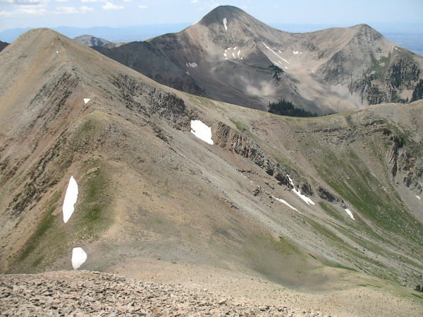
The ridgeline heading towards
Mellenthin. |
 |
 |
View looking back down the
ridge
from Mellenthin. |
The ridge
which can be followed
back down to Gold Basin. |
|
|

