| Summary: |
A nice technical canyon with
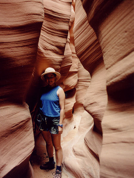
3 rappels and some sideways scraping along
through a narrow twisty mostly shallow slot. To
complete this canyon you will need 100 ft of
rope, webbing, harness, helmet & descending gear. Leave
the bolt kit at home, the canyon is not bolted
and should be kept that way. Natural anchors may
be used at all drops. |
| Directions: |
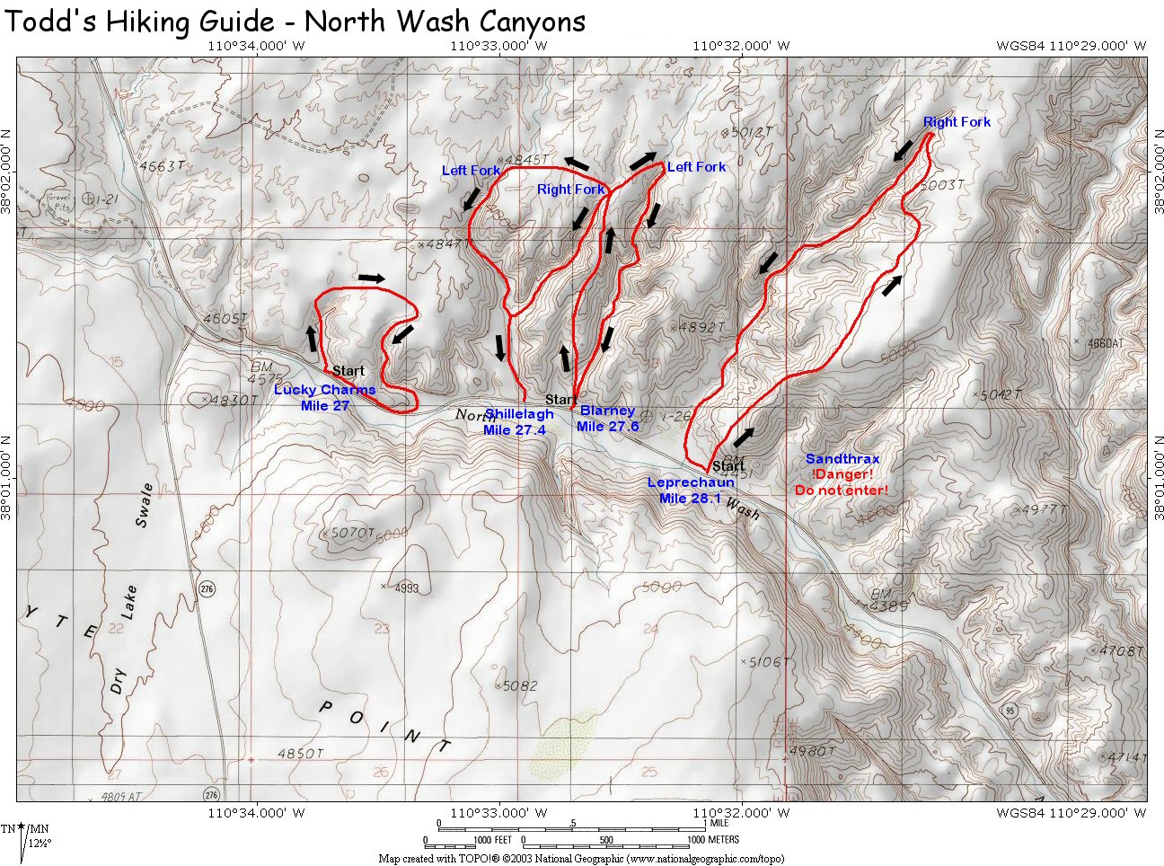
North Wash is
located off of Highway 95, south of Hanksville,
UT and north of the Hite Marina on Lake Powell.
Drive on Highway 95 to between mile posts 29 &
28 (about mile 28.1). Pull off the pavement onto a short
dirt road located on the east and park under some cottonwood trees
(UTM 540933mE, 4207711mN). |
| Road Conditions: |
Passenger Car - paved all the way |
| Navigation: |
Difficult - you have to cross
much slick rock to reach the entrance, and many
drainages in the area look very similar. I
suggest the use of a GPS & topo maps to avoid
entering a canyon that may get you into trouble
 . . |
| Length: |
~3 miles |
| Date Hiked: |
June,
2002 |
| Weather Conditions: |
Hot! |
|
Required Skills: |


 |
| Hike Description: |
Walk up the
slick rock heading northeast. When you reach the
top, youll see the drainage down to your left.
Continue northeast towards point (542076mE,
4209300mN). Note: after following the drainage
up a ways drop down and stay below the topmost
cliff band as you contour your way around the
canyon. If you wind up above the cliff band and
these coordinates you might find it difficult to
enter the drainage. Continue to contour around
the drainage to the head of Leprechaun Canyon at
(542161mE, 4209941mN). Put on your
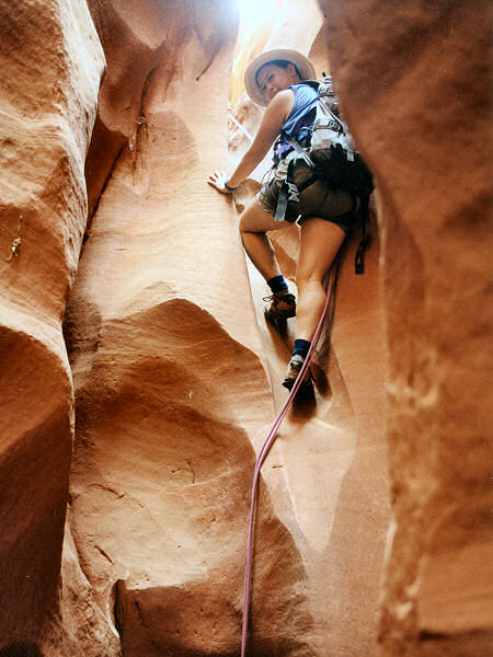
harness & perform the first of many down climbs
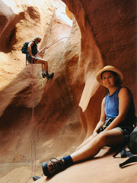
into the narrow crack before you. Rappel #1 is a
30' sloping rap from a small wedged chokestone
on the floor. There is some more down climbing
and narrows which will require you to walk
sideways to pass & occasionally some wider
sections to provide a break. Rap #2 is another
30 footer from another wedged chokestone
followed by more twisty narrows. Soon you'll
arrive at rappel #3 (30' from a sling around a
rock embedded in the floor of a pot hole) which
occurs directly above the confluence with the
central drainage of Leprechaun. If you climb the
slickrock bench to the right, just above rap #3
you can look up canyon at the boulder strewn
deep, dark section of middle fork and just
beyond to the point where the left fork enters
(along with the right fork that you are in,
these are the three primary drainages in the
canyon & all provide canyoneering
opportunities). Complete rap #3 to the junction
with middle fork (much graffiti on the canyon
walls in this area) and hike down canyon through
a short, deep stretch of narrows (note the Mae
West slot above your head), before the canyon
widens and it's a short sand slog back to the
road and your car. |
| Rating (1-5 stars): |

Thanks to Dave Black for leading my wife and I
through this nice canyon. Dave is a master of
the art of minimal impact canyoneering. His
skills are ones that we
should all aspire to. The canyon was completed
in 4 hours. |
|
Books: |
Technical Slot Canyon
Guide to the Colorado Plateau - Michael R.
Kelsey |
| Maps: |
Click
here for a
map of the area |
| Photos: |
Click picture for larger view, click your browser's 'Back' button to return to this page. |

