| |
Ding and Dang Canyons - San
Rafael Swell
| Summary: |
A fun
loop hike with some climbing through scenic
canyons with nice sections of narrows.
Do not attempt these hikes if the forecast
calls for rain. |
| Directions: |
You can get
to this canyon from both inside and outside of
the Swell. Most people complete this hike from
the east side (which will put you much closer
to the canyons), but requires driving over
some sandy stretches. Drive along Highway 24
which runs between I-70 to the north and
Hanksville to the south. Near mile post 137
head west on a paved road following the signs
for Goblin Valley State Park. After a few
miles the road continues straight and branches
left towards Goblin Valley.
Outside the Reef - Turn left towards Goblin Valley.
Just before you reach the fee station for the
park, turn right on the unpaved road with the
sign for Little Wild Horse Canyon.
Inside the Reef - Stay straight
at the intersection and head towards the reef.
A short distance later the pavement ends.
Continue straight on the main well graded road
for 17 miles. When you reach a junction for
I-70 (right), follow the sign for Tan
Seep/Reds Canyon, 2.7 miles later you'll reach
another junction, follow the sign towards Red
Canyon/McKay Flat. One mile later you'll reach
another signed junction: Reds Canyon
(straight), McKay Flat (left). Turn left and
drive 8.5 miles to the turn off for Hidden
Splendor Mine. Turn left towards the mine and
drive 7.9 miles and look for an unnamed road
on the left. Turn left. Passenger cars can
drive in a short distance to a level spot that
is ok for camping. High clearance vehicles can
drive right up to the entrance to Ramp (follow
the hiking instructions below). |
| Road Conditions: |
High
Clearance Vehicle - Outside the Swell
Passenger Car - Inside the Swell |
| Navigation: |
Moderate |
| Length: |
Not sure? See
time table below. |
| Date Hiked: |
October, 2001 |
| Weather Conditions: |
Warm and
sunny |
|
Required Skills: |


 |
| Hike Description: |
The author completed this hike from inside the reef, however, most people do this hike from the outside. The most common route is up Ding and down Dang, though
the author did it the other way around. There are no major obstacles in Ding canyon to speak of, while in Dang there are five or so boulder climbs of moderate difficulty. Both canyons have a decent section of narrows in the Navajo sandstone.
From outside the reef, simply walk down the dry stream bed in which you're parked. About 20 minutes later you'll come to a moderately sized drainage heading right (towards the reef), this is Ding Canyon, if you continue on you'll run into a similar drainage 20 minutes later (Dang). If you head up Dang (like I did) the stream bed winds it's way towards the reef and soon becomes quite deep. As you head up through the narrows you will encounter several chockstones blocking your path. People of moderate climbing ability should be able to negotiate these difficulties with some effort. Later you will hit a large dry fall which may be bypassed on canyon right (right side of the canyon if you are facing the direction water would flow). As you near the top of the canyon it widens out and eventually brings you to the other side of the reef. In the upper canyon look for a prominent wash on the right hand side. Follow this wash around to the right and climb a low ridge and soon it becomes a rather distinct path. The path heads up then down
towards a break in the sandstone wall to the drainage of Ding Canyon. Simply walk down Ding, there are a few scrambles to get around some large boulder piles and a few large potholes in the upper section, but nothing difficult. Once through the reef, follow the streambed out to the larger dry wash you had been hiking on earlier. If you are parked outside the reef, turn left and head back to your car.
From inside the reef this hike is much longer. There is no trail to follow to complete this route, though you may see quite a few footprints. From the Hidden
Splendor Mine Road turn off begin walking towards the reef. In about 20 minutes you'll come to a junction with an old sky blue wreck of a car off to the right. Stay left and walk the prominent drainage towards the head of Ramp Canyon. Just before you reach the head of the canyon look for a ORV road on the left that runs along the back side of the reef. Turn left and follow this steep road as it climbs up, then drops steeply down into the next canyon over (this is Cistern Canyon). Walk down Cistern Canyon - there are no major obstacles and the canyon is not terribly remarkable (though there is a rather large chockstone in the lower end that you walk under - a photo of this chockstone is on the cover of Steve Allan's "Canyoneering" book). Once through Cistern follow the wide drainage out until you see a prominent wash entering in on the left hand side. Turn left and walk this dry flat creek bed east for quite a while. Eventually the stream bed narrows and begins climbing some low red rock hills then drops down into a creek bed once again. A short distance later you will see a sizable drainage heading left towards the reef - this is Dang Canyon (it took the author 1 hr 20 min to hike the stream bed from the end of Cistern to Dang Canyon). Follow the loop described above (up Dang and down Ding). At the end of Ding Canyon turn right and retrace your route back to Cistern Canyon, then back to your car.
Time Table:
Hidden Spender Road to end of Cistern - 90 minutes
End of Cistern to Dang - 80 minutes
Up Dang - 90 minutes
Down Ding - 60 minutes
Back to end of Cistern - 80 minutes
Back to your car - 90 minutes
Total = ~ 8 hours
|
| Rating (1-5 stars): |

The author and his wife parked just off Hidden
Splendor Mine Road and hiked the route
described above. At the end of the hike,
instead of going up Cistern Canyon, we
attempted to head west then hike up Ramp
Canyon instead. Unfortunately this route is
somewhat confusing (see also: Cistern/Ramp
loop hike) and we wound up going up the wrong
drainage. As it was getting late in the day,
we back tracked to Cistern and retraced our
steps to our car. Our total hike time was a
very long 11 hours. |
| Maps: |
USGS: Little
Wild Horse Mesa and Hunt Draw (1:24,000) |
| Books: |
Canyon
Hiking Guide to the Colorado Plateau -
Michael Kelsey |
| Photos: |
Click picture for larger view, click your browser's 'Back' button to return to this page. |
 |
 |
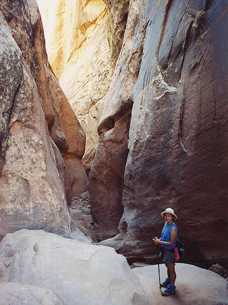
View
in the narrows of
Dang Canyon. |
More narrows. |
|
|
