| |
Misery Canyon - Zion National Park
| Summary: |
A very nice
technical canyon with wading, swimming and route
finding required. To complete this canyon you
will need: good map reading skills, a compass or
gps, a 75' rope, harness w/ descending gear,
webbing, dry bags, helmet and probably a wet
suit. This canyon technically lies outside the
boundary of the park, so no permit is required. |
| Directions: |
From the east entrance to
Zion N.P. drive a short distance past the pull
out for Checkerboard Mesa to one of the next two
smaller unmarked pull offs on the north side of
the road (the second one is bigger and closer to
your entry point). From the west you can arrive
at the same location by driving 3.0 miles east,
from the second (smaller) tunnel. The gps
coordinate for this location is: 332834mE
4121689mN. |
| Road Conditions: |
Passenger Car (paved all the
way) |
| Navigation: |
Difficult - you will need
excellent map reading skills, compass and/or gps
(with spare batteries) |
| Length: |
8-10 hours |
| Date Hiked: |
September,
2002 |
| Weather Conditions: |
Nice & warm |
|
Required Skills: |


 |
| Hike Description: |
From the car
park (gps: 332834mE
4121689mN)
walk across the road and begin walking up the
dry wash on the west side of Checkerboard Mesa.
There is a pretty good trail to follow as you
walk across the slick rock then begin a long
sandy slog up to a saddle (gps: 332793mE
4120122mN). The path descends the other side of
the saddle then bends left around the back side
of Checkerboard Mesa. The trail descends in and
out of four drainages (the 4th being Misery).
Take care as you enter a drainage to pick up the
trail as it climbs out the other side. At the
second drainage the trail splits (this is where
you will rejoin the path on the way out). Do not
follow the footprints down this wash, but
instead cross the drainage and climb the slick
rock slope on the other side (gps: 333975mE
4119121mN). Continue down and across drainage #3
then route find your way down into drainage #4
which is Misery canyon (gps: 334563mE
4118883mN). It took our group about 2 hours to
reach this point. Begin hiking down Misery
Canyon. There are a few easily bi-passable pot
holes at the beginning, then it's a sandy slog
through a wide drainage for about 20 minutes
until you reach the narrows. You have two
options to enter the narrows: either stay in the
drainage and perform a 25' rappel off an old
crappy bolt on canyon left or climb the left
slope and perform a 30' rap off a tree. The
canyon then alternates between nice narrows and
a wide sandy wash. There are a few down climbs &
slides in this section, but nothing terribly
difficult. We encountered a few shallow pools,
but water levels will depend on recent weather.
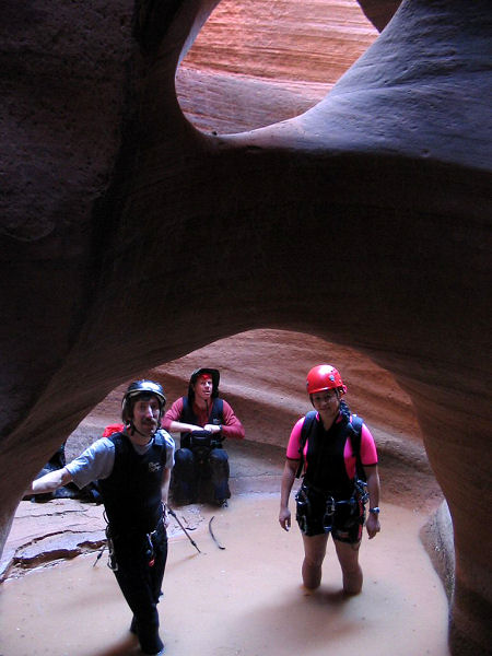
You will encounter two short drops in an area
with a nice natural arch. You can slide down the
first drop of 15' or thread your rope through
the old anchor (what appears to be bent rebar)
around the corner on the right for use as a
rappel point or hand line. Use the arch as an
anchor or try a belay and partner assist (like
we did) to negotiate the second drop of 25'.
Just below this point is another drop and
natural arch which can easily be bypassed by
climbing around on the right. As you near the
east fork of Misery, the canyon will begin a
series of steep pot hole drops. Avoid this
section by exiting the drainage on the left and
route finding your way down to the bottom of the
east fork. A short distance beyond you will
encounter a drop off of 25' formed by break
down. Use one of the boulders on the left as an
anchor. There are two great sets of deep narrows
below this point. You will encounter a few down
climbs and slides that you may wish to use rope
for, but it is not necessary. Near the end of
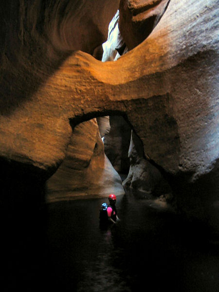
the second narrows you will enter a very cool
chamber with twin arches and a large pool and
warm spring. Swim through the pool then through
a green hallway to the confluence with the East
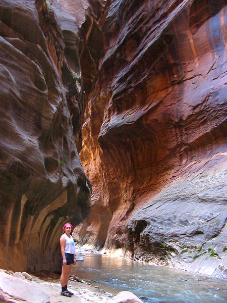
Fork of the Virgin River (also known as Parunuweap Canyon). Turn right, and as you wade
down Parunuweap through a beautiful stretch of
canyon keep an eye out for a use trail on the
right located just before a prominent horseshoe
bend in the stream. The use trail is your exit
point, but most
people walk the additional 1/2 mile to a small
unimpressive waterfall before beginning the
climb (while the falls is not interesting, there
is a nice stretch of canyon that makes it worth
the trip). On canyon right on the far side of
the horseshoe bend is the Powell Memorial
Plaque. It reads: "Major John Wesley Powell
1834-1902 explorer, scientist, Steven V. Jones
1840-1920 teacher, topographer, Joseph W. Young
1829-1873 Mormon pioneer leader, Descended
Labyrinth Falls 1/2 mile below Monday, September
30, 1872 during first Parunuweap Canyon
traverse. Powell named this canyon from the
Paiute Indian word 'Parunuweap' which means
roaring water canyon. Dedicated September 30,
1972." When ready, begin the very steep climb up
the use trail. You will encounter numerous faint
trails near the top. Pick a trail that leads you
back up Parunuweap then Misery a ways, then the
trail should bend left and take you over sand
and slick rock up to the junction described
earlier - if you carry a gps you can
use it to help lead you back to the junction (gps: 333975mE
4119121mN). From the junction, simply
follow your footprints back to your car. |
| Rating (1-5 stars): |
    
This canyon is a real gem and one of my
favorites in Zion.
The author his wife and a friend
completed this hike at a leisurely pace,
enjoying the narrows and taking photos in 10
hours. |
| Maps: |
Trails Illustrated - Zion National Park, Zion N.P. Park Map |
| Books: |
None |
| Photos: |
Click picture for larger view, click your browser's 'Back' button to return to this page. |
 |
 |
|
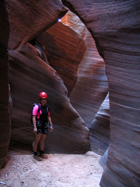
Nice narrows. |
Rappel arch. |
 |
 |
|
Dark narrows. |
Parunuweap. |
|
|

