| |
Englestead Hollow - Zion
National Park
| Summary: |
A technical canyon with about a dozen rappels, including a long 300 footer to start things off. Some nice narrows and an arch can be seen before dropping into Orderville Canyon to see the very pretty lower section. To complete this canyon you will need: 2 x 60 meter ropes, harness w/ descending gear, ascending gear, webbing, helmet and a permit (available at the Backcountry Desk in the Visitors Center). You may also wish to bring a wet suit in cooler weather, since there is deep wading and possibly swimming involved in lower Orderville Canyon. Leave the bolt kit at home, this canyon is already over bolted. Do not attempt this canyon if heavy rains threaten. |
| Directions: |
Send me a
request for directions via e-mail. |
| Road Conditions: |
4-Wheel Drive |
| Navigation: |
Moderate |
| Length: |
7-10 hours |
| Date Hiked: |
June, 2002 |
| Weather Conditions: |
Nice |
|
Required Skills: |


 |
| Hike Description: |
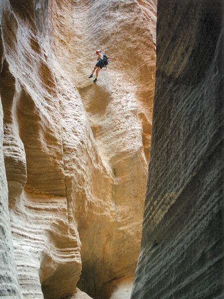
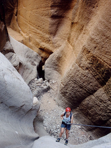
There are several ways into this canyon. From the spot the author parked, walk due east along the top of a steeply sloping hill until you reach the second drainage. Bushwack your way down the steep slope into this drainage. Note: there is a faint remnant of an old logging road when you reach the bottom. Continue east to a shallow drainage (which also runs east) follow it down (you'll likely see other foot prints in this area). At the bottom of the drainage you'll see the main canyon of the Orderville Tributary below you. Work your way left and down a short slick rock escarpment (you may wish to set up a rope to get down this section, though the author had no trouble). Once at the main canyon walk to the right to the head of a 300 ft dry fall. The dry fall is descended in two stages: a 100 ft rappel to a corner bolt station, then a 200 ft rappel to the canyon bottom. The bolt station is located at a small corner ledge on the west side of the canyon (locate it by walking around to the other side of the drop). Draw a mental line straight up and locate the tree above it & a little to the left of the station - this is your anchor point. When the author was here, the drop was negociated by sending the first person down (carrying ascending gear) on a single strand of rope to the bolt station, where the 2nd 200 ft rope was attached (also single strand). The first person began the 200' rappel while the next person rappels to the station. The last person rigged the top rope double strand. At the bolt station, they connected the two ropes, pulled the top rope, then descended into the canyon. Tip: if the first person clips the top rope into the bolt station (allowing plenty of slack) it will enable the rest of the party to travel more easily to the station since it's a short distance to the side of the tree anchor. OK - pull your ropes and you are now in the canyon. If your ropes are slightly longer than 200 ft, you'll be able to descend the next drop directly, if not use the single bolt and hanger (B&H) on the right to rig a 25' rappel. Walk 10 ft, the third rap is 40' from a sling around a rock. Walk another few steps and the fourth rap is 30' from another sling around a rock (note: be careful that the sling doesn't slip up and over the anchor on this one, a back up or belay is prudent). The fifth rap is from a long piece of webbing tied to a log and will take about 210' ft of rope. It combines a 15' drop into a pot hole, with an 80 footer down a cool chute. Careful not to twist your ropes since you'll be pulling them around a corner. After this you'll have a long stretch of walking through sandstone hallways before hitting some short rappels. Here are the details:
Rap 6: 15' from a log jam
Rap 7: 12' from a log over a big choke stone
Rap 8: 15' from a superfluous B&H on the left or use a log
Rap 9: 15' from the big log back a
ways from the drop or maybe down climb it
Rap 10: 15' from a log jam
This next section of canyon is quite pretty, if short, and you'll pass under a nice arch.
Rap 11: 20' dry fall, rig off a stump at the top
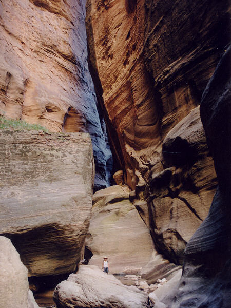
There is another drop at the confluence with Orderville Canyon, but this is easily bypassed by climbing down on the left. Head down Orderville through a very pretty section of canyon (in my mind this is actually the best part of the hike). There are a few down climbs required as well as deep wading and possibly a little swimming before reaching the confluence with the Virgin River. Follow the Virgin back to the Zion Road End and a Shuttle. |
| Rating (1-5 stars): |
    
A very nice canyon, and one that is being increasingly impacted by humans. The author and his wife and two friends completed the canyon in a leisurely 9 hours.
The author returned at a later date an completed
the hike in 8 1/2 hours. Using a 600' rope the
party descended the first big wall drop right at
the canyon head. |
| Maps: |
Trails Illustrated - Zion National Park, Zion N.P. Park Map |
| Books: |
None |
| Photos: |
Click picture for larger view, click your browser's 'Back' button to return to this page. |
 |
 |
The
bottom of
Rap #1. |
Rap
#2 |
 |
 |
| Rap
#3 |
Lower
Orderville |
|
|

