| |
Meadow Canyon - Coconino National Forest
| Summary: |
A technical
canyon trip down a rocky (but non-brushy)
tributary of West Clear Creek. Some climbing
and bouldering are required, as well as 2-4
rappels of 20-80 feet. Your reward is some
good scenery and a nice (if short) stretch of
narrows. This hike may be performed as a down
and back trip or as part of a longer hike
along West Clear Creek. To complete this hike
as a down and back trip you will need one to
three 50' ropes (I suggest at least two) and a
100' rope, harness, carabiners, webbing,
helmet and descending and ascending gear. For
a through trip, one 200' rope will
suffice. |
| Directions: |
From Phoenix take I-17 north to Camp Verde to exit 287. Turn right (east) onto Highway 260. Follow 260
out of town up onto the rim and under the
power lines. Just before you reach mile post
245, turn left onto an unnamed dirt road
(there is a gate blocking this road that you
will have to open to get through). Once on the
dirt road take an immediate left and follow
this rutted dirt track 1.2 miles until you
reach the power lines. Turn right and follow
the road that runs beneath the power lines.
There are two tributaries to upper Meadow
Canyon, you can start your hike in either one.
The western most one can be reached by turning
left onto a dirt road after driving 0.3 miles
under the power lines - head through a fence
then drive down a very rough & rocky road
0.2 miles and park next to a stock pond. The
eastern tributary can be reached by continuing
along the power lines until the road stops
descending. |
| Road Conditions: |
4-Wheel
Drive, a High Clearance Vehicle will probably
get you close |
| Navigation: |
Easy |
| Length: |
6 miles |
| Date Hiked: |
January 2002 |
| Weather Conditions: |
Cold
w/patches of ice and snow |
|
Required Skills: |
 |
| Hike Description: |
I will
describe this hike beginning at the western
tributary of Meadow Canyon, however, from
whichever area you start your hike, simply
begin walking down the rocky streambed. After
about 15 minutes you will come to an
intersection with the main canyon, turn left
and head down stream. The canyon is shallow
and filled with basketball sized rocks at this
point, however this is more than made up for
by the fact that no bush wacking is required
in the entire canyon. If you look closely you
will see that many of the rocks have
fossilized shells partially exposed in their
surface. After a while the stream bed begins
cutting into the sandstone and you will be
faced with a series of dry falls that may be
down climbed. Shortly afterwards you will
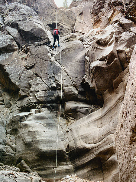
reach an 80' dry fall. The drop consists of a
20' drop to a ledge then a 60' drop to the
canyon floor. It might be possible to down
climb the first 20', but since there are no
anchor points on the ledge, it's best to rig
this falls from the top. The author used a
prominent tree on the right side of the canyon
to rig off of (though there are other options)
and used a 200' rope, ~85' of which wound up
sitting on the ground (I believe this rappel
can be performed with a 100' rope depending on
your choice of an anchor). Continuing down
canyon, you will enter a section where large
boulders choke the canyon floor. This slows
your progress somewhat as you pick your way
through, climbing where necessary. Eventually
you will reach a 45 foot dry fall and your
next rappel point. There is a large boulder on
the right side just above the drop that makes
for a good anchor point (15' of webbing should
do it). The author used a 50' rope which was
about the right length. More rock hopping down
canyon, and your next obstacle is an 85'
steeply sloping chute - the author and his
wife simply walked down (though some may
prefer to use a rope). Shortly below the chute
is a 20' drop off that is best negotiated with
a rope (the author down climbed this point,
but doesn't recommend it), the anchor is a
large tree on the right. Below this drop, the
canyon narrows up nicely and you will pass
through a very pretty section of canyon. This
ends far too soon, however, and the canyon
opens up just before you reach the confluence
with West Clear Creek. The author and his wife
spent 20 minutes skipping stones across a
large pool just upstream of the confluence,
then turned around, retrieving all rope and
webbing on the way out. |
| Rating (1-5 stars): |
   
The author and his wife completed this
hike in just under 6 hours at a leisurely
pace. Some of the drop offs had pools at the
bottom, but all were frozen solid when we were
here. |
| Maps: |
Coconino National Forest Map |
| Photos: |
Click picture for larger view, click your browser's 'Back' button to return to this page. |
 |
 |
 |
|
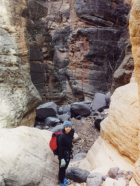
The upper canyon. |
Negotiating
the 80' rappel. |
The
start of the
short narrows. |
|
|

