| |
James / Kelly Canyon Loop -
Coconino National Forest
| Summary: |
A technical canyon hike
near Flagstaff that involves hiking, swimming and 2 rappels. The author recommends
wet suits for the cold swims and at least one floatation device, especially if you want to
get photos. |
| Directions: |
From Phoenix drive north
on I-17 almost to Flagstaff. Take exit #331 'Kelly Canyon Rd', head west off the
exit ramp and park. |
| Road
Conditions: |
Passenger car |
| Navigation: |
Moderate - the author
took a wrong turn near the end of this hike, however, simply by heading east you're bound
to run into I-17 and the trail head. |
| Length: |
~11 miles |
| Date
Hiked: |
May, 2000 & July 2001 |
| Weather
Conditions: |
Warm in the sun, freezing
in the water, do this hike on a warm day. |
|
Required Skills: |


 |
| Hike
Description: |
Note: Description
accuracy depends on the amount of water in the canyon, water levels may vary.
From Kelly Canyon Rd., begin by following a jeep track south (stay right of
the barbed wire fence) paralleling I-17. Turn right following the fence at the
bottom of the depression and you will arrive at the edge of James Canyon. There are
several steep scrambling routes to the bottom. Once in the bottom, begin rock
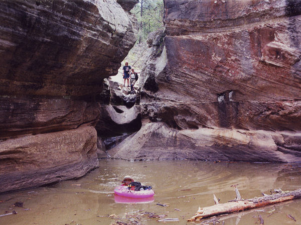
hopping & bush whacking down stream. About 0.5 mile down canyon you will come to
the first of many swims (water fills about every section of narrows in this canyon and the
water is very cold). There is a 10 ft down climb followed by a pool.
Once through, get walking again right away to warm up. Another 0.4 miles brings you
to the first of two technical sections. This first one consists of a 12-foot drop
into a pool (there is a second smaller drop right afterwards, however, this is easily free
climbed). The best way through this section is to rappel down until just above the
water, at this point you can support yourself by placing your feet on either side of the
sandstone narrow. Unclip your decender then lower yourself by hand into the water
& a short swim. You can pull the rope down after you from the ledge that
separates the two pools. Continue down stream through a few more narrows requiring
wading/swimming. The last one in this section consists of an 8 foot drop off into a
big pool. When the author was there, a section of webbing was rigged to an old log
permitting easy decent (hold your breath though, to avoid inhaling the gnats flying out of
the log the webbing is tied to). The next 0.5 mile is easier rock hopping until you
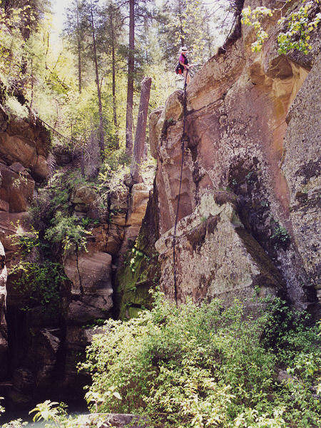
come to the second technical portion of the hike, a 40 ft drop off. There are good
trees to rig from on both sides of the stream bed (webbing tied to trees indicates that
both sides have been used), however, if you rig from the left side (facing down stream)
you can avoid the pool below and another cold swim. Continuing down stream there are
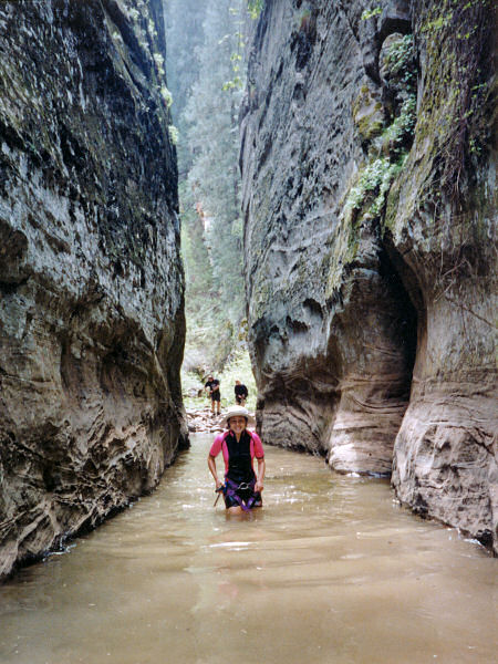
a few more narrows requiring swimming (2 when the author was there), one of which is a
long section through an 8 ft wide hallway (this one was particularly tiring - having a
float for your pack keeps gear dry as well as alleviates extra weight during these longer
swims). About 2 miles from the second rappel brings you to the confluence with
Pumphouse Wash. Tyler's book (see below) recommends heading down Pumphouse (left) to
highway 89A. This requires an additional car shuttle. The author turned right
and headed up this sunny dry canyon. There is a large falls about 0.5 miles up
Pumphouse Wash, use trails on either side of the canyon lead around this obstacle.
Another 1.5 miles brings you to the confluence with Kelly Canyon, which comes in
from the right hand side. Turn right up Kelly and follow the fairly distinct trail
which runs most of it's length. Kelly Canyon is a pleasant, if wide 3.5 mile long
canyon, and according to Tyler's book will bring you directly back to Kelly Canyon Rd.
Judging by Tyler's map, it looks like you want to bear right at a confluence near
the upper end of the canyon, but this is where the author took a wrong turn. The
author followed a distinct trail up the left side of the canyon and wound up heading too
far north. It's difficult to go too far astray, however, since heading due east once
out of the canyon will bring you up against I-17 once again. Follow I-17 south until
you reach Kelly Canyon Rd and your car. |
| Rating
(1-5 stars): |
   
Interesting canyoneering type hike with some decent narrows and fun rappels.
The author and his wife wore shorty wet suits and neoprene socks through James
Canyon and were glad for the warmth they provided. He also carried a 150 ft static
rope for the technical portion (a somewhat shorter rope would have sufficed - 100ft?).
Two friends that came along did not wear wet suits and were quite convinced we were
trying to do them in :) The hike was completed in 9 1/2 hours (one hour was probably
added due to the confusion in upper Kelly Canyon). The author and his wife
returned in July 2001 and completed the James/Pumphouse Wash hike as a
through trip (with car shuttle). The water was much warmer on this trip,
though wet suits were still worn (& welcome). |
| Maps: |
Coconino National Forest
Map |
| Books: |
'Canyoneering Arizona',
Tyler Williams |
| Photos: |
Click picture for larger
view, click your browser's 'Back' button to return to this page. |
 |
 |
The first swim (can be
bypassed on the right). |
Getting ready for the
40 ft. rappel. |
 |
 |
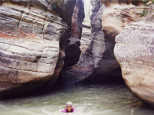
| Another section of icy water. |
The cold hallway. |
|
|

