| |
Humphreys Peak Trail -
Coconino National Forest
| Summary: |
The easier
of two ways to summit the highest peak in Arizona (see Weatherford Trail
for the tougher one). |
| Directions: |
From Phoenix take I-17
north to Flagstaff. Follow Highway 180 north out of Flag 7
miles. Turn right at the signs for Snowbowl ski area near mile post
223. Folow the Snow Bowl Road 6.5 miles and turn left into the
signed parking area for the Humphreys Peak and Katchina Trails. |
| Road
Conditions: |
Passenger car - paved all the way. |
| Navigation: |
Easy |
| Length: |
9 miles |
| Date
Hiked: |
Oct, 2000 |
| Weather
Conditions: |
Warm at the
bottom, cool on top. |
|
Required Skills: |
 |
| Hike
Description: |
From the
signed trailhead, begin by walking across the ski slope, under the lifts
into the forest beyond. The first part of this hike winds it's way
through a pine forest crowded with dead fall (a result of overzealous fire
suppressionists perhaps). Eventually the trees become more stunted
and finally cease to grow as you reach the tree line at 10,500 ft. A
short steep climb brings you to Doyle Saddle (and the intersection with
the right branching Weatherford Trail). From the saddle head left up
a steep section which sometimes requires the use of hands. The trail
then becomes somewhat less steep, ascending over a couple false peaks
(with some nice views to the right down into Lockett Meadow) and finally
to the summit at 12,633 ft. Enjoy the view, take a few photos (peak
baggers can stand next to the wooden summit sign as proof of their
accomplishment), then return the way you came. |
| Rating
(1-5 stars): |
 
This is another crowded hike (in the summer at least,
winters you'll probably have the place to yourself, but that's a whole
new ball game), but there are some nice views that make it worth it.
Bring extra clothes for the summit which will likely be quite cool even in
the middle of the summer. If performing this hike in the monsoon
season, keep an eye on the clouds. If afternoon thunderheads begin
forming, it's probably better to be below tree line than waving your
aluminum walking stick around on an exposed ridge line. The author
and his wife completed this hike in 6 hours. |
| Maps: |
Coconino National Forest
Map |
| Books: |
The Favorite Hikes, Flagstaff & Sedona,
Cosmic Ray |
| Photos: |
Click picture for larger
view, click your browser's 'Back' button to return to this page. |
 |
 |
 |
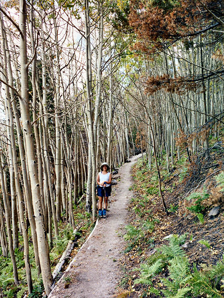
| Aspen on the ascent. |
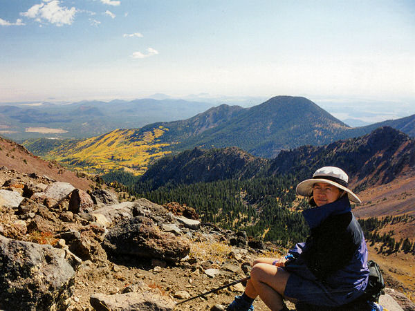
The view
from Humphrey's Peak
looking north into Lockett Meadow. |
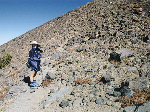
Climbing
towards the peak. |
|
|
