| Summary: |
An off trail hike down a little visited drainage in the
Marble Canyon area of the Grand Canyon. |
| Directions: |
From Flagstaff drive north on Highway 89. Turn left on
Highway 89A towards Jacob Lake and follow it across the Navajo Bridge. Turn
left on a dirt road just past mile post 557. Zero the trip meter on your car
and head south on this dirt road. In 2.1 miles bear left at a road junction
and cattle guard, at 3.3 miles stay left again. At 4.6 miles you'll reach
the Kram Ranch, turn right and pass through a fence. The road heads south
for about a half mile then bends east. At 5.6 miles you'll reach another
fork, stay left and continue driving. You'll pass a few signs in this
section urging you to protect the Brady Pincushion Cactus which grows along
the rim in this part of Marble Canyon (please keep your vehicle on
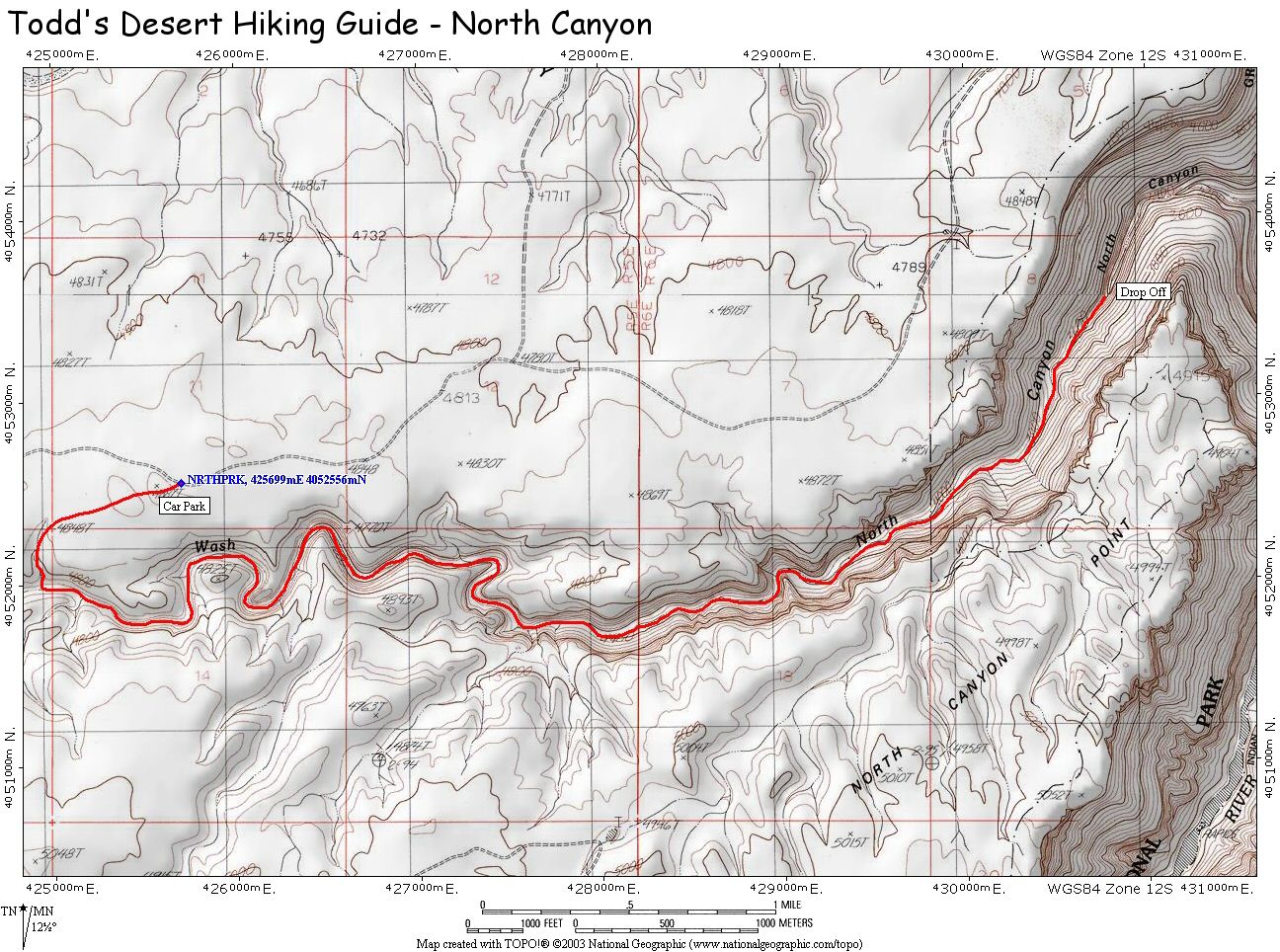
established roads). At 7.6 miles pull to the side of the road at an
unremarkable bare patch of ground
(GPS: 12S 425699mE 4052556mN). |
| Road
Conditions: |
Passenger Car (if roads are dry) |
| Navigation: |
Moderate - a little route finding to get into the canyon,
then it's easy |
| Length: |
~12 miles |
| Date
Hiked: |
October, 2004 |
| Weather
Conditions: |
Grey and drizzly |
|
Required Skills: |
None |
| Hike
Description: |
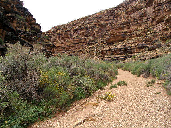
From the road, walk southwest through the
scrub brush and look for a minor drainage that will enable you to get down
into the canyon. Make a rock pile where you enter the drainage so that you
know where to come out again when on the return trip. Begin walking down the
wide gravel strewn wash. It's easy, flat walking at first as you pass
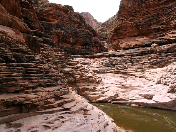
between moderately tall cliffs on either side. As the canyon deepens, the
drainage becomes wider and the filled with large boulders. Progress becomes
slower due to the climbing and route finding required to navigate through
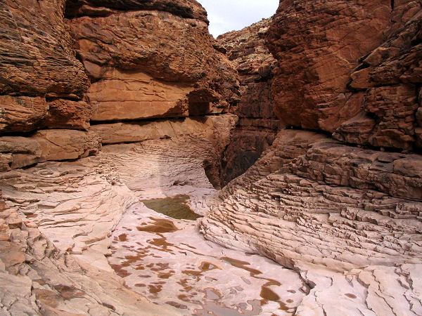
the boulder field. After several hours the dark red Supai layer appears
underfoot and the walking becomes easier. Soon the drainage begins
descending steeply through the Supai. There are several pour offs that can
be bypassed on one side or the other, then a larger pour off that can be
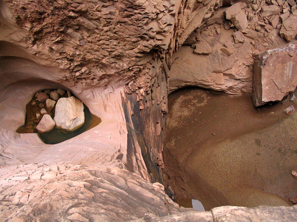
bypassed using a breakdown pile on canyon left (the left side of the canyon
when facing down stream). Just beyond this is a short slide into a pool
(don't go down without rope though) followed by a sheer drop which I
estimate at ~120 feet. Unless you're prepared for a technical descent, this
is where you turn around (if you are prepared, there are two large boulders
in the pool above this drop that could be used for an anchor). |
| Rating
(1-5 stars): |

The author and his wife completed the hike to the Supai pour off and back in
6.5 hours. I plan to return at some
point in the future with rope and ascending/descending gear and attempt to
make it all the way down to the river. |
| Maps: |
Click here for a map of the
hike. |
| Books: |
None |
| Photos: |
Click picture for larger
view, click your browser's 'Back' button to return to this page. |


