| |
South Canyon - Grand Canyon National Park
| Summary: |
A nice north rim hike to
a spring, cave and ruins. |
| Directions: |
From
Flagstaff drive north on Highway 89. Turn left on Highway 89A
towards Jacob Lake. Between mile posts 559 & 560, turn left onto
House Rock Buffalo Ranch Road (Road #8910, there is also a sign for South
Canyon). Follow this well graded dirt road for 19 miles then turn left
onto Road #632 (also signed for South Canyon). After 1.5 miles turn
right (before reaching the ranch) following the sign for the canyon once
again. Go through the gate and park in the area provided. |
| Road
Conditions: |
Passenger Car - well
graded dirt roads |
| Navigation: |
Easy |
| Length: |
~12.5 miles |
| Date
Hiked: |
November,
2000 |
| Weather
Conditions: |
Nice |
|
Required Skills: |

 |
| Hike
Description: |
From the
trail head descend a little past the info signs, duck under the barb wire
fence then begin descending very steeply into the canyon. This trail
is not maintained and requires the use of hands in a few places to get
down. When you reach a small bench with an overlook into the canyon
the trail bends right and continues steeply down the breakdown. Once
in the canyon bottom, the route proceeds
down canyon. There are cairns marking the way and some good sections
of hiker made trails on one side of the canyon or the other. In the
bottom end of the canyon you will have a choice of proceeding through the
narrows, or following the trail to the left up and around this
section. The narrow section contains 7 drop offs and presents a
challenge to complete, see below for a description of this route. On
the hiker trail, just before reaching the river a use trail branches
right. This trail leads up to a small indian ruin and an arch
(neither are particularly impressive). Once at the Colorado, turn
right and hike down river, on the rock wall to the right and you will see
the gated Stanton Cave. The cave is an archeological
site in which split figurines 3000-4000 years old were found as well as
animal bones dating back even further. The cave was gated for
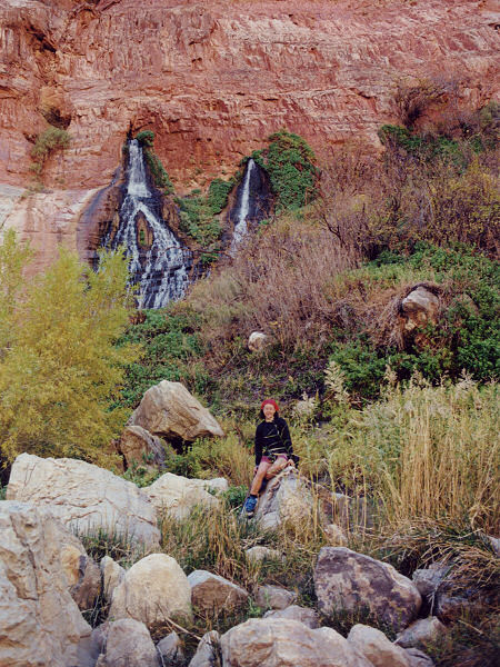
protection. Further down river you will come to Vassey's Paradise, a
large spring that is gushing from the canyon wall. This marks the
turn around point for your hike, return the way you came.
Lower Narrows: Be
aware that this section is quite challenging and may not be for
everyone. In addition, this route can change with the next rain
storm and this description may not be valid. There are 7 choke stone
drop offs that must be climbed to get all the way through and at least one
pool to wade. The largest of these drop offs is approximately 15
feet and the climbs become progressively more difficult as you head down
canyon. If you are descending, you will have to lower your pack,
then yourself and slide, then jump to get down the choke stones. An
ankle injury is a definite possibility with this option. A rope may
make your descent safer. If you are heading up canyon, you will be
presented with the most difficult climbs first. If you can make it
up the first two, the others won't be a problem. Having someone
along with you to provide a boost may make the ascent easier.
|
| Rating
(1-5 stars): |
   
The author and his wife hiked down canyon, taking the hiker
route around the narrows. At the river they looked at the ruins, arch,
cave then ate lunch below the spring. On the return trip the author
went up the narrows solo, while his wife went around on the trail. He
made it up the first climb with some difficulty, used a dead log as a step
to get up the second and had no trouble with the other ascents. He
took off his shoes to wade one pool. The hike was completed in 8.5
hours. |
| Maps: |
Trails Illustrated -
Grand Canyon National Park |
| Photos: |
Click picture for larger
view, click your browser's 'Back' button to return to this page. |
 |
 |
 |
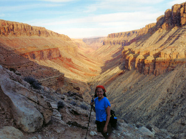
| South Canyon. |
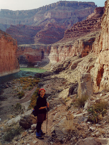
View near the Colorado. |
Vassey's Paradise. |
|
|

