| |
| Summary: |
Martinez Canyon is an easy
out and back hike up a gravel strewn wash to an
old ranch. Along the way you'll pass a short
section of narrows and a natural arch. The hike
is located northeast of the town of Florence. |
| Directions: |
From Phoenix, drive east on
Highway 60 to Florence Junction and head south
on Highway 79. After crossing the second set of
railroad tracks (just before the prison), turn
left on Price Road which begins as well graded
dirt as it passes through a few cotton farms.
About 10 miles from the highway, the road enters
a wash and becomes somewhat rougher. At the 11.8
mile point, you'll pass the Last Hope Mine (name
is written on a water tank) which will be on
your right. The author drove a few hundred yards
past the mine to a rough dirt road on the right,
then took this road in a short distance to park
next to a fire ring.
GPS coordinates for this spot are:
UTM
480539mE,
366447mN |
| Road Conditions: |
High Clearance Vehicle |
| Navigation: |
Easy |
| Length: |
~11 miles, can be longer or
shorter though depending on when you turn around |
| Date Hiked: |
December 2003 |
| Weather Conditions: |
Overcast & windy |
|
Required Skills: |
None |
| Hike Description: |
Martinez Canyon is located
behind and immediately east of the Lost Hope
Mine. There is a minor drainage between the car
park and the canyon that you'll have to get
around. From the car park, walk down the hill
into the closest wash. Follow this drainage down
towards the mine. As you near the mine, work
your way left into the main drainage of Martinez
(you'll recognize it by the fact that the canyon
is wide and gravel strewn with no vegetation in
the stream bed that would require bushwhacking).
Turn left and begin hiking up Martinez Canyon
(you'll soon pass UTM 480935mE,
3664356mN
if you're in the right place). It's easy walking
as you work your way up the dry wash. After 20
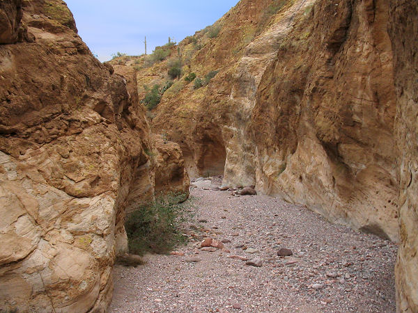
minutes or so, you'll enter a short stretch of
narrows. They are not terribly deep or sheer
walled, but they're nice enough. Another 10
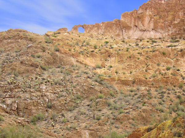
minutes up canyon you'll see an arch located in
an upper cliff band on the right. Above this
point you'll pass though some pretty desert
scenery with high walled cliffs and buttes.
There are a few minor washes that enter from one
side or the other, stay in the main drainage
(Martinez) at these junctions. As you continue
up canyon, the surrounding mountains diminish to
rolling hills and the hike becomes somewhat less
interesting. Eventually you'll reach a spot
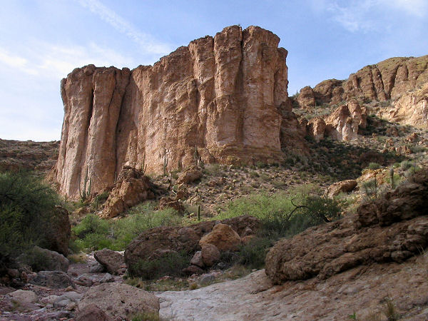
where a jeep road crosses the wash; above this
point the canyon enters a more rugged section
flanked by unique box shaped buttes. At about
the 5.5 mile point, a jeep track will enter the
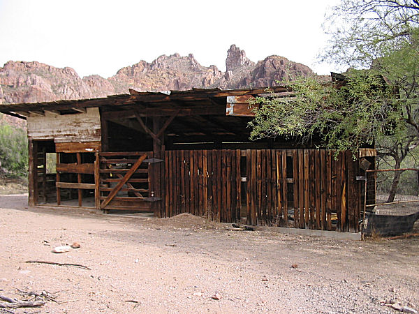
drainage from the left. If you follow this road
a short distance, you will come to a cowboy camp
(think: graffiti, broken beer bottles, bullet
holes, trash etc.) at an old ranch and corral (UTM
483989mE,
3668562mN).
Return the way you came, or continue your
exploration up canyon. |
| Rating (1-5 stars): |
 
The author completed the hike to the old ranch
and back at a moderately brisk pace in 4.5
hours.. |
| Maps: |
A map of the hike can be found
here - 517KB. |
| Books: |
None |
| Photos: |
Click picture for larger view, click your browser's 'Back' button to return to this page. |
|
|
